
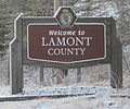
Wostok (Russian: Восток) is a hamlet in Alberta, Canada within Lamont County. It is located on Range Road 173, approximately 5 kilometres (3.1 mi) south...
5 KB (157 words) - 03:49, 10 September 2023

2020. "Wostok Dossier / Wostok". Wostok. Archived from the original on 27 April 2022. Retrieved 27 August 2020. "Tannenwald / Wostok". Wostok. Archived...
10 KB (899 words) - 15:53, 4 April 2024

Vostok Island (redirect from Wostok Island)
Island, Bostock Island, Leavitts Island, Reaper Island, Wostock Island or Wostok Island. The island was first sighted in 1820 by the Russian explorer Fabian...
10 KB (1,003 words) - 14:59, 1 July 2024
No. 516 was incorporated, uniting the three smaller districts of Pines, Wostok, and Leslie. The office was at the town of Lamont and the first council...
12 KB (617 words) - 03:43, 2 May 2022

original on 2014-07-24. Retrieved 2014-07-25. "Separatystycznym batalionem Wostok dowodził były dowódca ukraińskiego specnazu" (in Polish). Wiadomosci.gazeta...
21 KB (1,397 words) - 08:20, 8 February 2024

working for photography agency Wostok in September 2002 where he initially began photographing demonstrations. After leaving Wostok in 2005, Ochlik founded the...
22 KB (2,043 words) - 05:08, 28 June 2024

Alberta - after Stryi, Stryi Raion, Lviv Oblast. Ukalta, Alberta, north of Wostok off Secondary Highway 855 near the North Saskatchewan River - possibly a...
65 KB (6,493 words) - 20:57, 30 June 2024
Orthodox Church Mission in San Francisco, USA to the tiny settlement of Wostok near Edmonton. After the Russian Revolution, many Orthodox believers in...
4 KB (390 words) - 14:20, 17 January 2024

a change of -1.1% from its 2016 population of 1,100. With a land area of 5.6 km2 (2.2 sq mi), it had a population density of 194.3/km2 (503.2/sq mi)...
6 KB (397 words) - 06:02, 13 July 2024

1944, the M.D. of Pines No. 516 was united with the municipal districts of Wostok and Leslie to form the M.D. of Lamont No. 516.[citation needed] It was later...
9 KB (517 words) - 16:40, 8 March 2024

Widewater Wildwood Willingdon Wimborne Winfield Withrow Woking Woodhouse Woolford Worsley Wostok Wrentham Zama City Category Canada portal WikiProject...
12 KB (837 words) - 19:46, 27 June 2024

Yellowhead Highway's intersection with Cowboy Trail (Highway 22) is 9 kilometres (5.6 mi) east of the hamlet. The Lobstick River, which flows from Chip Lake to...
9 KB (504 words) - 02:37, 24 October 2023
a hamlet in central Alberta, Canada within Parkland County. It is located 5 kilometres (3.1 mi) south of Highway 16, approximately 30 kilometres (19 mi)...
5 KB (259 words) - 01:19, 9 May 2022

2019. "Hobbema, Alberta: A town in a 'state of crisis'", National Post, 5 April 2008 "Former Hobbema gang member hopes to make difference". CBC News...
17 KB (1,205 words) - 03:31, 10 September 2023

Lakes National Park). It is located at the southwestern terminus of Highway 5, approximately 54 kilometres (34 mi) west of the Town of Cardston and 55 kilometres...
9 KB (395 words) - 03:47, 10 November 2023

List of municipal districts in Alberta (redirect from Wostok No. 546, Alberta)
Retrieved November 5, 2016. "Municipal Profiles (Municipal Districts)" (PDF) (PDF). Alberta Municipal Affairs. January 3, 2014. Retrieved January 5, 2014. "Transitional...
70 KB (1,217 words) - 19:48, 19 May 2024
Alberta, Canada, within Northern Sunrise County. It is located 8 kilometres (5.0 mi) east of Highway 2, approximately 146 kilometres (91 mi) northeast of...
5 KB (272 words) - 02:23, 9 May 2022

Profiles – Fort Mackay, Alberta (Indian settlement)". Statistics Canada. January 5, 2015. Retrieved May 8, 2016. "census2018 Municipal Census Report" (PDF)....
15 KB (902 words) - 22:22, 5 March 2024
December 5, 2021. 1986 Census of Canada (PDF). Population. Vol. Unincorporated Places. Ottawa: Statistics Canada. July 1988. Retrieved December 5, 2021....
15 KB (982 words) - 19:32, 18 May 2024

Vol. Unincorporated Places. Ottawa: Statistics Canada. July 1988. Retrieved 5 December 2021. "Specialized and Rural Municipalities and Their Communities"...
19 KB (1,253 words) - 04:09, 10 September 2023
133 (Woolford) 13 (1986) Wostok Lamont County 53°51′00″N 112°28′01″W / 53.850°N 112.467°W / 53.850; -112.467 (Wostok) 15 (1991) Yates Yellowhead...
26 KB (626 words) - 02:44, 3 May 2024

with Highway 566, 24 km (15 mi) north of Calgary city centre and 12 km (7.5 mi) south of Airdrie. The hamlet is located in census division No. 6 and in...
10 KB (736 words) - 22:37, 1 July 2024

West Newspapers LP. Retrieved January 28, 2013. "Boom 103.5 - 80's & 90's". Boom 103.5. Boom 103.5 FM. Retrieved July 21, 2017. Wikivoyage has a travel guide...
39 KB (2,234 words) - 19:39, 8 May 2024
Widewater Wildwood Willingdon Wimborne Winfield Withrow Woking Woodhouse Woolford Worsley Wostok Wrentham Zama City Category Canada portal WikiProject...
18 KB (1,575 words) - 18:22, 9 June 2024

of 34.97 km2 (13.50 sq mi), it had a population density of 102.1/km2 (264.5/sq mi) in 2016. Grande Cache Recreation Centre Grande Cache Golf and Country...
17 KB (1,153 words) - 16:43, 17 June 2024

a land area of 3.58 km2 (1.38 sq mi), it had a population density of 190.5/km2 (493.4/sq mi) in 2016. In the 2011 Census, Wabamun had a population of...
13 KB (935 words) - 18:59, 27 June 2024

between August 31, 1907, and January 1, 1946. Langdon is located 12 km (7.5 mi) east of the City of Calgary at the intersection of Highway 560 (Glenmore...
19 KB (1,344 words) - 18:04, 9 June 2024
2016 population of 639. With a land area of 5.36 km2 (2.07 sq mi), it had a population density of 140.5/km2 (363.9/sq mi) in 2021. The population of...
29 KB (2,606 words) - 04:28, 28 May 2024
population of 20 living in 14 of its 14 total private dwellings, a change of -35.5% from its 2011 population of 31. With a land area of 0.16 km2 (0.062 sq mi)...
6 KB (368 words) - 02:53, 9 May 2022
change of -6.5% from its 2016 population of 415. With a land area of 0.38 km2 (0.15 sq mi), it had a population density of 1,021.1/km2 (2,644.5/sq mi) in...
5 KB (271 words) - 02:40, 9 May 2022