
DescriptionPh map manila.svg English: Street map of Manila, Philippines with points of interest indicated. This is an SVG version of Media:Ph map manila large...
(764 × 897 (2.43 MB)) - 11:05, 29 July 2024
(764 × 897 (2.43 MB)) - 04:06, 28 January 2023

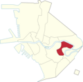
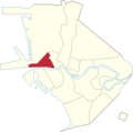
Attribution-Share Alike 3.0 truetrue English Santa Ana (red) in a district map of the City of Manila Wikimedia username: Namayan author name string: Roel Balingit...
(2,527 × 2,509 (306 KB)) - 13:37, 6 September 2022

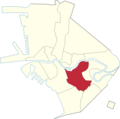
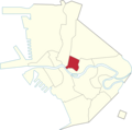
mayoral elections in the City of Manila. author name string: Timh ph Wikimedia username: Timh ph URL: https://commons.wikimedia.org/wiki/User:Timh_ph...
(800 × 931 (289 KB)) - 09:38, 4 June 2024

mayoral elections in the City of Manila. author name string: Timh ph Wikimedia username: Timh ph URL: https://commons.wikimedia.org/wiki/User:Timh_ph...
(800 × 870 (284 KB)) - 09:38, 4 June 2024

File:Ph map manila.svg is a vector version of this file. It should be used in place of this PNG file when not inferior. File:Ph map manila large.png →...
(920 × 1,115 (594 KB)) - 13:07, 20 June 2024

DescriptionPh fil congress districts manila.png English: Legislative districts of Manila Date 17 August 2012 Source Ph map manila.svg by User:Seav derivative...
(2,527 × 2,509 (348 KB)) - 03:15, 29 October 2020

File:Panandâ - a mobile app powered by Wikidata (WikidataCon 2019).pdf (matches file content)
heritage and history. ¹ Formerly Wikimedia Philippines ❖ Wikipedia Takes Manila, 2011 ❖ Wiki Loves Monuments, 2012 and 2013 ❖ Cultural Heritage Mapping...
(1,500 × 843 (4.41 MB)) - 17:38, 28 May 2022

DescriptionPh fil manila districts.png English: Map of Manila with districts Date 16 August 2012 Source Ph map manila.svg by User:Seav derivative work:...
(2,527 × 2,509 (393 KB)) - 04:29, 15 September 2020

DescriptionPh fil manila binondo.png English: Location of Binondo in Manila Date 16 August 2012 Source Ph map manila.svg by User:Seav derivative work:...
(2,527 × 2,509 (304 KB)) - 09:48, 28 October 2020

DescriptionPh fil manila ermita.png English: Location of Ermita in Manila Date 16 August 2012 Source Ph map manila.svg by User:Seav derivative work: User:Namayan...
(2,527 × 2,509 (305 KB)) - 15:44, 28 October 2020

DescriptionPh fil manila malate.png English: Location of Malate in Manila Date 16 August 2012 Source Ph map manila.svg by User:Seav derivative work: User:Namayan...
(2,527 × 2,509 (304 KB)) - 15:15, 28 October 2020

DescriptionPh fil manila intramuros.png English: Location of Intramuros in Manila Date 16 August 2012 Source Ph map manila.svg by User:Seav derivative...
(2,527 × 2,509 (304 KB)) - 22:39, 27 October 2020
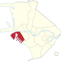
DescriptionPh fil manila pandacan.png English: Location of Pandacan in Manila Date 16 August 2012 Source Ph map manila.svg by User:Seav derivative work:...
(2,527 × 2,509 (306 KB)) - 12:10, 17 December 2022

DescriptionPh fil manila tondo.png English: Location of Tondo in Manila Date 16 August 2012 Source Ph map manila.svg by User:Seav derivative work: User:Namayan...
(2,527 × 2,509 (306 KB)) - 19:54, 28 October 2020
DescriptionPh fil manila paco.png English: Location of Paco in Manila Date 16 August 2012 Source Ph map manila.svg by User:Seav derivative work: User:Namayan...
(2,527 × 2,509 (305 KB)) - 22:39, 27 October 2020
DescriptionPh fil manila quiapo.png English: Location of Quiapo in Manila Date 16 August 2012 Source Ph map manila.svg by User:Seav derivative work: User:Namayan...
(2,527 × 2,509 (304 KB)) - 10:47, 28 October 2020

DescriptionPh fil manila sampaloc.png English: Location of Sampaloc in Manila Date 16 August 2012 Source Ph map manila.svg by User:Seav derivative work:...
(2,527 × 2,509 (305 KB)) - 15:04, 17 October 2020
DescriptionPh fil manila santa cruz.png English: Location of Santa Cruz in Manila Date 16 August 2012 Source Ph map manila.svg by User:Seav derivative...
(2,527 × 2,509 (305 KB)) - 21:16, 5 August 2024

File:Ph fil manila districts.png by Roel Balingit; source for original: Ph map manila.svg by User:Seav derivative work: User:Namayan Author Obsuser; original...
(2,527 × 2,509 (409 KB)) - 19:34, 27 October 2020

DescriptionPh fil manila santa mesa.png English: Location of Santa Mesa in Manila Date 16 August 2012 Source Ph map manila.svg by User:Seav derivative...
(2,527 × 2,509 (306 KB)) - 10:17, 28 October 2020
DescriptionPh fil manila san nicolas.png English: Location of San Nicolas in Manila Date 16 August 2012 Source Ph map manila.svg by User:Seav derivative...
(2,527 × 2,509 (304 KB)) - 06:43, 3 October 2020

DescriptionPh fil manila san andres.png English: Location of San Andres in Manila Date 16 August 2012 Source Ph map manila.svg by User:Seav derivative...
(2,527 × 2,509 (304 KB)) - 11:11, 28 October 2020
DescriptionPh fil manila port area.png English: Location of Port Area in Manila Date 16 August 2012 Source Ph map manila.svg by User:Seav derivative work:...
(2,527 × 2,509 (306 KB)) - 21:24, 15 September 2020

DescriptionPh fil manila san miguel.png English: Location of San Miguel in Manila Date 16 August 2012 Source Ph map manila.svg by User:Seav derivative...
(2,527 × 2,509 (305 KB)) - 15:15, 28 October 2020

|Description={{en|1=Blank map of the [[:en:Philippines|Philippines]] showing the location of all the regions and provinces. [[:File:Ph regions and provinces.svg|See the...
(802 × 762 (70 KB)) - 14:13, 23 January 2024

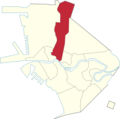
DescriptionPh fil congress manila 5d.png English: Location of the 5th Legislative district of Manila. Date 17 August 2012 Source Ph map manila.svg by User:Seav...
(2,527 × 2,509 (321 KB)) - 22:05, 18 July 2024

DescriptionPh fil congress manila 6d.png English: Location of the 6th Legislative district of Manila. Date 17 August 2012 Source Ph map manila.svg by User:Seav...
(2,527 × 2,509 (323 KB)) - 14:53, 26 September 2020

DescriptionPh fil congress manila 2d.png English: Location of the 2nd Legislative district of Manila. Date 17 August 2012 Source Ph map manila.svg by User:Seav...
(2,527 × 2,509 (319 KB)) - 05:42, 23 July 2024

DescriptionPh fil congress manila 3d.png English: Location of the 3rd Legislative district of Manila. Date 17 August 2012 Source Ph map manila.svg by User:Seav...
(2,527 × 2,509 (321 KB)) - 18:24, 20 September 2020