DescriptionSweden location map.svg Deutsch: Positionskarte von Schweden Quadratische Plattkarte, N-S-Streckung 214,7895 %. Geographische Begrenzung der...
(954 × 1,836 (2.03 MB)) - 08:15, 2 July 2024
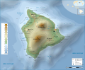
select the license of your choice. English Hawaii Island topographic map Swedish Topografisk karta över ön Hawaii URL: https://commons.wikimedia...
(3,110 × 2,563 (2.11 MB)) - 20:53, 11 August 2024

This image is a derivative work of the following images: File:Sweden_location_map_(Nord).svg licensed with Cc-by-sa-3.0,2.5,2.0,1.0, GFDL 2008-08-08T07:23:34Z...
(224 × 203 (1.89 MB)) - 02:13, 2 October 2020

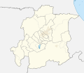
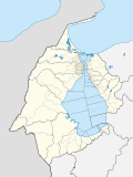
You may select the license of your choice. English Location map of Uppsala county in Sweden Swedish Karta över Uppsala län i Sverige author name string:...
(842 × 1,097 (381 KB)) - 06:28, 16 February 2024

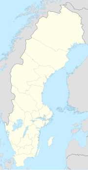
N: 71.5° N * S: 57.6° N * W: 4.1° O * O: 31.6° O {{en|Loc File:Sweden location map.svg licensed with Cc-by-sa-3.0, GFDL 2009-01-27T09:24:12Z Erik Frohne...
(744 × 1,052 (1.92 MB)) - 18:16, 13 July 2023

This image is a derivative work of the following images: File:Sweden_Kalmar_location_map.svg licensed with Cc-by-3.0, GFDL 2009-01-27T08:23:54Z Erik Frohne...
(131 × 327 (29 KB)) - 17:32, 10 September 2020

This image is a derivative work of the following images: File:_Sweden_location_map_(Nord).svg licensed with Cc-by-sa-3.0,2.5,2.0,1.0, GFDL 2008-08-08T07:23:34Z...
(998 × 917 (234 KB)) - 09:17, 18 October 2020

of this file: Hadrians Wall map Swedish.png Hadrians Wall map mak.png Hadrians Wall map-ru.svg Hadrians Wall map.svg Hadrians Wall map hr.svg English...
(800 × 995 (215 KB)) - 19:43, 23 October 2021
This image is a derivative work of the following images: File:Sweden_Scania_location_map.svg licensed with Cc-by-3.0, GFDL 2009-01-27T08:56:37Z Erik Frohne...
(2,039 × 1,845 (225 KB)) - 17:01, 4 October 2024

from [[:Image:Location European nation states.svg]] using same colours 2006-09-25T23:00:04Z Madman2001 748x546 (224972 Bytes) A blank map of Europe using...
(596 × 710 (90 KB)) - 12:10, 18 March 2022

image is a derivative work of the following images: File:Map_of_Sweden_(polar_stereographic).svg licensed with PD-self 2009-05-01T17:29:24Z Koyos 365x882...
(365 × 882 (446 KB)) - 12:50, 17 August 2024

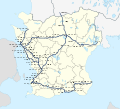
rail map with basic geographic features. Based on File:Sweden Stockholm location map.svg by User:Erik Frohne and File:Stockholm commuter rail map.svg by...
(600 × 700 (729 KB)) - 07:54, 27 October 2020

image is a derivative work of the following images: File:Map_of_Sweden_(polar_stereographic).svg licensed with PD-self 2009-05-01T17:29:24Z Koyos 365x882...
(365 × 882 (447 KB)) - 09:15, 18 October 2020

File:Allsvenskan 2010 fotboll karta.jpg (category Association football maps of Sweden)
This image is a derivative work of the following images: File:Sweden_location_map,_40south.svg licensed with Cc-by-sa-3.0, GFDL 2009-02-07T16:27:50Z Lokal...
(352 × 406 (53 KB)) - 21:35, 2 August 2023

rail map with basic geographic features. Based on File:Sweden Stockholm location map.svg by User:Erik Frohne and File:Stockholm commuter rail map.svg by...
(1,800 × 2,100 (1.19 MB)) - 04:39, 27 October 2020

This image is a derivative work of the following images: File:Sweden_location_map.svg licensed with Cc-by-sa-3.0, GFDL 2009-01-27T09:24:12Z Erik Frohne...
(250 × 481 (47 KB)) - 02:37, 2 October 2020

der Karte:}} {{en|Location map [[w:en:Hesse|Hesse]], Germany. Geographic limits of the map:}} * N: 51 Lower Saxony location map.svg licensed with Cc-by-sa-3...
(928 × 1,116 (1.22 MB)) - 09:08, 23 March 2022

This SVG map is part of a locator map series applying the widespread location map scheme. Please see root category to browse for more. FDFBEA → Marked...
(512 × 386 (1.4 MB)) - 23:54, 1 January 2024

This SVG map is part of a locator map series applying the widespread location map scheme. Please see root category to browse for more. FDFBEA → Marked...
(512 × 386 (556 KB)) - 23:56, 1 January 2024
This SVG map is part of a locator map series applying the widespread location map scheme. Please see root category to browse for more. FDFBEA → Marked...
(512 × 448 (1.8 MB)) - 02:45, 22 May 2024
This SVG map is part of a locator map series applying the widespread location map scheme. Please see root category to browse for more. FDFBEA → Marked...
(512 × 684 (2.88 MB)) - 16:51, 8 June 2024
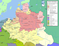
File:Rzeczpospolita voivodships.png (category Maps of the Polish-Lithuanian Commonwealth)
The following is a list of maps created by Halibutt and uploaded to commons, as well as their present and projected derivatives. English Wikimedia username:...
(2,000 × 1,568 (448 KB)) - 19:19, 22 December 2022
This SVG map is part of a locator map series applying the widespread location map scheme. Please see root category to browse for more. FDFBEA → Marked...
(512 × 209 (1.77 MB)) - 22:47, 7 March 2024

Location of Västerås in Sweden Created by uploader Original source is CIA Factbook map of Sweden English...
(326 × 712 (19 KB)) - 22:42, 29 September 2020
This SVG map is part of a locator map series applying the widespread location map scheme. Please see root category to browse for more. FDFBEA → Marked...
(512 × 343 (4.36 MB)) - 23:55, 1 January 2024

Location of Malmö in Sweden Created by uploader Original source is CIA Factbook map of Sweden English...
(328 × 714 (19 KB)) - 03:22, 8 October 2020

This SVG map is part of a locator map series applying the widespread location map scheme. Please see root category to browse for more. FDFBEA → Marked...
(512 × 386 (1.4 MB)) - 23:54, 1 January 2024
This SVG map is part of a locator map series applying the widespread location map scheme. Please see root category to browse for more. FDFBEA → Marked...
(512 × 448 (1.8 MB)) - 00:00, 2 January 2024
This SVG map is part of a locator map series applying the widespread location map scheme. Please see root category to browse for more. FDFBEA → Marked...
(512 × 386 (556 KB)) - 23:56, 1 January 2024

This SVG map is part of a locator map series applying the widespread location map scheme. Please see root category to browse for more. FDFBEA → Marked...
(512 × 684 (2.88 MB)) - 16:50, 8 June 2024