
 French
 Deutsch
ملف:Buckinghamshire UK location map.svg - ويكيبيديا

حجم معاينة PNG لذلك الملف ذي الامتداد SVG: 507 × 600 بكسل. الأبعاد الأخرى: 203 × 240 بكسل | 406 × 480 بكسل | 649 × 768 بكسل | 865 × 1٬024 بكسل | 1٬731 × 2٬048 بكسل | 1٬070 × 1٬266 بكسل.
الملف الأصلي (ملف SVG، أبعاده 1٬070 × 1٬266 بكسل، حجم الملف: 2٫13 ميجابايت)
| هذا ملف من ويكيميديا كومنز. معلومات من صفحة وصفه مبينة في الأسفل. كومنز مستودع ملفات ميديا ذو رخصة حرة. |
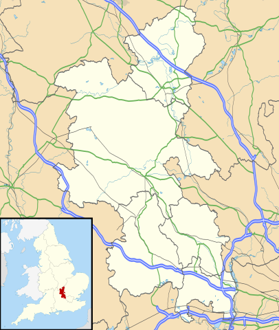
| الوصف | Map of Buckinghamshire, UK with the following information shown:
Equirectangular map projection on WGS 84 datum, with N/S stretched 160% Geographic limits:
|
| التاريخ | |
| المصدر |
|
| المؤلف | Nilfanion, created using Ordnance Survey data |
| الترخيص (إعادة استخدام هذا الملف) | هذا الملفُّ مُرخَّص بموجب رخصة المشاع الإبداعي نسبة المُصنَّف إِلى مُؤَلِّفه - المشاركة بالمثل 3.0 العامة نسب العمل لمُؤَلِّفه: Contains Ordnance Survey data © Crown copyright and database right
|
| إصدارات أخرى | File:Buckinghamshire UK district map (blank).svg - Blank map |
.svg)
تاريخ الملف
اضغط على زمن/تاريخ لرؤية الملف كما بدا في هذا الزمن.
| زمن/تاريخ | صورة مصغرة | الأبعاد | مستخدم | تعليق | |
|---|---|---|---|---|---|
| حالي | 18:41، 26 سبتمبر 2010 | | 1٬070 × 1٬266 (2٫13 ميجابايت) | Nilfanion | {{Information |Description=Map of Buckinghamshire, UK with the following information shown: *Administrative borders *Coastline, lakes and rivers *Roads and railways *Urban areas Equirectangular map projection on WGS 84 datum, with N |
استخدام الملف
ال3 صفحات التالية تستخدم هذا الملف:
الاستخدام العالمي للملف
الويكيات الأخرى التالية تستخدم هذا الملف:
- الاستخدام في bg.wikipedia.org
- الاستخدام في ceb.wikipedia.org
- الاستخدام في cs.wikipedia.org
- الاستخدام في en.wikipedia.org
- Amersham
- Milton Keynes
- High Wycombe
- Aylesbury
- Buckingham
- Maids Moreton
- Southcourt
- West Wycombe
- Chesham
- Quarrendon
- Bedgrove
- Stoke Mandeville
- Great and Little Kimble cum Marsh
- Cheddington
- New Zealand, Buckinghamshire
- California, Buckinghamshire
- Aston Clinton
- Beaconsfield
- Bierton
- Wendover
- Broughton, Aylesbury
- Great and Little Hampden
- Winslow, Buckinghamshire
- Cliveden
- Amersham station
- RAF Halton
- Long Crendon
- Shabbington
- Addington, Buckinghamshire
- Adstock
- Monks Risborough
- Princes Risborough
- Calvert, Buckinghamshire
- Woughton (parish)
- Olney, Buckinghamshire
- Hughenden Valley
- Castlethorpe
- Watermead, Buckinghamshire
- Caldecote, Buckinghamshire
- Whiteleaf, Buckinghamshire
- Newport Pagnell
- Tylers Green
- Dorney
- Stowe, Buckinghamshire
- Stoke Hammond
- Hanslope
- Burcott, Bierton
اعرض المزيد من الاستخدام العام لهذا الملف.