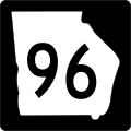
Datei:Georgia 96.svg – Wikipedia

Größe der PNG-Vorschau dieser SVG-Datei: 600 × 600 Pixel. Weitere aus SVG automatisch erzeugte PNG-Grafiken in verschiedenen Auflösungen: 240 × 240 Pixel | 480 × 480 Pixel | 768 × 768 Pixel | 1.024 × 1.024 Pixel | 2.048 × 2.048 Pixel
Originaldatei (SVG-Datei, Basisgröße: 600 × 600 Pixel, Dateigröße: 5 KB)
Dateiversionen
Klicke auf einen Zeitpunkt, um diese Version zu laden.
| Version vom | Vorschaubild | Maße | Benutzer | Kommentar | |
|---|---|---|---|---|---|
| aktuell | 17:14, 3. Jun. 2010 |  | 600 × 600 (5 KB) | Fredddie | |
| 20:42, 5. Jun. 2006 |  | 500 × 500 (9 KB) | Pedriana~commonswiki | changed font from Series D to Series C to reflect actual use in the field | |
| 16:52, 16. Apr. 2006 |  | 500 × 500 (11 KB) | Pedriana~commonswiki | Georgia State Route 96 shield, 24 inches square. Based on [http://www.dot.state.ga.us/operations/traffic-safety-design/Documents/PDF/3.%20Non-Interstate%20Signing%20and%20Marking%20Design%20Guidelines.pdf GDOT's Non-Interstate Signing and Marking Design G |
Dateiverwendung
Die folgende Seite verwendet diese Datei:
Globale Dateiverwendung
Die nachfolgenden anderen Wikis verwenden diese Datei:
- Verwendung auf en.wikipedia.org
- Interstate 16
- Wilkinson County, Georgia
- Twiggs County, Georgia
- Taylor County, Georgia
- Talbot County, Georgia
- Peach County, Georgia
- Houston County, Georgia
- Crawford County, Georgia
- Fort Valley, Georgia
- U.S. Route 341
- List of state routes in Georgia
- Georgia State Route 3
- Waycross Air Line Railroad
- Interstate 75 in Georgia
- Fall Line Freeway
- Wikipedia:WikiProject U.S. Roads/Redirects/Georgia
- Georgia State Route 95
- Georgia State Route 358
- List of highways numbered 96
- Georgia State Route 7
- Georgia State Route 90
- Georgia State Route 11
- Georgia State Route 18
- Georgia State Route 19
- Georgia State Route 22
- Georgia State Route 29
- Georgia State Route 41
- Georgia State Route 49
- Georgia State Route 247
- Georgia State Route 240
- U.S. Route 80 in Georgia
- Georgia State Route 96
- U.S. Route 19 in Georgia
- Georgia State Route 137
- U.S. Route 23 in Georgia
- U.S. Route 129 in Georgia
- U.S. Route 441 in Georgia
- U.S. Route 41 in Georgia
- Columbus–Auburn–Opelika combined statistical area
- Georgia State Route 87
- Georgia State Route 97
- Georgia State Route 128
- User:Morriswa/Clinched highways/State highways
- User:Morriswa/Clinched highways/County and other highways
- Template:Fitzgerald Subdivision
- Verwendung auf es.wikipedia.org
Weitere globale Verwendungen dieser Datei anschauen.


 French
 Deutsch