Bandar-e Gaz
Bandar-e Gaz Persian: بندرگز | |
|---|---|
City | |
| Coordinates: 36°46′26″N 53°56′53″E / 36.77389°N 53.94806°E[1] | |
| Country | Iran |
| Province | Golestan |
| County | Bandar-e Gaz |
| District | Central |
| Population (2016)[2] | |
| • Total | 20,742 |
| Time zone | UTC+03:30 (IRST) |
| Bandar-e Gaz at GEOnet Names Server | |
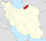
Bandar-e Gaz (Persian: بندرگز)[a] is a city in the Central District of Bandar-e Gaz County, Golestan Province, Iran, serving as capital of both the county and the district.[4]
Demographics
[edit]Language
[edit]The people of Bandar-e-Gaz speak the Mazandarani language.[5]
Population
[edit]At the time of the 2006 National Census, the city's population was 17,923 in 4,679 households.[6] The following census in 2011 counted 18,734 people in 5,481 households.[7] The 2016 census measured the population of the city as 20,742 people in 6,715 households.[2]
Overview
[edit]Bandar-e Gaz is in the southeastern fringes of Gorgan Bay (ru:Горганский залив), at a distance of 20 km south of Bandar Torkaman and 48 km from Gorgan.
Before the establishment of Bandar Torkaman, this port was the most important commercial port in west of Mazandaran, Semnan and Khorasan. Bandar-e Gaz became an industrial center due to its location on the commercial highway in northwest Iran. The oil-extraction, rice-grinding and cotton-purifying factories were established in this city. The coastal areas of the city include wetlands, groves and wildlife.
Climate
[edit]| Climate data for Bandar-e Gaz (elevation: -14, precipitation normals) 2013-2023 36°46′01″N 53°57′00″E / 36.767°N 53.95°E | |||||||||||||
|---|---|---|---|---|---|---|---|---|---|---|---|---|---|
| Month | Jan | Feb | Mar | Apr | May | Jun | Jul | Aug | Sep | Oct | Nov | Dec | Year |
| Average precipitation mm (inches) | 43.62 (1.72) | 43.88 (1.73) | 62.16 (2.45) | 43.55 (1.71) | 29.38 (1.16) | 16.16 (0.64) | 25.96 (1.02) | 13.13 (0.52) | 45.09 (1.78) | 64.65 (2.55) | 66.43 (2.62) | 32.99 (1.30) | 487 (19.2) |
| Source: IRIMO[8] | |||||||||||||
See also
[edit]Notes
[edit]References
[edit]- ^ OpenStreetMap contributors (16 October 2024). "Bandar-e Gaz, Bandar-e Gaz County" (Map). OpenStreetMap (in Persian). Retrieved 16 October 2024.
- ^ a b Census of the Islamic Republic of Iran, 1395 (2016): Golestan Province. amar.org.ir (Report) (in Persian). The Statistical Center of Iran. Archived from the original (Excel) on 29 March 2019. Retrieved 19 December 2022.
- ^ Bandar-e Gaz can be found at GEOnet Names Server, at this link, by opening the Advanced Search box, entering "-3055115" in the "Unique Feature Id" form, and clicking on "Search Database".
- ^ Habibi, Hassan (7 June 1394) [Approved 29 April 1376]. Reforms and changes of national divisions in Mazandaran province. rc.majlis.ir (Report) (in Persian). Ministry of the Interior, Political-Defense Commission of the Government Board. Proposal 1.4.42.4803; Notification 62229/18390K. Archived from the original on 28 May 2015. Retrieved 14 February 2014 – via Islamic Parliament Research Center.
- ^ Borjian, Habib (2004). "Māzandarān: Language and People". Iran & the Caucasus. 8 (2). Brill: 295. doi:10.1163/1573384043076045. JSTOR 4030997.
- ^ Census of the Islamic Republic of Iran, 1385 (2006): Golestan Province. amar.org.ir (Report) (in Persian). The Statistical Center of Iran. Archived from the original (Excel) on 20 September 2011. Retrieved 25 September 2022.
- ^ Census of the Islamic Republic of Iran, 1390 (2011): Golestan Province. irandataportal.syr.edu (Report) (in Persian). The Statistical Center of Iran. Archived from the original (Excel) on 17 January 2023. Retrieved 19 December 2022 – via Iran Data Portal, Syracuse University.
- ^ "Monthly total precipitation for Bandar-e Gaz (99304)". data.irimo.ir. I.R. of Iran Meteorological Organization. Retrieved 9 May 2024.


 French
 Deutsch
