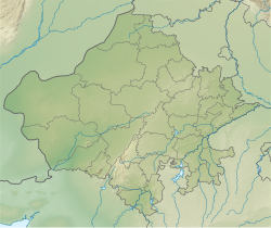
Beedasariya
Beedasariya | |
|---|---|
Village | |
| Coordinates: 27°51′36″N 73°50′12″E / 27.8600°N 73.8367°E | |
| Country | |
| State | Rajasthan |
| District | Bikaner |
| Sub-District | Jasrasar |
| Assembly Constituency | Dungargarh |
| Government | |
| • Type | Panchayati Raj |
| • Body | Government of Rajasthan |
| Area | |
• Total | 14.18 km2 (5.47 sq mi) |
| Population (2011)[1] | |
• Total | 1,561 |
| Language | |
| • Official Language | Hindi[2] |
| • Regional Language | Bagri[3] Marwari[4] |
| Time zone | UTC+5:30 (IST) |
| Area code | 334802 |
| Vehicle registration | RJ-50, RJ-07 |
Beedasariya is a village in Bikaner District of Rajasthan state in India. It is located near Bhom Beedasariya village, these villages are connected to each other.
Climate
[edit]Beedasariya is located at the middle of the Thar desert and has a hot desert climate.
| Climate data for Beedasariya (1991–2020, extremes 1901–2020) | |||||||||||||
|---|---|---|---|---|---|---|---|---|---|---|---|---|---|
| Month | Jan | Feb | Mar | Apr | May | Jun | Jul | Aug | Sep | Oct | Nov | Dec | Year |
| Record high °C (°F) | 32.9 (91.2) | 37.2 (99.0) | 42.8 (109.0) | 47.2 (117.0) | 49.4 (120.9) | 48.9 (120.0) | 47.8 (118.0) | 43.4 (110.1) | 43.9 (111.0) | 42.2 (108.0) | 38.5 (101.3) | 33.8 (92.8) | 49.4 (120.9) |
| Mean daily maximum °C (°F) | 23.1 (73.6) | 26.9 (80.4) | 32.8 (91.0) | 38.5 (101.3) | 42.2 (108.0) | 41.7 (107.1) | 38.8 (101.8) | 37.2 (99.0) | 37.3 (99.1) | 36.2 (97.2) | 31.2 (88.2) | 26.0 (78.8) | 34.3 (93.7) |
| Daily mean °C (°F) | 15.4 (59.7) | 19.3 (66.7) | 25.2 (77.4) | 31.0 (87.8) | 35.1 (95.2) | 35.6 (96.1) | 33.8 (92.8) | 32.1 (89.8) | 31.5 (88.7) | 28.6 (83.5) | 22.7 (72.9) | 17.3 (63.1) | 27.3 (81.1) |
| Mean daily minimum °C (°F) | 7.7 (45.9) | 11.6 (52.9) | 17.4 (63.3) | 23.1 (73.6) | 27.7 (81.9) | 29.4 (84.9) | 28.5 (83.3) | 27.2 (81.0) | 25.6 (78.1) | 20.8 (69.4) | 14.4 (57.9) | 9.2 (48.6) | 20.3 (68.5) |
| Record low °C (°F) | −4.0 (24.8) | −2.5 (27.5) | −0.6 (30.9) | 8.3 (46.9) | 13.7 (56.7) | 17.8 (64.0) | 20.5 (68.9) | 20.6 (69.1) | 16.5 (61.7) | 7.6 (45.7) | 0.6 (33.1) | −2.8 (27.0) | −4.0 (24.8) |
| Average rainfall mm (inches) | 4.9 (0.19) | 7.7 (0.30) | 8.0 (0.31) | 7.9 (0.31) | 23.7 (0.93) | 36.9 (1.45) | 90.5 (3.56) | 56.9 (2.24) | 32.2 (1.27) | 13.1 (0.52) | 1.2 (0.05) | 2.9 (0.11) | 285.9 (11.26) |
| Average rainy days | 0.5 | 0.9 | 0.8 | 1.2 | 1.6 | 2.6 | 4.5 | 3.6 | 2.0 | 0.6 | 0.2 | 0.3 | 18.8 |
| Average relative humidity (%) (at 17:30 IST) | 35 | 27 | 20 | 16 | 17 | 28 | 45 | 48 | 40 | 27 | 31 | 36 | 31 |
| Average dew point °C (°F) | 3 (37) | 5 (41) | 7 (45) | 9 (48) | 13 (55) | 19 (66) | 23 (73) | 23 (73) | 20 (68) | 12 (54) | 8 (46) | 5 (41) | 12 (54) |
| Average ultraviolet index | 5 | 6 | 7 | 9 | 9 | 9 | 8 | 8 | 8 | 7 | 6 | 4 | 7 |
| Source 1: India Meteorological Department[5][6] Time and Date (dewpoints, 2005-2015)[7] | |||||||||||||
| Source 2: Tokyo Climate Center (mean temperatures 1991–2020)[8] Weather Atlas[9] | |||||||||||||
Demographics
[edit]In Beedasariya Village, female literacy rate is 29.01% and male literacy rate is 57.58% and according to 2011 census the literacy rate of the entire village is 44.46%. There are 216 houses in whole village.[10]
Population of the village follows Hinduism.[11]
Bagri is the major language spoken here, while Hindi and English are the language of the educated.[13]
Transport
[edit]Beedasariya has access to the road system. However, there is currently no railway facility accessible. Beedasariya is 12 kilometres from the SH-20(B) Bikaner-Ladnun Highway.[14]
See also
[edit]References
[edit]- ^ ORGI. "Census of India : Provisional Population Totals Paper 1 of 2011 : Rajasthan".
- ^ "52nd Report of the Commissioner for Linguistic Minorities in India" (PDF). nclm.nic.in. Ministry of Minority Affairs. Archived from the original (PDF) on 25 May 2017. Retrieved 12 January 2021.
- ^ "Bagri Language". 16 June 2024.
- ^ "Marwari Language". 16 June 2024.
- ^ "Climatological Tables 1991–2020" (PDF). India Meteorological Department. p. 21. Archived from the original (PDF) on 1 January 2023. Retrieved 15 November 2024.
- ^ "Extremes of Temperature & Rainfall for Indian Stations (Up to 2012)" (PDF). India Meteorological Department. December 2016. p. M176. Archived from the original (PDF) on 5 February 2020. Retrieved 15 November 2024.
- ^ "Climate & Weather Averages in Bikaner, Rajasthan, India". Time and Date. Retrieved 15 November 2024.
- ^ "Normals Data: Beedasariya – India Latitude: 28.00°N Longitude: 73.30°E Height: 223 (m)". Japan Meteorological Agency. Retrieved 15 November 2024.
- ^ "Climate and monthly weather forecast Beedasariya, India". Weather Atlas. Retrieved 15 November 2024.
- ^ "Census of Beedasariya Village(2011)". Retrieved 20 October 2024.
- ^ "Population by religious community - Bikaner District".
- ^ "Table C-01 Population By Religion - Rajasthan". census.gov.in. Registrar General and Census Commissioner of India.
- ^ "Languages".
- ^ "Bikaner - Napasar - Ladnun Highway construction ongoing". June 2024.
External links
[edit]- Beedasariya Profile on weather.com


 French
 Deutsch
