Beroroha
Beroroha | |
|---|---|
 The Mangoky River at Beroroha | |
| Coordinates: 21°7′S 44°38′E / 21.117°S 44.633°E | |
| Country | |
| Region | Atsimo-Andrefana |
| District | Beroroha |
| Time zone | UTC3 (EAT) |
| Postal code | 611 |
Beroroha is a municipality in Atsimo-Andrefana Region, Madagascar. Made up of 17 villages, the commune has a total population of 17,000. The area was severely affected by the 2009 passage of Cyclone Fanele.
Beroroha lies on the Mangoky river, which is fast flowing, and can vary between 5 m and 500 m wide. The road from Ranohira (National road 15) is unpaved and only possible with 4x4 and normally takes two days from Antananarivo. An airport serves the town.
Nature
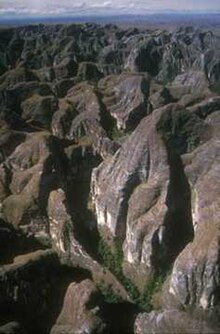
[edit]The Makay Massif lies partly in Beroroha.

References
[edit]- ^ Estimated based on DEM data from Shuttle Radar Topography Mission


 French
 Deutsch
