
 French
 Deutsch
Bonnefontaine
Bonnefontaine | |
|---|---|
 The town hall in Bonnefontaine | |
Location of Bonnefontaine  | |
 Bonnefontaine  Bonnefontaine | |
| Coordinates: 46°43′45″N 5°44′51″E / 46.7292°N 5.7475°E | |
| Country | France |
| Region | Bourgogne-Franche-Comté |
| Department | Jura |
| Arrondissement | Lons-le-Saunier |
| Canton | Poligny |
| Intercommunality | Bresse Haute Seille |
| Government | |
| • Mayor (2020–2026) | Isabelle Roussey[1] |
Area 1 | 8.8 km2 (3.4 sq mi) |
| Population (2022)[2] | 110 |
| • Density | 13/km2 (32/sq mi) |
| Time zone | UTC+01:00 (CET) |
| • Summer (DST) | UTC+02:00 (CEST) |
| INSEE/Postal code | 39065 /39800 |
| Elevation | 534–745 m (1,752–2,444 ft) (avg. 580 m or 1,900 ft) |
| 1 French Land Register data, which excludes lakes, ponds, glaciers > 1 km2 (0.386 sq mi or 247 acres) and river estuaries. | |
Bonnefontaine (French pronunciation: [bɔnfɔ̃tɛn]) is a commune in Jura, a department in Bourgogne-Franche-Comté in eastern France.[3]
Geography
[edit]Bonnefontaine is located in the core of the first plateau of the Jura on the edge of the Côte de l'Heute to 580 meters of altitude. In addition to its centre, the village includes a hamlet : Le Patouillet.
Population
[edit]| Year | Pop. | ±% p.a. |
|---|---|---|
| 1968 | 107 | — |
| 1975 | 86 | −3.07% |
| 1982 | 97 | +1.73% |
| 1990 | 98 | +0.13% |
| 1999 | 84 | −1.70% |
| 2009 | 97 | +1.45% |
| 2014 | 98 | +0.21% |
| 2020 | 116 | +2.85% |
| Source: INSEE[4] | ||

Gallery
[edit]-
 Town hall
 -
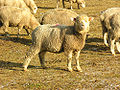 The « Bergerie de l'Heute »'s ewes

See also
[edit]References
[edit]- ^ "Répertoire national des élus: les maires" (in French). data.gouv.fr, Plateforme ouverte des données publiques françaises. 13 September 2022.
- ^ "Populations de référence 2022" (in French). The National Institute of Statistics and Economic Studies. 19 December 2024.
- ^ INSEE commune file
- ^ Population en historique depuis 1968, INSEE
External links
[edit]- (in French) Communauté de communes Bresse Haute Seille
Wikimedia Commons has media related to Bonnefontaine.
| International | |
|---|---|
| National | |