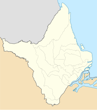
Cunani, Calçoene
Cunani | |
|---|---|
| Coordinates: 2°51′33″N 51°7′44″W / 2.85917°N 51.12889°W | |
| Country | |
| Region | North |
| State | Amapá |
| Municipality | Calçoene |
| Elevation | 28 m (92 ft) |
| Population (2010) | |
• Total | 940 |
| Time zone | UTC−3 (BRT) |
Cunani (also Counani) is a district in the Brazilian municipality of Calçoene, in the interior of the state of Amapá. According to the Brazilian Institute of Geography and Statistics (IBGE), its population in 2010 was 940 inhabitants, 516 men and 424 women, with a total of 343 private households.[1] Cunani is a recognised Quilombo (escaped slaves) settlement. It was also the capital of two unrecognised countries.
History
[edit]The dispute between France and Brazil about the region between the Oiapoque and the Amazon River in the 19th century attracted escaped Brazilian slaves to the region. The Quilombo were joined by French and Brazilian traders and adventurers.[2] Between 1886 and 1891, the town of Cunani was the capital of the unrecognised Republic of Independent Guiana,[3] In 1900, the territory was awarded to Brazil.[2] Not withstanding that fact, Cunani became the capital of the unrecognised Free State of Counani between 1901 and 1904.[4]

In the 20th century, Brazilian migrants settled in Cunani, and the economy of the village was mainly based on fur trade, fishing and supplying the garimpeiro (illegal gold prospectors) who were active in the area.[2] The opening of BR-156 in the early 1970s resulted in a migration to Calçoene. The restricting of access to the Cunani River accelerated the decline.[5] Açaí became the main export product for the village.[6]
In 2015,[7] Cunani was recognised as a Quilombo settlement inhabited by Brazilian Maroons, and has been given its own territory similar to the indigenous territories.[8]
Climate
[edit]Cunani has a tropical monsoon climate (Am) with moderate to little rainfall from August to November and heavy to very heavy rainfall in the remaining months.
| Climate data for Cunani | |||||||||||||
|---|---|---|---|---|---|---|---|---|---|---|---|---|---|
| Month | Jan | Feb | Mar | Apr | May | Jun | Jul | Aug | Sep | Oct | Nov | Dec | Year |
| Mean daily maximum °C (°F) | 29.2 (84.6) | 28.6 (83.5) | 29.5 (85.1) | 29.3 (84.7) | 29.6 (85.3) | 30.1 (86.2) | 31.0 (87.8) | 31.9 (89.4) | 32.7 (90.9) | 33.0 (91.4) | 32.2 (90.0) | 30.5 (86.9) | 30.6 (87.1) |
| Daily mean °C (°F) | 25.5 (77.9) | 25.2 (77.4) | 25.7 (78.3) | 25.9 (78.6) | 26.0 (78.8) | 26.0 (78.8) | 26.3 (79.3) | 26.8 (80.2) | 27.1 (80.8) | 26.9 (80.4) | 26.6 (79.9) | 26.1 (79.0) | 26.2 (79.1) |
| Mean daily minimum °C (°F) | 21.9 (71.4) | 21.9 (71.4) | 22.0 (71.6) | 22.5 (72.5) | 22.5 (72.5) | 22.0 (71.6) | 21.7 (71.1) | 21.7 (71.1) | 21.5 (70.7) | 20.9 (69.6) | 21.1 (70.0) | 21.7 (71.1) | 21.8 (71.2) |
| Average rainfall mm (inches) | 429 (16.9) | 434 (17.1) | 457 (18.0) | 485 (19.1) | 554 (21.8) | 346 (13.6) | 186 (7.3) | 92 (3.6) | 45 (1.8) | 36 (1.4) | 101 (4.0) | 319 (12.6) | 3,484 (137.2) |
| Source: Climate-Data.org[9] | |||||||||||||
References
[edit]- ^ Instituto Brasileiro de Geografia e Estatística (IBGE) (16 November 2011). "Sinopse por setores". Retrieved 9 October 2013.
- ^ a b c Kohler & Eloy 2011, p. 271.
- ^ "Livres anciens : Etat libre du Counani : Livre rouge n°3". Bibliotheque Numerique Caraibe Amazone Plateau des Guyanes (in French). 1906. Retrieved 26 September 2020.
- ^ "10 Private Adventurers And The Nations They Forged". Listverse.com. 6 June 2015. Retrieved 26 September 2020.
- ^ Kohler & Eloy 2011, p. 272.
- ^ Kohler & Eloy 2011, p. 274.
- ^ "Comunidade quilombola do Cunani não pode ter seu território reduzido pelo Parque Nacional do Cabo Orange". Amazonia (in Portuguese). Retrieved 30 March 2021.
- ^ "Cabo Orange National Park - Brazil" (PDF). Ramsar.org. p. 10. Retrieved 29 March 2021.
- ^ "Climate: Cunani". Climate-Data.org. Retrieved August 14, 2020.
Bibliography
[edit]- Kohler, Florent; Eloy, Ludivine (2011). New Knowledge in a New Era of Globalization. doi:10.5772/25192.


 French
 Deutsch
