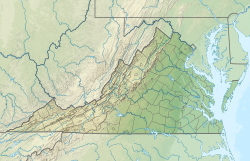
Danville Regional Airport
Danville Regional Airport | |||||||||||||||
|---|---|---|---|---|---|---|---|---|---|---|---|---|---|---|---|
| Summary | |||||||||||||||
| Airport type | Public | ||||||||||||||
| Owner | City of Danville | ||||||||||||||
| Serves | Danville, Virginia | ||||||||||||||
| Elevation AMSL | 571 ft / 174 m | ||||||||||||||
| Coordinates | 36°34′20″N 079°20′10″W / 36.57222°N 79.33611°W | ||||||||||||||
| Website | www.danville-va.gov/... | ||||||||||||||
| Map | |||||||||||||||
 | |||||||||||||||
| Runways | |||||||||||||||
| |||||||||||||||
| Statistics (2019) | |||||||||||||||
| |||||||||||||||
Danville Regional Airport (IATA: DAN, ICAO: KDAN, FAA LID: DAN) is three miles east of Danville, in southern Virginia.[1] The Federal Aviation Administration (FAA) National Plan of Integrated Airport Systems for 2017–2021 categorized it as a regional general aviation facility.[2]
The first scheduled flights to the airport were Eastern Airlines DC-3s in 1947; Eastern pulled out in 1964. Piedmont Airlines arrived in 1948.
Facilities
[edit]The airport covers 800 acres (320 ha) at an elevation of 571 feet (174 m). It has two asphalt runways: 2/20 is 5,900 by 100 feet (1,798 x 30 m) and 13/31 is 3,910 by 100 feet (1,192 x 30 m).[1]
In the year ending December 31, 2019 the airport had 19,120 aircraft operations, average 52 per day: 100% general aviation and <1% military. In December 2019, 38 aircraft were based at the airport: 35 single-engine, 1 multi-engine, 1 jet, and 1 helicopter.[1]
Taxiway revamp
[edit]In January 2017 the City Council of Danville approved a 3.1 million dollar project to rebuild taxiway A, and narrow it to 35 feet. Construction work was scheduled to begin in March 2017.[3]
References
[edit]- ^ a b c d FAA Airport Form 5010 for DAN PDF, effective August 10, 2023.
- ^ "List of NPIAS Airports" (PDF). FAA.gov. Federal Aviation Administration. 21 October 2016. Retrieved 23 January 2017.
- ^ Pinto, Caren (2017-01-18). "Revamp of Taxiway at Danville Regional Airport is about to take off". 13 WSET News. Danville, Virginia. Retrieved 2017-01-23.
City Council approved a revamp for Taxiway A
External links
[edit]- Danville Regional Airport at City of Danville website
- Aerial photo as of 1 April 1994 from USGS The National Map
- FAA Terminal Procedures for DAN, effective April 17, 2025
- Resources for this airport:
- FAA airport information for DAN
- AirNav airport information for KDAN
- ASN accident history for DAN
- FlightAware airport information and live flight tracker
- NOAA/NWS weather observations: current, past three days
- SkyVector aeronautical chart, Terminal Procedures


 French
 Deutsch
