Dehaqan
Dehaqan Persian: دهاقان | |
|---|---|
City | |
| Coordinates: 31°56′19″N 51°38′51″E / 31.93861°N 51.64750°E[1] | |
| Country | Iran |
| Province | Isfahan |
| County | Dehaqan |
| District | Central |
| Population (2016)[2] | |
• Total | 17,945 |
| Time zone | UTC+3:30 (IRST) |
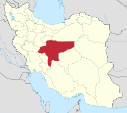
Dehaqan (Persian: دهاقان)[a] is a city in the Central District of Dehaqan County,[b] Isfahan province, Iran, serving as capital of both the county and the district.[5]
Demographics
[edit]Population
[edit]At the time of the 2006 National Census, the city's population was 16,899 in 4,664 households.[6] The following census in 2011 counted 17,108 people in 5,244 households.[7] The 2016 census measured the population of the city as 17,945 people in 5,790 households.[2]
Overview
[edit]The town consists of the old town, Nehzat Abad neighbourhood and Ata Abad (now part of the town). The old town itself consists of many neighborhoods, such as Melle Now (Mahalle Now), Posht Gombezi, Ghale, etc. ...
Dehaqan is located at 30 km from Shahreza city. The word "Dehaqan" originated from "Dehaq" which means "Watery Place or "Dehqan" which means farmers"
The climatic condition of this city is divided into:
- North and east zone, which experience semi-dry climate, suitable for agronomy and animal husbandry activities.
- South and west zone, which has mountain climate and green hills, suitable for green house activities.
Local fruits include pears and walnuts. There are so many springs(streams) around it, including at Cheshme Benoy. Its water is mineral and very tasty.[original research?] In winter there is a place for skiing which is a common destination for people in Isfahan province.[citation needed] In the first month of spring a flower grows there which is called Lalehye wajgoon (upside down tulip). There are two universities in Dehaghan including: Payame Noor University Dehaghan Branch and Islamic Azad University Dehaghan Branch.
See also
[edit]Notes
[edit]References
[edit]- ^ OpenStreetMap contributors (27 November 2024). "Dehaqan, Dehaqan County" (Map). OpenStreetMap (in Persian). Retrieved 27 November 2024.
- ^ a b Census of the Islamic Republic of Iran, 1395 (2016): Isfahan Province. amar.org.ir (Report) (in Persian). The Statistical Center of Iran. Archived from the original (Excel) on 19 October 2020. Retrieved 19 December 2022.
- ^ Dehaqan can be found at GEOnet Names Server, at this link, by opening the Advanced Search box, entering "-3060239" in the "Unique Feature Id" form, and clicking on "Search Database".
- ^ Davodi, Parviz (c. 2024) [Approved 21 July 1387]. Approval letter regarding changing the name of Semirom-e Sofla County from Isfahan province to Dehaqan County. lamtakam.com (Report) (in Persian). Ministry of the Interior, Political-Defense Commission. Proposal 4/1/42/105381; Letter 158802/T38854H; Notification 124901/T36224K. Archived from the original on 6 February 2024. Retrieved 6 February 2024 – via Lam ta Kam.
- ^ Aref, Mohammad Reza (8 November 1392) [Approved 5 May 1382]. Divisional reforms in Isfahan province. rc.majlis.ir (Report) (in Persian). Ministry of the Interior, Political-Defense Commission of the Government Board. Proposal 1.4.42.26972; Letter 58538/T26118; Notification 22099/T28822K. Archived from the original on 1 November 2013. Retrieved 4 February 2024 – via Research Center of the System of Laws of the Islamic Council of the Farabi Library of Mobile Users.
- ^ Census of the Islamic Republic of Iran, 1385 (2006): Isfahan Province. amar.org.ir (Report) (in Persian). The Statistical Center of Iran. Archived from the original (Excel) on 20 September 2011. Retrieved 25 September 2022.
- ^ Census of the Islamic Republic of Iran, 1390 (2011): Isfahan Province. irandataportal.syr.edu (Report) (in Persian). The Statistical Center of Iran. Archived from the original (Excel) on 17 January 2023. Retrieved 19 December 2022 – via Iran Data Portal, Syracuse University.


 French
 Deutsch
