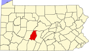
Dumb Hundred, Pennsylvania
Dumb Hundred, Pennsylvania | |
|---|---|
| Coordinates: 40°19′01″N 78°24′38″W / 40.31694°N 78.41056°W | |
| Country | United States |
| State | Pennsylvania |
| County | Blair |
| Township | Taylor |
| Area | |
• Total | 0.19 sq mi (0.49 km2) |
| • Land | 0.19 sq mi (0.49 km2) |
| • Water | 0.00 sq mi (0.00 km2) |
| Elevation | 1,283 ft (391 m) |
| Population | |
• Total | 84 |
| • Density | 446.81/sq mi (172.12/km2) |
| Time zone | UTC-5 (Eastern (EST)) |
| • Summer (DST) | UTC-4 (EDT) |
| ZIP Code | 16673 (Roaring Spring) |
| Area code(s) | 814/582 |
| FIPS code | 42-20214 |
| GNIS feature ID | 2805485[2] |
Dumb Hundred is an unincorporated community and census-designated place (CDP) in Blair County, Pennsylvania, United States. It was first listed as a CDP prior to the 2020 census.[2]
The CDP is in southern Blair County, in the southwestern part of Taylor Township. It sits along Pennsylvania Route 867, which leads north 1 mile (1.6 km) to Roaring Spring and south 14 miles (23 km) to Interstate 99 at St. Clairsville.
Dumb Hundred is in the western part of the Morrisons Cove valley, with Dunning Mountain rising to the west.
Demographics
[edit]| Census | Pop. | Note | %± |
|---|---|---|---|
| 2020 | 84 | — | |
| U.S. Decennial Census[4] | |||
Education
[edit]It is in the Spring Cove School District.[5]
References
[edit]- ^ "ArcGIS REST Services Directory". United States Census Bureau. Retrieved October 12, 2022.
- ^ a b c U.S. Geological Survey Geographic Names Information System: Dumb Hundred, Pennsylvania
- ^ "Census Population API". United States Census Bureau. Retrieved October 12, 2022.
- ^ "Census of Population and Housing". Census.gov. Retrieved June 4, 2016.
- ^ "2020 CENSUS - SCHOOL DISTRICT REFERENCE MAP: Blair County, PA" (PDF). U.S. Census Bureau. Retrieved January 2, 2025. - Text list


 French
 Deutsch

