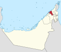
Emirates of the United Arab Emirates
| Emirates of the United Arab Emirates إمارات دولة الإمارات العربية المتحدة (Arabic) | |
|---|---|
| Category | Federated state |
| Location | United Arab Emirates |
| Number | 7 Emirates |
| Populations | 72,000 (Umm Al Quwain) – 4,177,059 (Dubai) |
| Areas | 260 km2 (100 sq mi) (Ajman) – 67,000 km2 (26,000 sq mi) (Abu Dhabi) |
| Government | |
| Subdivisions |
|
The United Arab Emirates consists of seven emirates (Arabic: إمارات ʾimārāt; singular: إمارة ʾimārah), which were historically known as the Trucial States.[1] All emirates are founding members of the union, apart from Ras Al Khaima which joined two months after the rest. There is almost always full freedom of movement between the different emirates of the UAE (an example of an exception is that during the COVID-19 pandemic, for instance, there were limitations of movement between the various emirates).[2]
List of Emirates
[edit]| Map | Flag[3] | Emirate | Arabic name | Date joined the UAE | Capital | Area (km2)[4] | Area (sq mi) |
|---|---|---|---|---|---|---|---|
 |  | Abu Dhabi | أبو ظبي ʾAbū dhabī | 2 December 1971 | Abu Dhabi | 67,340 | 26,000 |
 |  | Ajman | عجمان ʿAjmān | 2 December 1971 | Ajman | 259 | 100 |
 |  | Dubai | دبي Dubai | 2 December 1971 | Dubai | 4,114 | 1,590 |
 |  | Fujairah | الفجيرة Al-Fujayrah | 2 December 1971 | Fujairah | 1,450 | 560 |
 |  | Ras Al Khaimah | رأس الخيمة Raʾs al-khaimah | 10 February 1972 | Ras Al Khaimah | 1,684 | 650 |
 |  | Sharjah | الشارقة Aš-Šāriqah | 2 December 1971 | Sharjah | 2,590 | 1,000 |
 |  | Umm Al Quwain | أم القيوين ʾUmm Al-Qaywayn | 2 December 1971 | Umm Al Quwain | 720 | 280 |
See also
[edit]| This article is part of a series on the |
| Politics of the United Arab Emirates |
|---|
 |
| |
References
[edit]- ^ "United Arab Emirates | History, Culture, Population, Map, & Capital". Encyclopedia Britannica. Retrieved 31 August 2021.
- ^ "Travelling amid COVID-19: Moving within the UAE".
- ^ Flag of United Arab Emirates – A Brief History
- ^ "Census 2005". Ministry of Economy and Planning, Government of the United Arab Emirates. 2005. Archived from the original on 6 November 2009. Retrieved 13 November 2009.


 French
 Deutsch