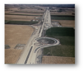
File:AASHO Road Test - Areal View.png
AASHO_Road_Test_-_Areal_View.png (431 × 366 pixels, file size: 274 KB, MIME type: image/png)
File history
Click on a date/time to view the file as it appeared at that time.
| Date/Time | Thumbnail | Dimensions | User | Comment | |
|---|---|---|---|---|---|
| current | 08:26, 12 August 2020 |  | 431 × 366 (274 KB) | BlaeX | cropped |
| 15:15, 11 August 2020 |  | 512 × 441 (327 KB) | BlaeX | Uploaded a work by US Federal Highway Administration from https://www.fhwa.dot.gov/highwayhistory/ with UploadWizard |
File usage
The following page uses this file:
Global file usage
The following other wikis use this file:
- Usage on ar.wikipedia.org
- Usage on de.wikipedia.org
- Usage on es.wikipedia.org
- Usage on uk.wikipedia.org
- Usage on www.wikidata.org


 French
 Deutsch
