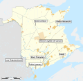
File:Administrative areas of New Brunswick with First Nations lands map-7 sites -fr.svg

Size of this PNG preview of this SVG file: 610 × 600 pixels. Other resolutions: 244 × 240 pixels | 488 × 480 pixels | 781 × 768 pixels | 1,042 × 1,024 pixels | 2,083 × 2,048 pixels | 2,237 × 2,199 pixels.
Original file (SVG file, nominally 2,237 × 2,199 pixels, file size: 1.61 MB)
File history
Click on a date/time to view the file as it appeared at that time.
| Date/Time | Thumbnail | Dimensions | User | Comment | |
|---|---|---|---|---|---|
| current | 00:24, 25 May 2014 |  | 2,237 × 2,199 (1.61 MB) | Red Castle | Mise à jour Hanwell et Cocagne |
| 17:43, 12 August 2012 |  | 2,237 × 2,199 (1.61 MB) | Dr Wilson | Kedgwick est désormais une communauté rurale. | |
| 11:57, 13 November 2011 |  | 2,237 × 2,199 (1.61 MB) | Bourrichon | correction | |
| 22:06, 12 November 2011 |  | 2,237 × 2,199 (1.61 MB) | Bourrichon | bug typo | |
| 22:03, 12 November 2011 |  | 2,237 × 2,199 (1.54 MB) | Bourrichon | == {{int:filedesc}} == {{Information |Description={{fr|1=Carte muette des divisions administratives du Nouveau-Brunswick, au Canada, incluant les réserves indiennes.<br> Légende : {{Legend|#FEFEE4|District de services locaux|css=border:1px solid #AA8753 |
File usage
The following page uses this file:
Global file usage
The following other wikis use this file:
- Usage on fr.wikipedia.org


 French
 Deutsch