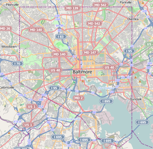
File:Baltimore osm-mapnik location map.png
Baltimore_osm-mapnik_location_map.png (490 × 475 pixels, file size: 349 KB, MIME type: image/png)
File history
Click on a date/time to view the file as it appeared at that time.
| Date/Time | Thumbnail | Dimensions | User | Comment | |
|---|---|---|---|---|---|
| current | 21:29, 13 December 2012 |  | 490 × 475 (349 KB) | Alexrk2 | {{Information |Description={{en|1=Map of Baltimore Geographic limits of the map: * N: 39.3805° * S: 39.1953° * W: -76.7426° * E: -76.4957° }} |Source=http://www.openstreetmap.org |Author=OpenStreetMap contributors |Date=2012-12 |Permission=Cart... |
File usage
More than 100 pages use this file. The following list shows the first 100 pages that use this file only. A full list is available.
- Abell, Baltimore
- Arlington, Baltimore
- Armistead Gardens, Baltimore
- Ashburton, Baltimore
- B&O Railroad Museum
- B'nai Israel Synagogue (Baltimore)
- Baltimore Hebrew Congregation
- Barclay, Baltimore
- Barre Circle, Baltimore
- Battle Monument
- Bayview, Baltimore
- Belvedere Hotel
- Berea, Baltimore
- Bolton Hill, Baltimore
- Brewers Hill, Baltimore
- Broadway East, Baltimore
- Business and Government Historic District
- Butchers Hill, Baltimore
- Canton, Baltimore
- Carroll Mansion
- Carrollton Viaduct
- Cathedral Hill Historic District (Baltimore, Maryland)
- Cedarcroft, Baltimore
- Clifton Park, Baltimore
- Coldstream-Homestead-Montebello, Baltimore
- College of Medicine of Maryland
- Congregation Shomrei Emunah (Baltimore)
- Congregation Tiferes Yisroel
- Coppin Heights, Baltimore
- Curtis Bay, Baltimore
- Cylburn Arboretum
- Dickeyville Historic District
- Downtown Baltimore
- Ednor Gardens-Lakeside, Baltimore
- Ellwood Park, Baltimore
- Elmer V. McCollum House
- Fallstaff, Baltimore
- Federal Hill, Baltimore
- Fell's Point, Baltimore
- First Church of Christ, Scientist (Baltimore, Maryland)
- First Unitarian Church (Baltimore, Maryland)
- Graceland Park, Baltimore
- Greektown, Baltimore
- Guilford, Baltimore
- Halethorpe, Maryland
- Hamilton Hills, Baltimore
- Hampden, Baltimore
- Henry August Rowland House
- Highfield House Condominium
- Highlandtown, Baltimore
- Hollins Market
- Homeland, Baltimore
- Inner Harbor
- Ira Remsen House
- Jewish Museum of Maryland
- Lauraville, Baltimore
- Little Italy, Baltimore
- Lloyd Street Synagogue
- Locust Point, Baltimore
- Lord Baltimore Hotel
- Loudon Park National Cemetery
- Lyric Baltimore
- M&T Bank Stadium
- Mayfield, Baltimore
- McElderry Park, Baltimore
- Middle East, Baltimore
- Mount Washington, Baltimore
- NS Savannah
- National Brewing Company
- Northwood, Baltimore
- Oliver, Baltimore
- Oriole Park at Camden Yards
- Park Heights, Baltimore
- Peale Museum
- Phoenix Shot Tower
- Pigtown, Baltimore
- Radnor-Winston, Baltimore
- Reservoir Hill, Baltimore
- Ridgely's Delight, Baltimore
- SS John W. Brown
- Seton Hill, Baltimore
- Silo Point Condominium
- St. Agnes Hospital (Baltimore)
- Stonewood-Pentwood-Winston, Baltimore
- Transamerica Tower (Baltimore)
- USCGC Taney
- USS Torsk
- Union Square, Baltimore
- United States Coast Guard Yard
- United States lightship Chesapeake (LV-116)
- Upper Fell's Point
- Upton, Baltimore
- Washington Hill, Baltimore
- Waverly, Baltimore
- Weiskittel-Roehle Burial Vault
- Westminster Hall and Burying Ground
- Westport, Baltimore
- Wetheredsville, Maryland
- William H. Welch House
- Woodberry, Baltimore
View more links to this file.
Global file usage
The following other wikis use this file:
- Usage on ar.wikipedia.org
- Usage on arz.wikipedia.org
- Usage on bh.wikipedia.org
- Usage on ceb.wikipedia.org
- Usage on fa.wikipedia.org
- Usage on fr.wikipedia.org
- Walters Art Museum
- M&T Bank Stadium
- Oriole Park at Camden Yards
- CFG Bank Arena
- Aquarium national de Baltimore
- Memorial Stadium (Baltimore)
- Legg Mason Building
- American Visionary Art Museum
- Phoenix Shot Tower
- Maryland Science Center
- Commerce Place
- Maison et musée Edgar-Allan-Poe
- Circuit urbain de Baltimore
- Modèle:Géolocalisation/Baltimore
- Bugle Field
- Module:Carte/données/baltimore
- UMBC Stadium
- Retriever Soccer Park
- West Cold Spring (métro de Baltimore)
- Mondawmin (métro de Baltimore)
- Penn-North (métro de Baltimore)
- Upton (métro de Baltimore)
- State Center (métro de Baltimore)
- Lexington Market (métro de Baltimore)
- Charles Center (métro de Baltimore)
- Shot Tower (métro de Baltimore)
- Six Flags Power Plant
- Usage on id.wikipedia.org
- Usage on ja.wikipedia.org
View more global usage of this file.


 French
 Deutsch
