File:Cornwall electoral division map 2021.svg

Original file (SVG file, nominally 1,306 × 1,266 pixels, file size: 1.79 MB)

Summary

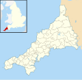
Description Blank map of Cornwall showing the 2021 electoral divisions
Date (UTC)
Source This file was derived from: Cornwall Council political divisions May 2021 map.svg
Author

Licensing

I, the copyright holder of this work, hereby publish it under the following license:
w:en:Creative Commons
attribution share alike
This file is licensed under the Creative Commons Attribution-Share Alike 3.0 Unported license.
You are free:
  • to share – to copy, distribute and transmit the work
  • to remix – to adapt the work
Under the following conditions:
  • attribution – You must give appropriate credit, provide a link to the license, and indicate if changes were made. You may do so in any reasonable manner, but not in any way that suggests the licensor endorses you or your use.
  • share alike – If you remix, transform, or build upon the material, you must distribute your contributions under the same or compatible license as the original.

Original upload log

This image is a derivative work of the following images:

  • File:2021 Cornwall Council election.svg licensed with Cc-by-sa-3.0
    • 2021-05-08T10:30:21Z Ralbegen 1088x779 (3587799 Bytes) Uploaded a work by Coloured by Ralbegen from [[w:Ordnance Survey|Ordnance Survey]] [https://www.ordnancesurvey.co.uk/opendatadownload/products.html OpenData]. *Geography data from Boundary-Line product. with UploadWizard
  • File:Cornwall Council political divisions May 2021 map.svg licensed with Cc-by-sa-3.0
    • 2021-05-09T20:28:39Z Gazamp 1306x1266 (1913102 Bytes) Changed St Ives West and Towednack from LD to Independent (CC website had incorrect list)
    • 2021-05-09T16:39:48Z Talleyrand6 1306x1266 (1913110 Bytes) Lighter grey
    • 2021-05-09T16:38:57Z Talleyrand6 1306x1266 (1913096 Bytes) Lighter Independent colour.
    • 2021-05-08T20:53:38Z Talleyrand6 1306x1266 (1913144 Bytes) Removed Devon city names.
    • 2021-05-08T20:43:55Z Talleyrand6 1306x1266 (2317509 Bytes) Uploaded a work by Nilfanion from Cornwall UK mainland electoral division map 2013 (blank).svg with UploadWizard

Uploaded with derivativeFX

Captions

Add a one-line explanation of what this file represents

Items portrayed in this file

depicts

image/svg+xml

4d678a746815257e7bfeee7423e25f3fc8ff5d68

1,878,747 byte

1,266 pixel

1,306 pixel

File history

Click on a date/time to view the file as it appeared at that time.

Date/TimeThumbnailDimensionsUserComment
current20:42, 9 May 2021Thumbnail for version as of 20:42, 9 May 20211,306 × 1,266 (1.79 MB)GazampVersion with Devon and corner map. Derivative of File:Cornwall Council political divisions May 2021 map.svg
14:09, 8 May 2021Thumbnail for version as of 14:09, 8 May 2021778 × 726 (1.98 MB)GazampNot so distorted
13:42, 8 May 2021Thumbnail for version as of 13:42, 8 May 2021875 × 918 (1.98 MB)Gazamp== {{int:filedesc}} == {{Information |Description=Blank map of Cornwall showing the 2021 electoral divisions |Source={{Derived from|2021 Cornwall Council election.svg|display=50}} |Date=2021-05-08 13:40 (UTC) |Author=* File:2021 Cornwall Council election.svg: Coloured by Ralbegen * derivative work: [[User:{{subst:REVISIONUSER}}|{{subst:REVISIONUSER}}]] |Permission= |other_versions= }} == {{int:license-header}} == {{self|Cc-by-sa-3.0}} == {{Origin...
No pages on the English Wikipedia use this file (pages on other projects are not listed).

Metadata