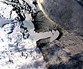
File:Drygalski.jpg

Size of this preview: 718 × 599 pixels. Other resolutions: 288 × 240 pixels | 575 × 480 pixels | 920 × 768 pixels | 1,138 × 950 pixels.
Original file (1,138 × 950 pixels, file size: 250 KB, MIME type: image/jpeg)
File history
Click on a date/time to view the file as it appeared at that time.
| Date/Time | Thumbnail | Dimensions | User | Comment | |
|---|---|---|---|---|---|
| current | 04:18, 1 January 2008 |  | 1,138 × 950 (250 KB) | Hal8999 | {{Information |Description={{en|Satellite image of Drygalski ice tongue taken from NASA [http://aqua.nasa.gov/ Aqua] satellite with [http://modis.gsfc.nasa.gov/ MODIS] sensor on 30 March 2006: spatial resolution is 250 meters. Th |
File usage
The following page uses this file:
Global file usage
The following other wikis use this file:
- Usage on bg.wikipedia.org
- Usage on ceb.wikipedia.org
- Usage on de.wikipedia.org
- Usage on en.wiktionary.org
- Usage on fr.wikipedia.org
- Usage on he.wikipedia.org
- Usage on it.wikipedia.org
- Usage on ka.wikipedia.org
- Usage on lv.wikipedia.org
- Usage on nn.wikipedia.org
- Usage on no.wikipedia.org
- Usage on pl.wikipedia.org
- Usage on pt.wikipedia.org
- Usage on tr.wikipedia.org
- Usage on www.wikidata.org


 French
 Deutsch
