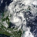
File:Hurricane Paula 2010-10-12 1620Z.jpg

Size of this preview: 600 × 600 pixels. Other resolutions: 240 × 240 pixels | 480 × 480 pixels | 768 × 768 pixels | 1,024 × 1,024 pixels | 2,048 × 2,048 pixels | 5,600 × 5,600 pixels.
Original file (5,600 × 5,600 pixels, file size: 8.06 MB, MIME type: image/jpeg)
File history
Click on a date/time to view the file as it appeared at that time.
| Date/Time | Thumbnail | Dimensions | User | Comment | |
|---|---|---|---|---|---|
| current | 03:33, 28 June 2013 |  | 5,600 × 5,600 (8.06 MB) | HurricaneSpin | cropped |
| 22:56, 12 October 2010 |  | 5,600 × 7,200 (6.19 MB) | HurricaneSpin | {{Information |Description={{en|1=Hurricane Paula.}} |Source=[http://rapidfire.sci.gsfc.nasa.gov/gallery/?2010285-1012/Paula.A2010285.1620.2km.jpg] |Author=NASA/MODIS Rapid Response System |Date=2010-10-12 |Permission=See below |other_versions= }} [[Cate |
File usage
The following 3 pages use this file:
Global file usage
The following other wikis use this file:
- Usage on de.wikipedia.org
- Usage on en.wikinews.org
- Usage on es.wikipedia.org
- Usage on fr.wikipedia.org
- Usage on ko.wikipedia.org
- Usage on nl.wikipedia.org
- Usage on pt.wikipedia.org
- Usage on simple.wikipedia.org
- Usage on www.wikidata.org
- Usage on zh.wikipedia.org


 French
 Deutsch
