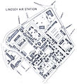
File:Lindsey Air Station map.jpg

Size of this preview: 547 × 600 pixels. Other resolutions: 219 × 240 pixels | 438 × 480 pixels | 701 × 768 pixels | 934 × 1,024 pixels | 1,497 × 1,641 pixels.
Original file (1,497 × 1,641 pixels, file size: 707 KB, MIME type: image/jpeg)
File history
Click on a date/time to view the file as it appeared at that time.
| Date/Time | Thumbnail | Dimensions | User | Comment | |
|---|---|---|---|---|---|
| current | 01:33, 6 August 2013 |  | 1,497 × 1,641 (707 KB) | Drdoht | dito |
| 01:30, 6 August 2013 |  | 1,497 × 1,641 (707 KB) | Drdoht | Bild gedreht und Google Earth angepaßt | |
| 20:21, 3 May 2006 |  | 1,260 × 1,135 (252 KB) | Kandschwar | {{Information| |Description=Map of the ''Lindsey_Air_Station'' in Wiesbaden, Germany |Source=http://www.usarmygermany.com/Communities/Wiesbaden/Installation_Lindsey%20AS.htm |Date=late 1970s |Author=unknow |Permission={{PD-USGov-Military-Air Force}} |othe |
File usage
The following page uses this file:
Global file usage
The following other wikis use this file:
- Usage on azb.wikipedia.org
- Usage on de.wikipedia.org


 French
 Deutsch