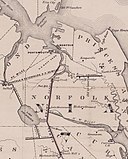
File:Map of the Dismal Swamp Canal 1867.jpg

Size of this preview: 477 × 599 pixels. Other resolutions: 191 × 240 pixels | 382 × 480 pixels | 611 × 768 pixels | 815 × 1,024 pixels | 1,630 × 2,048 pixels | 3,910 × 4,911 pixels.
Original file (3,910 × 4,911 pixels, file size: 2.48 MB, MIME type: image/jpeg)
File history
Click on a date/time to view the file as it appeared at that time.
| Date/Time | Thumbnail | Dimensions | User | Comment | |
|---|---|---|---|---|---|
| current | 01:22, 17 June 2010 |  | 3,910 × 4,911 (2.48 MB) | MarmadukePercy | {{Information |Description={{en|1="Map of the Dismal Swamp Canal," by D. S. Walton. Civil Engineer, 1867. Courtesy of the University of North Carolina Libraries.}} |Source=http://www.learnnc.org/lp/multimedia/9393 |Author=map by D. S. Walton (published by |
File usage
The following page uses this file:
Global file usage
The following other wikis use this file:
- Usage on de.wikipedia.org
- Usage on fr.wikipedia.org


 French
 Deutsch


