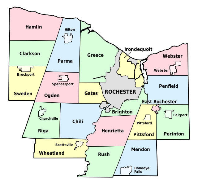
File:Monroe County (New York) - Towns, Villages, and City.svg

Size of this PNG preview of this SVG file: 640 × 600 pixels. Other resolutions: 256 × 240 pixels | 819 × 768 pixels | 1,092 × 1,024 pixels | 2,185 × 2,048 pixels | 1,500 × 1,406 pixels.
Original file (SVG file, nominally 1,500 × 1,406 pixels, file size: 73 KB)
File history
Click on a date/time to view the file as it appeared at that time.
| Date/Time | Thumbnail | Dimensions | User | Comment | |
|---|---|---|---|---|---|
| current | 16:58, 30 November 2008 |  | 1,500 × 1,406 (73 KB) | LtPowers | {{Information |Description={{en|1=Map of Monroe County, New York, showing its constituent towns, villages, and city. Labels in English.}} |Source=Own work by uploader, based on public domain USGS topographic maps |Author=[[U |
File usage
The following 21 pages use this file:
- Adams Basin, New York
- Black Creek (Genesee River tributary)
- Black Creek Park
- Clarkson (CDP), New York
- Cobbs Hill Reservoir
- Gates (CDP), New York
- Gates Center, New York
- Genesee Junction, New York
- Hamlin (CDP), New York
- Hart's Woods
- High Falls (Rochester, New York)
- Honeoye Creek
- Irondequoit Bay State Marine Park
- Irondequoit Gully
- Maplewood Park
- Monroe County, New York
- North Chili, New York
- North Greece, New York
- Union Hill, New York
- University of Rochester Arboretum
- Template:MonroeCountyNY-geo-stub
Global file usage
The following other wikis use this file:
- Usage on es.wikipedia.org
- Usage on fr.wikipedia.org
- Usage on ja.wikipedia.org
- Usage on la.wikipedia.org
- Usage on pt.wikipedia.org
- Usage on www.wikidata.org


 French
 Deutsch