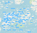
File:Nagu map - central.png

Size of this preview: 682 × 600 pixels. Other resolutions: 273 × 240 pixels | 546 × 480 pixels | 873 × 768 pixels | 1,165 × 1,024 pixels | 2,279 × 2,004 pixels.
Original file (2,279 × 2,004 pixels, file size: 1.81 MB, MIME type: image/png)
File history
Click on a date/time to view the file as it appeared at that time.
| Date/Time | Thumbnail | Dimensions | User | Comment | |
|---|---|---|---|---|---|
| current | 11:23, 31 October 2019 |  | 2,279 × 2,004 (1.81 MB) | Cogitato | Backas, Kaiplot, Rilot, Ekholm |
| 08:02, 27 October 2019 |  | 2,229 × 2,004 (1.43 MB) | Cogitato | Petsor added | |
| 07:54, 27 October 2019 |  | 2,226 × 2,004 (1.43 MB) | Cogitato | Names of villages and islands CAPITAL only if present in https://nagu.hembygd.fi/lokalhistoria/byar_i_nagu/, otherwise Mixed Case | |
| 14:35, 26 October 2019 |  | 2,214 × 2,004 (1.43 MB) | Cogitato | Added a few villages, changed a few spellings based on requests by locals | |
| 08:39, 26 October 2019 |  | 2,229 × 2,004 (1.44 MB) | Cogitato | User created page with UploadWizard |
File usage
The following page uses this file:
Global file usage
The following other wikis use this file:
- Usage on sv.wikipedia.org


 French
 Deutsch