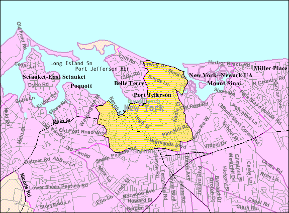
File:Port-jefferson-map.gif
Port-jefferson-map.gif (575 × 425 pixels, file size: 55 KB, MIME type: image/gif)
File history
Click on a date/time to view the file as it appeared at that time.
| Date/Time | Thumbnail | Dimensions | User | Comment | |
|---|---|---|---|---|---|
| current | 06:18, 23 August 2013 |  | 575 × 425 (55 KB) | Dcirovic | {{Information |Description={{en|en:U.S. Census 2000 reference map for en:Port Jefferson, New York<br/> en:Category:Maps of Long Island, New York}} |Source=Transferred from [http://en.wikipedia.org en.wikipedia]<br/> (Original text :... |
File usage
The following 2 pages use this file:
Global file usage
The following other wikis use this file:
- Usage on ar.wikipedia.org
- Usage on azb.wikipedia.org
- Usage on ca.wikipedia.org
- Usage on ceb.wikipedia.org
- Usage on cy.wikipedia.org
- Usage on es.wikipedia.org
- Usage on eu.wikipedia.org
- Usage on fa.wikipedia.org
- Usage on ht.wikipedia.org
- Usage on sh.wikipedia.org
- Usage on simple.wikipedia.org
- Usage on sr.wikipedia.org
- Usage on www.wikidata.org
- Usage on zh.wikipedia.org


 French
 Deutsch
