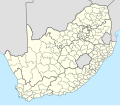
File:South Africa municipalities 2016 blank.svg

Size of this PNG preview of this SVG file: 684 × 599 pixels. Other resolutions: 274 × 240 pixels | 548 × 480 pixels | 876 × 768 pixels | 1,168 × 1,024 pixels | 2,337 × 2,048 pixels | 809 × 709 pixels.
Original file (SVG file, nominally 809 × 709 pixels, file size: 1.81 MB)
File history
Click on a date/time to view the file as it appeared at that time.
| Date/Time | Thumbnail | Dimensions | User | Comment | |
|---|---|---|---|---|---|
| current | 10:16, 15 January 2017 |  | 809 × 709 (1.81 MB) | Htonl | Add XML declaration |
| 23:59, 17 August 2016 |  | 809 × 709 (1.81 MB) | Htonl | == {{int:filedesc}} == {{Information |Description={{en|1=Map showing the borders of the municipalities of South Africa at the time of the 2016 local elections.}} |Source=Own work, based on official municipality boundary data from the [[w:Municipal Dema... |
File usage
The following 4 pages use this file:
Global file usage
The following other wikis use this file:
- Usage on es.wikipedia.org
- Usage on fi.wikipedia.org
- Usage on zh.wikipedia.org


 French
 Deutsch