
 French
 Deutsch
File:Thomas Mill Covered Bridge.JPG
Size of this preview: 800 × 600 pixels. Other resolutions: 320 × 240 pixels | 640 × 480 pixels | 1,024 × 768 pixels | 1,280 × 960 pixels | 2,592 × 1,944 pixels.
Original file (2,592 × 1,944 pixels, file size: 2.91 MB, MIME type: image/jpeg)
| This is a file from the Wikimedia Commons. Information from its description page there is shown below. Commons is a freely licensed media file repository. You can help. |
Summary
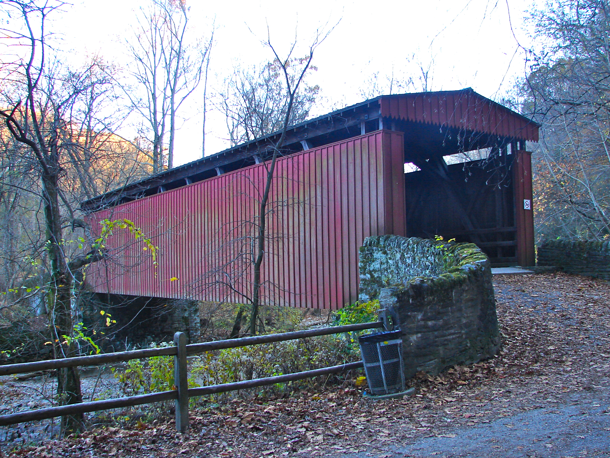
| Description | English: Thomas Mill Covered Bridge on the NRHP since December 1, 1980. On Thomas Mill Road (or footpath) across Wissahickon Creek connecting to Forbidden Drive in Fairmount Park, Philadelphia. This is the only surviving covered bridge in a major city in the US. It's an odd bridge in that there is an extensive stone bridge leading up to it from the east side. Also in the Wissahickon Gorge there is something of a microclimate. Lots of foliage and difficult light makes it difficult to photograph. There is a good black and white photo from Jack Boucher HABS on Commons, but photogs who want to get a good picture of this marvel will need to dedicate a lot of time on it. |
| Date | |
| Source | Own work |
| Author | Smallbones |
| Camera location | | View this and other nearby images on: OpenStreetMap |
|---|
Licensing
| I, the copyright holder of this work, release this work into the public domain. This applies worldwide. In some countries this may not be legally possible; if so: I grant anyone the right to use this work for any purpose, without any conditions, unless such conditions are required by law. |
File history
Click on a date/time to view the file as it appeared at that time.
| Date/Time | Thumbnail | Dimensions | User | Comment | |
|---|---|---|---|---|---|
| current | 16:29, 12 November 2010 | | 2,592 × 1,944 (2.91 MB) | Smallbones | {{Information |Description={{en|1=Thomas Mill Covered Bridge on the NRHP since December 1, 1980. On Thomas Mill Road (or footpath) across Wissahickon Creek connecting to Forbidden Drive in Fairmount Park, Philadelphia. This is the only surviving covered b |
File usage
The following 4 pages use this file: