
 French
 Deutsch
File:Village centre of Mortsel, Belgium (aerial view).jpg

Size of this preview: 800 × 465 pixels. Other resolutions: 320 × 186 pixels | 640 × 372 pixels | 1,024 × 595 pixels | 1,280 × 744 pixels | 2,560 × 1,487 pixels | 3,869 × 2,248 pixels.
Original file (3,869 × 2,248 pixels, file size: 3.34 MB, MIME type: image/jpeg)
| This is a file from the Wikimedia Commons. Information from its description page there is shown below. Commons is a freely licensed media file repository. You can help. |
.jpg)
Summary
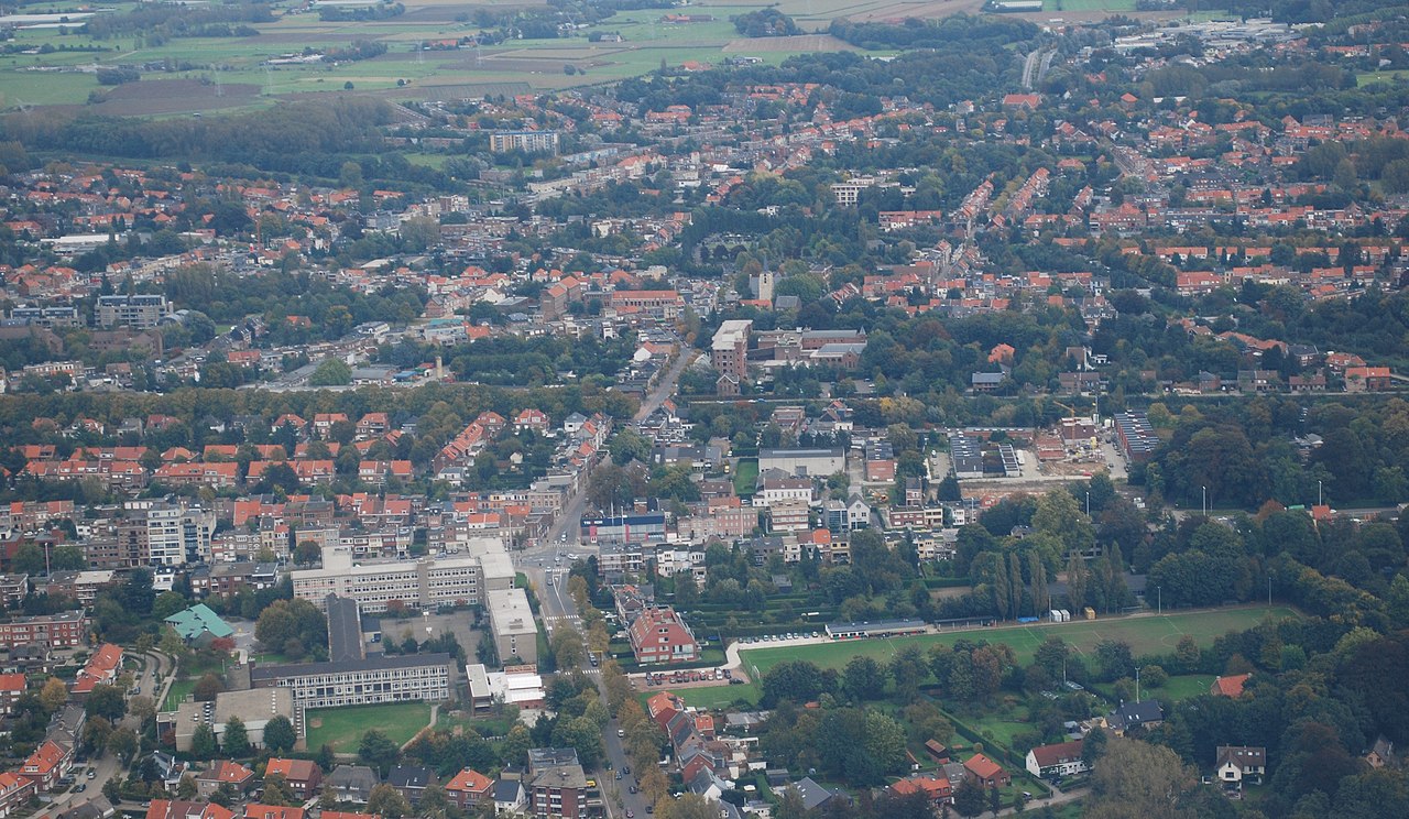
| Description | English: Aerial photograph from the West towards the centre of Mortsel. The near-horizontal line in the middle is the Antwerp-Brussels railroad. The red brick structure in front of the church is Saint Joseph's hospital. Nikon D60 f=48mm f/7.1 ISO 200 1/200s. Reframed and colour corrected using Adobe Photoshop 4.0. Nederlands: Luchtfoto van de dorpskern van Mortsel vanuit het westen. De bijna horizontale lijn in het midden is de spoorweg Antwerpen-Brussel. Het rode bakstenen gebouw voor de kerk is het Sint-Jozefziekenhuis. Nikon D60 f=48mm f/7.1 ISO 200 1/200s. Cadrage en kleurcorrectie met Adobe Photoshop 4.0. |
| Date | CEST |
| Source | Own work |
| Author | Lieven Smits |
Licensing
I, the copyright holder of this work, hereby publish it under the following licenses:
 | Permission is granted to copy, distribute and/or modify this document under the terms of the GNU Free Documentation License, Version 1.2 or any later version published by the Free Software Foundation; with no Invariant Sections, no Front-Cover Texts, and no Back-Cover Texts. A copy of the license is included in the section entitled GNU Free Documentation License. |
This file is licensed under the Creative Commons Attribution-Share Alike 3.0 Unported, 2.5 Generic, 2.0 Generic and 1.0 Generic license.
- You are free:
- to share – to copy, distribute and transmit the work
- to remix – to adapt the work
- Under the following conditions:
- attribution – You must give appropriate credit, provide a link to the license, and indicate if changes were made. You may do so in any reasonable manner, but not in any way that suggests the licensor endorses you or your use.
- share alike – If you remix, transform, or build upon the material, you must distribute your contributions under the same or compatible license as the original.
You may select the license of your choice.
File history
Click on a date/time to view the file as it appeared at that time.
| Date/Time | Thumbnail | Dimensions | User | Comment | |
|---|---|---|---|---|---|
| current | 20:39, 15 October 2008 | | 3,869 × 2,248 (3.34 MB) | Lieven Smits | {{Information |Description={{en|1=Aerial photograph from the West towards the centre of Mortsel. The near-horizontal line in the middle is the Antwerp-Brussels railroad. The red brick structure in front of the church is Saint Joseph's hospital. Nikon D60 |
File usage
The following pages on the English Wikipedia use this file (pages on other projects are not listed):
Global file usage
The following other wikis use this file:
- Usage on ar.wikipedia.org
- Usage on bg.wikipedia.org
- Usage on br.wikipedia.org
- Usage on ca.wikipedia.org
- Usage on ceb.wikipedia.org
- Usage on eo.wikipedia.org
- Usage on es.wikipedia.org
- Usage on eu.wikipedia.org
- Usage on fa.wikipedia.org
- Usage on ga.wikipedia.org
- Usage on it.wikipedia.org
- Usage on la.wikipedia.org
- Usage on nl.wikipedia.org
- Usage on pt.wikipedia.org
- Usage on ro.wikipedia.org
- Usage on ru.wikipedia.org
- Usage on sk.wikipedia.org
- Usage on sv.wikipedia.org
- Usage on tr.wikipedia.org
- Usage on vi.wikipedia.org
- Usage on www.wikidata.org
.jpg)