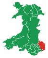
File:Wales Monmouthshire.svg

Size of this PNG preview of this SVG file: 501 × 599 pixels. Other resolutions: 201 × 240 pixels | 401 × 480 pixels | 642 × 768 pixels | 857 × 1,024 pixels | 1,713 × 2,048 pixels | 512 × 612 pixels.
Original file (SVG file, nominally 512 × 612 pixels, file size: 277 KB)
File history
Click on a date/time to view the file as it appeared at that time.
| Date/Time | Thumbnail | Dimensions | User | Comment | |
|---|---|---|---|---|---|
| current | 02:44, 21 December 2023 |  | 512 × 612 (277 KB) | DankJae | Uploaded own work with UploadWizard |
File usage
The following 26 pages use this file:
- A4042 road
- A40 road
- A449 road
- A465 road
- Abergavenny railway station
- Caldicot railway station
- Celtic Trail cycle route
- Chepstow railway station
- Gloucester–Newport line
- List of crossings of the River Wye
- M48 motorway
- M4 motorway
- Monmouthshire
- Monmouthshire and Brecon Canal
- National Cycle Route 4
- National Cycle Route 42
- National Cycle Route 8
- River Wye
- Severn Tunnel Junction railway station
- South Wales Main Line
- Stagecoach South Wales
- Transport in Wales
- Trunk roads in Wales
- Welsh Marches line
- File talk:Wales Monmouthshire.svg
- Template:Transport in Monmouthshire


 French
 Deutsch