Haret Al Fawar
Haret Al Fawar حارة الفوار | |
|---|---|
Village | |
 | |
| Coordinates: 34°25′58″N 35°53′18″E / 34.4328°N 35.8884°E | |
| Country | |
| Governorate | North Governorate |
| District | Zgharta District |
| Elevation | 196 m (643 ft) |
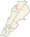
Haret Al Fawar (Arabic: حارة الفوار) is a village in Zgharta District, in the Northern Governorate of Lebanon. Its population is composed of Maronite Christians Sunni Muslims.[1]
The village is located on a foothill of Terboul Mountain, surrounded by valleys. It stands 196 metres (643 ft) above sea level.[2] There's a mosque in the old section of the village. As well as a modern hall for Islamic occasions such as weddings and the celebration of Mawlid of the Islamic prophet Muhammad. More than 80% of its population are Muslims, and most are with AICP (Association of Islamic Charitable Projects).[citation needed]
Etymology
[edit]The village's name, which translates to "bubbling lane," originates from an old stream. [citation needed]
History
[edit]For the past 100 years, the village has been populated by three main families: Awik, Jalloul, and Tabbaa. During the Lebanese Civil War, from 1975 until 1990, the village witnessed much destruction due to bombardment from the war. As it was considered strategic with a good view of the surrounding areas.
References
[edit]- ^ "Municipal and ikhtiyariah elections in Northern Lebanon" (PDF). The Monthly. March 2010. p. 23. Archived from the original on 3 June 2016. Retrieved 29 October 2016.
{{cite web}}: CS1 maint: bot: original URL status unknown (link) - ^ "Haret Al Fawar, Lebanon: Basic Facts". Geotsy.
External links
[edit]- Haret el Fouar, Localiban
- Ehden Family Tree


 French
 Deutsch