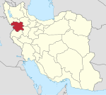
Hezar Kanian
Hezar Kanian Persian: هزاركانيان | |
|---|---|
City | |
| Coordinates: 35°46′05″N 46°48′42″E / 35.76806°N 46.81167°E[1] | |
| Country | Iran |
| Province | Kurdistan |
| County | Divandarreh |
| District | Saral |
| Population (2016)[2] | |
| • Total | 544 |
| Time zone | UTC+3:30 (IRST) |
Hezar Kanian (Persian: هزاركانيان)[a] is a city in, and the capital of, Saral District of Divandarreh County, Kurdistan province, Iran.[4] It also serves as the administrative center for Saral Rural District.[5] The village is populated by Kurds.[6]
Demographics
[edit]Population
[edit]At the time of the 2006 National Census, Hezar Kanian's population was 511 in 109 households, when it was a village in Saral Rural District.[7] The following census in 2011 counted 773 people in 156 households.[8] The 2016 census measured the population of the village as 544 people in 115 households. It was the most populous village in its rural district.[2]
After the census, the village of Hezar Kanian was elevated to the status of a city.[9]
Overview
[edit]It has rapid growth in the main areas of agriculture. The location of the new city of Hezar Kanian can be explained and analyzed in many points: access location, geomorphological construction, economic foundations and population strategies, are more effective for the development of such settlements, which if the right policies are adopted, will cause the physical development of this new city. It is emphasized again that it is necessary to provide the ground for the sustainability of the population with a new functional definition and diversification of the urban economy.[citation needed]
See also
[edit]Notes
[edit]References
[edit]- ^ OpenStreetMap contributors (17 August 2023). "Hezar Kanian, Divandarreh County" (Map). OpenStreetMap (in Persian). Retrieved 17 August 2023.
- ^ a b "Census of the Islamic Republic of Iran, 1395 (2016)". AMAR (in Persian). The Statistical Center of Iran. p. 12. Archived from the original (Excel) on 8 May 2022. Retrieved 19 December 2022.
- ^ Hezar Kanian can be found at GEOnet Names Server, at this link, by opening the Advanced Search box, entering "-3848667" in the "Unique Feature Id" form, and clicking on "Search Database".
- ^ Aref, Mohammad Reza (15 April 1382). "Divisional reforms in Kurdistan province". Islamic Parliament Research Center (in Persian). Ministry of Interior, Political-Defense Commission of the Government Board. Archived from the original on 29 April 2015. Retrieved 22 January 2024.
- ^ "Creation and formation of 21 rural districts including villages, farms and places in Sanandaj County under Kurdistan province". Islamic Parliament Research Center (in Persian). Ministry of Interior, Council of Ministers. 18 May 1366. Archived from the original on 10 May 2015. Retrieved 23 January 2024.
- ^ Mohammadirad, Masoud; Anonby, Erik; et al. "Language distribution in Kordestan Province, Iran". Atlas of the languages of Iran (ALI). Geomatics and Cartographic Research Centre, Carleton University. Archived from the original on 28 May 2023.
- ^ "Census of the Islamic Republic of Iran, 1385 (2006)". AMAR (in Persian). The Statistical Center of Iran. p. 12. Archived from the original (Excel) on 20 September 2011. Retrieved 25 September 2022.
- ^ "Census of the Islamic Republic of Iran, 1390 (2011)". Syracuse University (in Persian). The Statistical Center of Iran. p. 12. Archived from the original (Excel) on 19 January 2023. Retrieved 19 December 2022.
- ^ Fazli, Rahmani (26 March 2017). "Hezar Kanian, the center of Saral District, was upgraded to a city". Kurd Press (in Persian). Ministry of Interior, Cabinet of Ministers. Archived from the original on 17 August 2023. Retrieved 17 August 2023.


 French
 Deutsch

