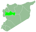
Hirbnafsah
Hirbnafsah حر بنفسه | |
|---|---|
Town | |
| Coordinates: 34°56′14″N 36°37′18″E / 34.93722°N 36.62167°E | |
| Country | |
| Governorate | Hama |
| District | Hama |
| Subdistrict | Hirbnafsah |
| Population (2004) | |
• Total | 3,574 |
Hirbnafsah (Arabic: حر بنفسه, romanized: Hīrbnafseh, also spelled Harb Nafseh) is a town in northwestern Syria, administratively part of the Hama Governorate, southwest of Hama. Nearby localities include Deir al-Fardis to the north, Tumin and al-Rastan to the east, Kisin and Kafr Nan to the south, Talaf to the southwest, . According to the Central Bureau of Statistics (CBS), Hirbnafsah had a population of 3,574 in the 2004 census. It is the administrative center and sixth largest locality of the Hirbnafsah nahiyah ("subdistrict") which consists of 26 localities with a collective population of 54,592.[1] Its inhabitants are predominantly Sunni Muslims.[2]
The Syria geographer Yaqut al-Hamawi mentioned that Hirbnafsah was "a village of Hims" when he visited in 1225 during Ayyubid rule.[3]
During the ongoing Syrian civil war, which began in 2011, opposition sources claimed that 40 people in Hirbnafsa were killed as a result of Syrian Army and pro-government militia bombardment on 6 August 2012. Other opposition accounts put the fatality figure at 11, including five children.[4]
References
[edit]- ^ General Census of Population and Housing 2004. Syria Central Bureau of Statistics (CBS). Hama Governorate. (in Arabic)
- ^ Smith, in Robinson and Smith, 1841, vol 3, 2nd appendix, p. 179
- ^ Le Strange, 1890, p. 448
- ^ Syria TV 'hit by bomb attack' in Damascus. BBC News. 2012-08-06.
Bibliography
[edit]- Le Strange, G. (1890). Palestine Under the Moslems: A Description of Syria and the Holy Land from A.D. 650 to 1500. Committee of the Palestine Exploration Fund.
- Robinson, E.; Smith, E. (1841). Biblical Researches in Palestine, Mount Sinai and Arabia Petraea: A Journal of Travels in the year 1838. Vol. 3. Boston: Crocker & Brewster.


 French
 Deutsch


