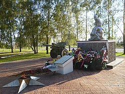
Kromy, Oryol Oblast
Kromy Кромы | |
|---|---|
 | |
| Coordinates: 52°41′23″N 35°46′03″E / 52.68972°N 35.76750°E | |
| Country | Russia |
| Federal subject | Oryol Oblast |
| Administrative district | Kromskoy District |
| Elevation | 170 m (560 ft) |
| Population | |
• Total | 6,733 |
| Time zone | UTC+3 (MSK |
| Postal code(s)[3] | 303200 |
| Dialing code(s) | +7 48643 |
| OKTMO ID | 54625151051 |

Kromy (Russian: Кромы) is an urban locality (an urban-type settlement) and the administrative center of Kromskoy District of Oryol Oblast, Russia, located on the Kroma River (a tributary of the Oka) 36 kilometers (22 mi) southwest of Oryol. Population: 6,733 (2010 Census);[1] 7,194 (2002 Census);[4] 7,082 (1989 Soviet census).[5]
It was first chronicled in 1147, the same year as Moscow. It was a seat of one of the Upper Oka Principalities of the 15th century. In 1595, it was fortified by Boris Godunov in order to defend the Grand Duchy of Moscow from the Tatar raids. During the Time of Troubles, it gained nationwide renown as a major stronghold of the rebels such as the Don Cossacks led by Andrey Korela and Ivan Bolotnikov's generals.[6]
Kromy was an important agricultural center throughout the 19th century. A railway from Moscow to Kharkov reached it in the 1850s. A large Neoclassical cathedral dates from this period. Kromy was contested by Anton Denikin's forces and the Red Army in October 1919.[7]
Kromy lost its town status and was demoted to an urban-type settlement in 1924.
References
[edit]- ^ a b Russian Federal State Statistics Service (2011). Всероссийская перепись населения 2010 года. Том 1 [2010 All-Russian Population Census, vol. 1]. Всероссийская перепись населения 2010 года [2010 All-Russia Population Census] (in Russian). Federal State Statistics Service.
- ^ "Об исчислении времени". Официальный интернет-портал правовой информации (in Russian). 3 June 2011. Retrieved 19 January 2019.
- ^ Почта России. Информационно-вычислительный центр ОАСУ РПО. (Russian Post). Поиск объектов почтовой связи (Postal Objects Search) (in Russian)
- ^ Federal State Statistics Service (21 May 2004). Численность населения России, субъектов Российской Федерации в составе федеральных округов, районов, городских поселений, сельских населённых пунктов – районных центров и сельских населённых пунктов с населением 3 тысячи и более человек [Population of Russia, Its Federal Districts, Federal Subjects, Districts, Urban Localities, Rural Localities—Administrative Centers, and Rural Localities with Population of Over 3,000] (XLS). Всероссийская перепись населения 2002 года [All-Russia Population Census of 2002] (in Russian).
- ^ Всесоюзная перепись населения 1989 г. Численность наличного населения союзных и автономных республик, автономных областей и округов, краёв, областей, районов, городских поселений и сёл-райцентров [All Union Population Census of 1989: Present Population of Union and Autonomous Republics, Autonomous Oblasts and Okrugs, Krais, Oblasts, Districts, Urban Settlements, and Villages Serving as District Administrative Centers]. Всесоюзная перепись населения 1989 года [All-Union Population Census of 1989] (in Russian). Институт демографии Национального исследовательского университета: Высшая школа экономики [Institute of Demography at the National Research University: Higher School of Economics]. 1989 – via Demoscope Weekly.
- ^ "Кромской район". Archived from the original on 2011-08-11. Retrieved 2010-09-26.
- ^ "Кромы - Города". www.oryol.ru. Archived from the original on 10 July 2015. Retrieved 28 August 2018.


 French
 Deutsch


