Lake Darling State Park
This article needs additional citations for verification. (March 2020) |
| Lake Darling State Park | |
|---|---|
 Lake Darling State Park entrance sign. | |
| Location | Washington, Iowa, United States |
| Coordinates | 41°11′30″N 91°53′45″W / 41.19167°N 91.89583°W |
| Area | 1,417 acres (5.73 km2) |
| Elevation | 682 ft (208 m)[1] |
| Established | 1950 |
| Named for | Jay Norwood Darling |
| Governing body | Iowa Department of Natural Resources |
| Website | Lake Darling State Park |
| Lake Darling | |
|---|---|
| Location | Washington County, Iowa, US |
| Coordinates | 41°12′10″N 91°54′22″W / 41.20278°N 91.90611°W |
| Basin countries | United States |
| Surface area | 302 acres (1.22 km2) |
| Surface elevation | 656 ft (200 m) |
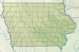
Lake Darling State Park is a state park in Washington County, Iowa, United States. The park is approximately 3 miles (4.8 km) west of Brighton; 6 miles (9.7 km) east of Richland; and 3 miles (4.8 km) north-west of Pleasant Plain.
Lake Darling is 302 acres (122 ha) and has approximately 18 miles (29 km) of shoreline. It is located on Honey Creek, a minor tributary of the Skunk River. The park as a whole is 1,417 acres (5.73 km2) in size.
History
[edit]Lake Darling State Park was dedicated on September 17, 1950. The park is named after Jay Norwood "Ding" Darling.
Land usage
[edit]Lake Darling State Park has a picnic shelter, camping cabins, campsites, restrooms, playground equipment, boat rentals, several trails, and a beach. Lake Darling is also home to a variety of fish.
References
[edit]- ^ "Lake Darling State Park". Geographic Names Information System. United States Geological Survey. April 30, 1979. Retrieved February 27, 2011.


 French
 Deutsch
