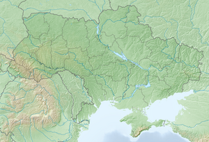
Lypetske
Lypetske Липе́цьке Lipețchi | |
|---|---|
Village | |
 | |
| Coordinates: 47°44′11″N 29°42′55″E / 47.73639°N 29.71528°E | |
| Country | |
| Oblast | |
| Raion | |
| Hromada | Podilsk urban hromada |
| Founded | 1753 |
| Area | |
| • Total | 1,366 km2 (527 sq mi) |
| Elevation | 121 m (397 ft) |
| Population | |
| • Total | 3,740 |
| • Density | 2,737.9/km2 (7,091/sq mi) |
| Postal code | 66354 |
 | |
Lypetske (Ukrainian: Липе́цьке; Romanian: Lipețchi), is a village in Podilsk Raion, Odesa Oblast, Ukraine. It belongs to Podilsk urban hromada, one of the hromadas of Ukraine.[2] The population is 3740 people.
History
[edit]According to data for 1859 in the state village of Ananyiv District of Kherson Province lived 2542 people (1288 males and 1254 - females), there were 428 households, there was an Orthodox Church.[3]
As of 1886, the former state village of Gandrabur Parish had 3,039 inhabitants, 589 yards, and an Orthodox church and school.[4]
According to the 1897 census, the population grew to 5,446 (2,740 males and 2,706 females), of whom 5,188 were Orthodox.[5]
At least 415 villagers died during the Soviet Holodomor of 1932–1933.[6]
According to the 1989 census of the Ukrainian SSR, the current population of the village was 4,627, of whom 2,028 were men and 2,599 women.[7]
According to the 2001 census of Ukraine, 3740 people lived in the village.[8]
On 24 February 2022, during the Russian invasion of Ukraine, a military facility in Lipetske was bombed by the Russian military, resulting in the death of 18 people.[9]
Language
[edit]Population distribution by mother tongue according to the 2001 census:[1][10]
| Language | Percentage |
|---|---|
| Moldovan (Romanian) | 90.08% |
| Russian | 5.45% |
| Ukrainian | 4.14% |
| Bulgarian | 0.13% |
| Armenian | 0.03% |
| Gagauz | 0.03% |
Notable people
[edit]- Kirill Ilyashenko (1915–1980), Soviet Moldavian politician
- Vasyl Spinatiev (1920–after 1970), Soviet and Ukrainian cinematographer
References
[edit]- ^ a b "Офіційна сторінка Всеукраїнського перепису населення | Банк даних" [All-Ukrainian population census | Database]. ukrcensus.gov.ua (in Ukrainian). Retrieved 23 August 2023.
- ^ "Подольская городская громада" (in Russian). Портал об'єднаних громад України.
- ^ Kherson province. List of populated places according to the information of 1859. Published by the Central Statistical Committee of the Ministry of the Interior. St. Petersburg. In the printing house of Karl Wolf. 1868. LXXX + 191 pages, (code 1098)
- ^ Volosts and the most important settlements of European Russia. According to a survey conducted by statistical agencies of the Ministry of Internal Affairs, on behalf of the Statistical Council. Publication of the Central Statistical Committee. Issue VIII. Gubernia of the Novorossiysk group. St. Petersburg. 1886. - VI + 157 p.
- ^ Populated places of the Russian Empire in 500 and more inhabitants with the indication of all available in them population and number of inhabitants of prevailing denominations according to the first general census of 1897 of St.-Petersburg. 1905. - IX + 270 + 120 p., (Pp. 1-255)
- ^ "Липецьке. Геоінформаційна система місць «Голодомор 1932—1933 років в Україні»". Український інститут національної пам'яті. June 18, 2020.
- ^ "Кількість наявного та постійного населення по кожному сільському населеному пункту, Одеська область (осіб) - Регіон, Рік, Категорія населення , Стать (1989(12.01))". database.ukrcensus.gov.ua. Retrieved 2022-02-25.
- ^ "Кількість наявного населення по кожному сільському населеному пункту, Одеська область (осіб) - Регіон , Рік (2001(05.12))". database.ukrcensus.gov.ua. Retrieved 2022-02-25.
- ^ Svyashchenko, Yuliya (24 February 2022). "В Одесской области в селе Липецкое от военного удара РФ погибли 18 человек,- ФОТО". 048.ua (in Ukrainian).
- ^ The Ukrainian census of 2001, language data by localities, at https://socialdata.org.ua/projects/mova-2001/


 French
 Deutsch