List of Metacomet Ridge summits
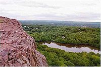
The following is a list of the more notable summits and sub–ranges that make up the crest of the Metacomet Ridge, a fault-block landform located in Connecticut and Massachusetts, known for its microclimate ecosystems, rare plant communities, scenic vistas, proximity to major urban centers, and recreational opportunities.[1]
In southern Connecticut, the Metacomet Ridge consists of two parallel ridges; the western ridge terminates near Meriden, Connecticut while the eastern ridge continues north into Massachusetts proximal to the Connecticut River.[2] Notable summits with elevations are included below, listed from south to north.
In Connecticut:
West ridgeline

| Name | Elevation | Location |
|---|---|---|
| East Rock | 366 ft (112 m) | New Haven and Hamden |
| West Rock Ridge | 700 ft (213 m) * | New Haven, Hamden, Woodbridge, and Bethany |
| Sleeping Giant | 739 ft (225 m) | Hamden and Wallingford |
| Mount Sanford | 880 ft (270 m) * | Hamden, Bethany, and Cheshire |
| Peck Mountain | 431 ft (131 m) | Cheshire |
East ridgeline


In Massachusetts

| Name | Elevation | Location |
|---|---|---|
| Provin Mountain | 600 ft (183 m) | Southwick, Agawam, and Westfield |
| East Mountain | 776 ft (237 m) | Holyoke, West Springfield, and Westfield |
| Mount Tom Range | 1202 ft (363 m) | Holyoke and Easthampton |
| Holyoke Range | 1106 ft (337 m) | Hadley, South Hadley, Granby, Amherst, and Belchertown |
| Mount Toby | 1269 ft (387 m) | Sunderland and Leverett |
| Sugarloaf Mountain | 791 ft (241 m) | Deerfield |
| Pocumtuck Range | 846 ft (258 m) | Deerfield and Greenfield |
* Estimated elevation accurate within +9/-0 ft (+3/-0 m).[2]
References
[edit]- ^ Farnsworth, Elizabeth J. (2004). "Metacomet-Mattabesett Trail Natural Resource Assessment." Archived 2007-08-07 at the Wayback Machine United States National Park Service. Retrieved November 20, 2007.
- ^ a b United States Geological Survey 1:25000 and 1:24000 scale 7.5 minute series topographic maps obtained via Topozone.com. Retrieved December 1, 2007.


 French
 Deutsch