List of hillside letters in California
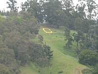
The Big C at the University of California at Berkeley

This is a list of hillside letters (also known as mountain monograms) in the U.S. state of California.[1][2][3] There are at least 83 hillside letters, acronyms, and messages in the state, possibly as many as 90, although some have been removed in recent years. Among these are the oldest letter (the C in Berkeley, 1905) and the largest letter (the L in Susanville, almost 600 feet long).

Monogram Town Description Location
A Agoura Hills 34°09′14″N 118°45′00″W / 34.1538°N 118.7499°W / 34.1538; -118.7499 (Agoura Hills)
A Azusa 34°09′18″N 117°53′31″W / 34.1551°N 117.8919°W / 34.1551; -117.8919 (Azusa)
A (Planning) Acton 34°28′50″N 118°10′27″W / 34.4805556°N 118.1741667°W / 34.4805556; -118.1741667 (Acton)
B Banner 33°04′10″N 116°32′39″W / 33.0694°N 116.5441°W / 33.0694; -116.5441 (Banner)
B Bard 32°50′14″N 114°31′43″W / 32.8373°N 114.5287°W / 32.8373; -114.5287 (Bard)
B Barstow 34°54′03″N 117°02′00″W / 34.9008°N 117.0333°W / 34.9008; -117.0333 (Barstow)
B Boron 35°00′52″N 117°39′38″W / 35.0145°N 117.6605°W / 35.0145; -117.6605 (Boron)
B Burbank 34°12′06″N 118°17′45″W / 34.2016°N 118.2959°W / 34.2016; -118.2959 (Burbank)
B Yucca Valley Burnt Mountain 34°06′19″N 116°24′47″W / 34.1054°N 116.4131°W / 34.1054; -116.4131 (Burnt Mountain)
B Ridgecrest Burroughs High School 35°39′19″N 117°36′46″W / 35.6554°N 117.6127°W / 35.6554; -117.6127 (Burroughs High School)
C Daggett Calico High School 34°52′25″N 116°53′42″W / 34.8736°N 116.8949°W / 34.8736; -116.8949 (Calico High School)
C San Juan Capistrano Capistrano High School 33°30′33″N 117°40′34″W / 33.5093°N 117.6762°W / 33.5093; -117.6762 (Capistrano High School)
C Coalinga 36°08′12″N 120°24′26″W / 36.1366°N 120.4073°W / 36.1366; -120.4073 (Coalinga)
C Coleville 38°34′21″N 119°30′54″W / 38.5726°N 119.515°W / 38.5726; -119.515 (Coleville)
C Rancho Cucamonga Chaffey College 34°10′27″N 117°34′37″W / 34.174294°N 117.576846°W / 34.174294; -117.576846 (Chaffey)
C Riverside University of California, Riverside 33°58′17″N 117°18′08″W / 33.9713°N 117.3022°W / 33.9713; -117.3022 (University of California Riverside)
C Berkeley University of California, Berkeley 37°52′29″N 122°14′59″W / 37.8746°N 122.2496°W / 37.8746; -122.2496 (University of California Berkeley)
C (Planning) Chilcoot-Vinton 39°48′30″N 120°07′10″W / 39.8082332°N 120.1194413°W / 39.8082332; -120.1194413 (Chilcoot-Vinton)
CALICO Calico 34°57′18″N 116°51′49″W / 34.955°N 116.8635°W / 34.955; -116.8635 (Calico)
CLU Thousand Oaks California Lutheran University 34°14′00″N 118°52′47″W / 34.2333°N 118.8797°W / 34.2333; -118.8797 (Cal Lutheran University)
CPP Pomona Cal Poly Pomona 34°03′34″N 117°49′37″W / 34.0595°N 117.8269°W / 34.0595; -117.8269 (CPP Hill)
CSD Berkeley above the now-UC Berkeley-owned Clark Kerr campus 37°51′51″N 122°14′39″W / 37.86430°N 122.24414°W / 37.86430; -122.24414 (CSD Letters)
DV Shoshone Death Valley 35°58′51″N 116°16′34″W / 35.9809°N 116.276°W / 35.9809; -116.276 (Death Valley)
D Dinuba Dinuba High School 36°34′55″N 119°20′47″W / 36.5819°N 119.3465°W / 36.5819; -119.3465 (Dinuba)
d Duarte 34°09′17″N 117°57′00″W / 34.1546°N 117.95°W / 34.1546; -117.95 (Duarte)
E Escondido 33°09′54″N 117°06′07″W / 33.165°N 117.102°W / 33.165; -117.102 (Escondido)
[Eagle] San Luis Obispo Camp San Luis Obispo (Nat. Guard Base) 35°19′51″N 120°43′15″W / 35.3309°N 120.7208°W / 35.3309; -120.7208 (Camp San Luis Obispo (Nat. Guard Base))
EC Lakeside El Capitan High School 32°52′04″N 116°55′35″W / 32.8678°N 116.9265°W / 32.8678; -116.9265 (El Capitan High School)
F Fillmore 34°24′33″N 118°53′35″W / 34.4091°N 118.893°W / 34.4091; -118.893 (Fillmore)
G El Cajon Grossmont High School 32°46′48″N 116°59′11″W / 32.78°N 116.9864°W / 32.78; -116.9864 (Grossmont)
GOLDSTONE Fort Irwin Goldstone Observatory 35°18′10″N 116°48′22″W / 35.3028°N 116.8062°W / 35.3028; -116.8062 (Goldstone Observatory)
H Glendale Hoover High School 34°10′44″N 118°15′22″W / 34.1789°N 118.2562°W / 34.1789; -118.2562 (Hoover High School)
H Hornbrook 41°54′40″N 122°32′46″W / 41.9111°N 122.5462°W / 41.9111; -122.5462 (Hornbrook)
K Kelseyville 38°59′01″N 122°47′45″W / 38.9835°N 122.7958°W / 38.9835; -122.7958 (Kelseyville)
L Laguna Beach Laguna Beach High School 33°32′42″N 117°46′28″W / 33.5450°N 117.7744°W / 33.5450; -117.7744 (Laguna Beach High School)
L Susanville Lassen High School 40°26′47″N 120°39′10″W / 40.4465°N 120.6528°W / 40.4465; -120.6528 (Lassen High School)
L Laytonville 39°41′47″N 123°27′56″W / 39.6965°N 123.4656°W / 39.6965; -123.4656 (Laytonville)
L Lemon Cove 36°23′16″N 119°00′34″W / 36.3878°N 119.0094°W / 36.3878; -119.0094 (Lemon Cove)
L Lindsay 36°13′02″N 119°03′06″W / 36.2173°N 119.0516°W / 36.2173; -119.0516 (Lindsay)
L Loyalton 39°41′37″N 120°12′20″W / 39.6936°N 120.2056°W / 39.6936; -120.2056 (Loyalton)
L Ludlow 34°43′07″N 116°10′29″W / 34.7186°N 116.1747°W / 34.7186; -116.1747 (Ludlow)
LA Hacienda Heights Los Altos High School 34°01′06″N 117°59′46″W / 34.0184°N 117.9962°W / 34.0184; -117.9962 (Los Altos High School)
L16P Lone Pine 36°36′10″N 118°05′15″W / 36.6027°N 118.0875°W / 36.6027; -118.0875 (Lone Pine)
LMU Los Angeles, California Loyola Marymount University 33°58′21″N 118°25′06″W / 33.9725°N 118.4182°W / 33.9725; -118.4182 (Loyola Marymount University)
LV Lee Vining 37°57′19″N 119°07′33″W / 37.9553°N 119.1259°W / 37.9553; -119.1259 (Lee Vining)
M Maricopa 35°02′10″N 119°24′43″W / 35.0361°N 119.412°W / 35.0361; -119.412 (Maricopa)
M San Luis Obispo Mission Preparatory Academy 35°16′57″N 120°40′29″W / 35.2824°N 120.6747°W / 35.2824; -120.6747 (Mission Prep Academy)
M Monrovia 34°09′30″N 118°00′52″W / 34.1582°N 118.0145°W / 34.1582; -118.0145 (Monrovia)
M Moreno Valley 33°57′35″N 117°16′44″W / 33.9597°N 117.2789°W / 33.9597; -117.2789 (Moreno Valley)
MB Morro Bay 35°22′38″N 120°51′01″W / 35.3772°N 120.8502°W / 35.3772; -120.8502 (Morro Bay)
MSAC Walnut Mount San Antonio College 34°02′29″N 117°50′32″W / 34.0413°N 117.8423°W / 34.0413; -117.8423 (Mt. San Antonio College)
NILES Fremont neighborhood 37°34′58″N 121°58′24″W / 37.5828°N 121.9732°W / 37.5828; -121.9732 (neighborhood)
O Oroville 39°32′50″N 121°33′03″W / 39.5472°N 121.5509°W / 39.5472; -121.5509 (Oroville)
P San Bernardino Pacific High School 34°08′00″N 117°15′55″W / 34.1334°N 117.2652°W / 34.1334; -117.2652 (Pacific High School)
P San Luis Obispo California Polytechnic State University 35°18′10″N 120°39′06″W / 35.3028°N 120.6518°W / 35.3028; -120.6518 (California Polytechnic State University)
P San Marcos Palomar College 33°09′21″N 117°10′23″W / 33.1557°N 117.173°W / 33.1557; -117.173 (Palomar College)
P Porterville 36°01′43″N 118°57′54″W / 36.0285°N 118.9649°W / 36.0285; -118.9649 (Porterville)
P Portola 39°48′18″N 120°26′43″W / 39.805°N 120.4453°W / 39.805; -120.4453 (Portola)
Q Quincy 39°56′19″N 120°56′01″W / 39.9386°N 120.9335°W / 39.9386; -120.9335 (Quincy)
R Randsburg 35°22′08″N 117°38′51″W / 35.3689°N 117.6476°W / 35.3689; -117.6476 (Randsburg)
R Redlands University of Redlands 34°11′00″N 117°06′18″W / 34.1834°N 117.105°W / 34.1834; -117.105 (University of Redlands)
R Reedley 36°41′29″N 119°25′30″W / 36.6913°N 119.4249°W / 36.6913; -119.4249 (Reedley)
ROCKAWAY BEACH Pacifica 37°36′46″N 122°29′49″W / 37.612778°N 122.49694°W / 37.612778; -122.49694 (Pacifica)
S (removed about 2010) Morgan Hill Ann Sobrato High School 37°08′45″N 121°40′53″W / 37.1457°N 121.6814°W / 37.1457; -121.6814 (Ann Sobrato High School)
S San Jacinto 33°49′13″N 116°56′23″W / 33.8204°N 116.9397°W / 33.8204; -116.9397 (San Jacinto)
S Sanger 36°41′40″N 119°25′34″W / 36.6945°N 119.426°W / 36.6945; -119.426 (Sanger)
S Santa Clarita Saugus High School 34°26′30″N 118°31′15″W / 34.4416°N 118.5209°W / 34.4416; -118.5209 (Saugus High School)
S Seville 36°30′49″N 119°12′44″W / 36.5137°N 119.2121°W / 36.5137; -119.2121 (Seville)
S Shandon 35°39′58″N 120°22′57″W / 35.6661°N 120.3826°W / 35.6661; -120.3826 (Shandon)
S Jamestown Sonora High School 37°52′49″N 120°30′14″W / 37.880369°N 120.503952°W / 37.880369; -120.503952 (Sonora High School)
SL San Luis Obispo San Luis Obispo High School 35°17′00″N 120°38′47″W / 35.2834°N 120.6463°W / 35.2834; -120.6463 (San Luis Obispo High School)
SP Santa Paula 34°19′34″N 119°02′32″W / 34.326°N 119.0423°W / 34.326; -119.0423 (Santa Paula)
SOUTH SAN FRANCISCO THE INDUSTRIAL CITY South San Francisco 37°39′48″N 122°25′05″W / 37.6634°N 122.4181°W / 37.6634; -122.4181 (South San Francisco)
SMC Moraga St. Mary's College 37°50′15″N 122°06′37″W / 37.8375°N 122.1102°W / 37.8375; -122.1102 (St. Mary's College)
SV Yermo Silver Valley High School 34°53′45″N 116°53′40″W / 34.8959°N 116.8945°W / 34.8959; -116.8945 (Silver Valley High School)
T Tehachapi 35°08′05″N 118°25′04″W / 35.1348°N 118.4179°W / 35.1348; -118.4179 (Tehachapi)
T Templeton 35°32′46″N 120°42′48″W / 35.5462°N 120.7132°W / 35.5462; -120.7132 (Templeton)
T Trona 35°47′05″N 117°23′43″W / 35.7847°N 117.3953°W / 35.7847; -117.3953 (Trona)
U Ukiah 39°09′07″N 123°14′20″W / 39.1519°N 123.2390°W / 39.1519; -123.2390 (Ukiah)
V Ventura 34°17′11″N 119°16′02″W / 34.2864°N 119.2672°W / 34.2864; -119.2672 (Ventura)
V Victorville 34°31′54″N 117°17′37″W / 34.5316°N 117.2935°W / 34.5316; -117.2935 (Victorville)
VC Ventura Ventura College 34°17′10″N 119°14′09″W / 34.2861°N 119.2357°W / 34.2861; -119.2357 (Ventura College)
W Weed 41°26′36″N 122°23′11″W / 41.4433°N 122.3864°W / 41.4433; -122.3864 (Weed)
W Whittier 33°58′41″N 118°01′26″W / 33.978°N 118.0238°W / 33.978; -118.0238 (Whittier)
W Willits 39°26′43″N 123°18′10″W / 39.4453°N 123.3028°W / 39.4453; -123.3028 (Willits)
W Woodlake 36°25′56″N 119°04′33″W / 36.4321°N 119.0758°W / 36.4321; -119.0758 (Woodlake)
Y Yucaipa 34°02′28″N 117°05′18″W / 34.0412°N 117.0882°W / 34.0412; -117.0882 (Yucaipa)

Sources

[edit]
  1. ^ Corning, Evelyn (2007). Hillside Letters A to Z : A Guide to Hometown Landmarks. Missoula, Mont.: Mountain Press Publishing Company.
  2. ^ Parsons, James J. (1988). "Hillside Letters in the Western United States". Landscape. 30 (1). Santa Fe, N.M.: 15–23. Retrieved 2011-08-09.
  3. ^ Rocha, Guy (June 2004), "Hillside Letters: In Plain Sight But Not Intended for Planes", Sierra Sage, archived from the original on 2011-07-22, retrieved 2011-08-09
[edit]