List of lakes of New Zealand

Lake Taupō, New Zealand's largest lake
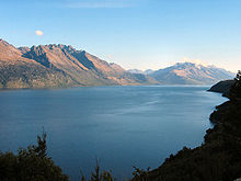
Lake Wakatipu from Queenstown
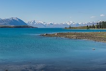
Lake Tekapo
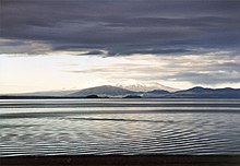
Lake Rotorua from above Rotorua
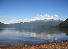
Lake Hauroko, New Zealand's deepest lake
Ōkārito Lagoon

This is a list of lakes in New Zealand.

A lake's location is identified by the region and either the territorial authority or national park (N.P.).

There are:

  • 43 lakes with a surface area larger than 10 km2 (1000 ha)
  • 231 lakes greater than 0.5 km2 (50 ha)
  • 3822 lakes greater than 0.01 km2 (1 ha)

Largest

[edit]

Lakes with a surface area of more than 10 square kilometres (3.9 sq mi)

Rank Name Surface area Region Notes
1 Lake Taupō 616 km2 (238 sq mi) Waikato Largest lake in New Zealand; second-largest freshwater lake in Oceania
2 Lake Te Anau 344 km2 (133 sq mi) Southland Largest lake in the South Island
3 Lake Wakatipu 291 km2 (112 sq mi) Otago Longest lake in New Zealand (80 kilometres (50 mi))
4 Lake Wānaka 192 km2 (74 sq mi) Otago
5 Lake Ellesmere / Te Waihora 180 km2 (69 sq mi) Canterbury Largest lagoon in mainland New Zealand
5 Te Whanga Lagoon 180 km2 (69 sq mi) Chatham Island Largest lake outside the North Island and South Island
7 Lake Pukaki 179 km2 (69 sq mi) Canterbury
8 Lake Manapouri 142 km2 (55 sq mi) Southland Contains largest inland island within New Zealand, Pomona Island
9 Lake Hāwea 141 km2 (54 sq mi) Otago
10 Lake Tekapo 83 km2 (32 sq mi) Canterbury
11 Lake Rotorua / Te Rotorua nui ā Kahumatamomoe 79 km2 (31 sq mi) Bay of Plenty
12 Lake Wairarapa 78 km2 (30 sq mi) Wellington
13 Lake Benmore 75 km2 (29 sq mi) Canterbury/Otago Largest artificial lake in New Zealand
14 Lake Hauroko 63 km2 (24 sq mi) Southland Deepest lake in New Zealand
15 Lake Ōhau 63 km2 (24 sq mi) Canterbury
16 Lake Waikaremoana 54 km2 (21 sq mi) Hawke's Bay
17 Lake Coleridge 47 km2 (18 sq mi) Canterbury
18 Lake Poteriteri 43 km2 (17 sq mi) Southland Largest lake in New Zealand without road access
19 Lake Brunner / Moana 40 km2 (15 sq mi) West Coast
20 Lake Tarawera 39 km2 (15 sq mi) Bay of Plenty
21 Lake Rotoiti / Te Roto kite ā Ihenga i ariki ai Kahu 35 km2 (14 sq mi) Bay of Plenty
22 Lake Waikare 34 km2 (13 sq mi) Waikato
23 Lake Monowai 31 km2 (12 sq mi) Southland
24 Lake Aviemore 29 km2 (11 sq mi) Canterbury Artificial
25 Lake McKerrow / Whakatipu Waitai 28 km2 (11 sq mi) Southland
26 Lake Dunstan 26 km2 (10 sq mi) Otago Artificial
27 Lake Rotoroa 23.5 km2 (9.1 sq mi) Tasman Largest lake in the Tasman Region
28 Lake Kaniere 22 km2 (8.5 sq mi) West Coast
29= Lake Ōmāpere 14 km2 (5.4 sq mi) Northland
29= Lake Sumner 14 km2 (5.4 sq mi) Canterbury
31 Lake Rotoaira 13 km2 (5.0 sq mi) Waikato
32= Ōkārito Lagoon 12 km2 (4.6 sq mi) West Coast
32= Lake Ohakuri 12 km2 (4.6 sq mi) Waikato Artificial
33 Lake Rotomā 11.2 km2 (4.3 sq mi) Bay of Plenty
+9 other lakes >10 km2

Deepest lakes

[edit]

Maximum depth and average depth in metres:

These six lakes are all situated on the South Island. The deepest lake on the North Island is:

North Island

[edit]

Northland

[edit]

The following lakes are located in the Northland Region.

Lake Location Area Notes Coordinates
Bulrush Lake Far North District 0.11 km2 Northern Aupōuri Peninsula 34°42′30″S 172°59′50″E / 34.70833°S 172.99722°E / -34.70833; 172.99722
Half Mile Lagoon Far North District Northern Aupōuri Peninsula 34°43′13″S 172°59′40″E / 34.72028°S 172.99444°E / -34.72028; 172.99444
Lake Carrot Far North District Isthmus of Aupōuri Peninsula 35°01′20″S 173°11′15″E / 35.02222°S 173.18750°E / -35.02222; 173.18750
Lake Gem (or Lake Little Gem) Far North District South of Lake Ngatu 35°02′22″S 173°11′40″E / 35.03944°S 173.19444°E / -35.03944; 173.19444
Lake Half Far North District Northern Aupōuri Peninsula 34°44′05″S 173°00′00″E / 34.73472°S 173.00000°E / -34.73472; 173.00000
Lake Heather Far North District 0.125 km2 North of Lake Rotoroa 35°03′00″S 173°11′40″E / 35.05000°S 173.19444°E / -35.05000; 173.19444
Lake Humuhumu Kaipara District Southern Pouto Peninsula 36°19′40″S 174°07′20″E / 36.32778°S 174.12222°E / -36.32778; 174.12222
Lake Kahuparere Kaipara District Southern Pouto Peninsula 36°22′10″S 174°09′30″E / 36.36944°S 174.15833°E / -36.36944; 174.15833
Lake Kaiiwi Kaipara District South of Lake Taharoa 35°48′50″S 173°39′20″E / 35.81389°S 173.65556°E / -35.81389; 173.65556
Lake Kaiwai Far North District 35°25′35″S 173°55′50″E / 35.42639°S 173.93056°E / -35.42639; 173.93056
Lake Kanono Kaipara District Southern Pouto Peninsula 36°21′50″S 174°08′40″E / 36.36389°S 174.14444°E / -36.36389; 174.14444
Lake Kapoai Kaipara District Northern Pouto Peninsula 36°02′40″S 173°49′57″E / 36.04444°S 173.83250°E / -36.04444; 173.83250
Lake Karaka Kaipara District Southern Pouto Peninsula 36°18′45″S 174°02′25″E / 36.31250°S 174.04028°E / -36.31250; 174.04028
Lake Karoro / Mathews Kaipara District Southern Pouto Peninsula 36°23′00″S 174°04′30″E / 36.38333°S 174.07500°E / -36.38333; 174.07500
Lake Kihona Far North District Northern Aupōuri Peninsula 34°37′45″S 172°54′10″E / 34.62917°S 172.90278°E / -34.62917; 172.90278
Lake Manuwai Far North District Northwest of Kerikeri 35°10′30″S 173°51′50″E / 35.17500°S 173.86389°E / -35.17500; 173.86389
Lake Mokeno Kaipara District Southern Pouto Peninsula 36°21′00″S 174°03′40″E / 36.35000°S 174.06111°E / -36.35000; 174.06111
Lake Morehurehu Far North District Northern Aupōuri Peninsula 34°38′30″S 172°59′40″E / 34.64167°S 172.99444°E / -34.64167; 172.99444
Lake Ngakapua Far North District Isthmus of Aupōuri Peninsula 35°01′13″S 173°11′35″E / 35.02028°S 173.19306°E / -35.02028; 173.19306
Lake Ngakeketa Far North District Northern Aupōuri Peninsula 34°31′05″S 172°46′10″E / 34.51806°S 172.76944°E / -34.51806; 172.76944
Lake Ngatu Far North District Isthmus of Aupōuri Peninsula 35°01′50″S 173°11′50″E / 35.03056°S 173.19722°E / -35.03056; 173.19722
Lake Ōmāpere Far North District 14 km2 North of Kaikohe. Maximum depth: 3m 35°21′00″S 173°48′00″E / 35.35000°S 173.80000°E / -35.35000; 173.80000
Lake Ora Whangarei District Northwest of Whangārei 35°41′45″S 174°17′05″E / 35.69583°S 174.28472°E / -35.69583; 174.28472
Lake Otapuiti Kaipara District Southern Pouto Peninsula 36°21′35″S 174°04′25″E / 36.35972°S 174.07361°E / -36.35972; 174.07361
Lake Owhareiti Far North District 35°23′20″S 173°56′40″E / 35.38889°S 173.94444°E / -35.38889; 173.94444
Lake Parawanui Kaipara District Northern Pouto Peninsula 36°03′42″S 173°51′00″E / 36.06167°S 173.85000°E / -36.06167; 173.85000
Lake Puhau Far North District Close to Hokianga Harbour 35°28′38″S 173°21′57″E / 35.47722°S 173.36583°E / -35.47722; 173.36583
Lake Rotokawau Far North District Isthmus of Aupōuri Peninsula 35°01′10″S 173°12′20″E / 35.01944°S 173.20556°E / -35.01944; 173.20556
Lake Rotokawau Far North District Karikari Peninsula 34°52′10″S 173°18′40″E / 34.86944°S 173.31111°E / -34.86944; 173.31111
Lake Rotokawau Kaipara District Southern Pouto Peninsula 36°20′50″S 174°08′50″E / 36.34722°S 174.14722°E / -36.34722; 174.14722
Lake Rotokereru Far North District 35°26′21″S 174°05′13″E / 35.43917°S 174.08694°E / -35.43917; 174.08694
Lake Rotomata Far North District Close to Hokianga Harbour 35°28′00″S 173°21′52″E / 35.46667°S 173.36444°E / -35.46667; 173.36444
Lake Rotootuauru Kaipara District Southern Pouto Peninsula 36°19′55″S 174°08′20″E / 36.33194°S 174.13889°E / -36.33194; 174.13889
Lake Rotopouua Kaipara District Southern Pouto Peninsula 36°19′10″S 174°06′30″E / 36.31944°S 174.10833°E / -36.31944; 174.10833
Lake Rotoroa Far North District 35°03′40″S 173°11′40″E / 35.06111°S 173.19444°E / -35.06111; 173.19444
Lake Rototuna Kaipara District Southern Pouto Peninsula 36°15′10″S 174°02′30″E / 36.25278°S 174.04167°E / -36.25278; 174.04167
Lake Rototuna Lower Kaipara District Southern Pouto Peninsula 36°15′27″S 174°03′05″E / 36.25750°S 174.05139°E / -36.25750; 174.05139
Lake Taeore Far North District Northern Aupōuri Peninsula 34°40′30″S 173°01′15″E / 34.67500°S 173.02083°E / -34.67500; 173.02083
Lake Taharoa Kaipara District 35°48′20″S 173°39′00″E / 35.80556°S 173.65000°E / -35.80556; 173.65000
Lake Tairutu Far North District Close to Hokianga Harbour 35°29′25″S 173°22′35″E / 35.49028°S 173.37639°E / -35.49028; 173.37639
Lake Tauanui Far North District 35°30′00″S 173°51′30″E / 35.50000°S 173.85833°E / -35.50000; 173.85833
Lake Te Kahika Far North District Northern Aupōuri Peninsula 34°37′27″S 173°00′00″E / 34.62417°S 173.00000°E / -34.62417; 173.00000
Lake Wahakari Far North District Northern Aupōuri Peninsula 34°39′10″S 172°55′30″E / 34.65278°S 172.92500°E / -34.65278; 172.92500
Lake Waikanae Far North District Northern Aupōuri Peninsula 34°36′15″S 172°52′32″E / 34.60417°S 172.87556°E / -34.60417; 172.87556
Lake Waikaramu Far North District Waihuahua Swamp, southern Aupōuri Peninsula 34°55′00″S 173°14′10″E / 34.91667°S 173.23611°E / -34.91667; 173.23611
Lake Waikere Kaipara District Northwest of Lake Taharoa 35°48′00″S 173°37′45″E / 35.80000°S 173.62917°E / -35.80000; 173.62917
Lake Waimimiha Far North District North of Ahipara 35°08′45″S 173°10′15″E / 35.14583°S 173.17083°E / -35.14583; 173.17083
Lake Waingaro Far North District Southwest of Kerikeri 35°15′40″S 173°52′50″E / 35.26111°S 173.88056°E / -35.26111; 173.88056
Lake Waingata Kaipara District Southern Pouto Peninsula 36°21′05″S 174°09′05″E / 36.35139°S 174.15139°E / -36.35139; 174.15139
Lake Wainui Kaipara District Northern Pouto Peninsula 36°06′05″S 173°52′55″E / 36.10139°S 173.88194°E / -36.10139; 173.88194
Lake Waiparera Far North District Southern Aupōuri Peninsula 34°56′40″S 173°10′50″E / 34.94444°S 173.18056°E / -34.94444; 173.18056
Lake Waiporohita Far North District Karikari Peninsula 34°54′00″S 173°20′55″E / 34.90000°S 173.34861°E / -34.90000; 173.34861
Lake Wairere Kaipara District Southern Pouto Peninsula 36°16′20″S 174°00′50″E / 36.27222°S 174.01389°E / -36.27222; 174.01389
Lake Whakaneke Kaipara District Southern Pouto Peninsula 36°22′05″S 174°03′45″E / 36.36806°S 174.06250°E / -36.36806; 174.06250
Lake Whirirau Far North District Close to Hokianga Harbour 35°27′37″S 173°18′54″E / 35.46028°S 173.31500°E / -35.46028; 173.31500
Phoebes Lake Kaipara District Southern Pouto Peninsula 36°18′10″S 174°04′40″E / 36.30278°S 174.07778°E / -36.30278; 174.07778
Rotopouri Kaipara District Southern Pouto Peninsula 36°18′10″S 174°05′18″E / 36.30278°S 174.08833°E / -36.30278; 174.08833
Salt Lake Far North District Northern Aupōuri Peninsula 34°42′20″S 173°01′30″E / 34.70556°S 173.02500°E / -34.70556; 173.02500
Shag Lake Kaipara District Northwest of Lake Taharoa 35°47′30″S 173°36′25″E / 35.79167°S 173.60694°E / -35.79167; 173.60694
Split Lake Far North District Southwest of Lake Rotoroa 35°03′59″S 173°10′57″E / 35.06639°S 173.18250°E / -35.06639; 173.18250
Swan Lake Far North District Northern Aupōuri Peninsula 34°44′55″S 173°00′00″E / 34.74861°S 173.00000°E / -34.74861; 173.00000
Swan Lake Far North District Southern Aupōuri Peninsula 34°54′23″S 173°08′50″E / 34.90639°S 173.14722°E / -34.90639; 173.14722
The Big Lake Far North District Northern Aupōuri Peninsula 34°32′40″S 172°49′40″E / 34.54444°S 172.82778°E / -34.54444; 172.82778
Waihopo Lake Far North District Northern Aupōuri Peninsula 34°45′20″S 173°02′35″E / 34.75556°S 173.04306°E / -34.75556; 173.04306
Waitahora Lagoon Far North District Close to Spirits Bay, northern Aupōuri Peninsula 34°27′20″S 172°48′00″E / 34.45556°S 172.80000°E / -34.45556; 172.80000
Whau Valley Reservoir Whangarei District Northwest of Whangārei 35°42′30″S 174°17′10″E / 35.70833°S 174.28611°E / -35.70833; 174.28611

Auckland

[edit]

The following lakes are located in the Auckland Region.

Many of the lakes in the Auckland Region are man made reservoirs, constructed in the hilly catchment areas of the Waitakere and Hunua ranges in order to provide a water supply for the Auckland urban area.

Lake Location Area Notes Coordinates
Cosseys Reservoir Auckland Region Reservoir in Hunua Ranges 37°03′25″S 175°06′30″E / 37.05694°S 175.10833°E / -37.05694; 175.10833
Crater Hill Lake Auckland Region Maar lake at Māngere[2] 36°59′09″S 174°49′37″E / 36.98583°S 174.82694°E / -36.98583; 174.82694
Lake Karaka Auckland Region On Te Korowai-o-Te-Tonga Peninsula 36°36′35″S 174°17′35″E / 36.60972°S 174.29306°E / -36.60972; 174.29306
Lake Kawaupaku Auckland Region Dune lake southeast of Bethells Beach 36°53′40″S 174°27′30″E / 36.89444°S 174.45833°E / -36.89444; 174.45833
Lake Kereta Auckland Region On Te Korowai-o-Te-Tonga Peninsula 36°35′35″S 174°16′50″E / 36.59306°S 174.28056°E / -36.59306; 174.28056
Lake Kuwakatai Auckland Region On Te Korowai-o-Te-Tonga Peninsula 36°31′40″S 174°14′20″E / 36.52778°S 174.23889°E / -36.52778; 174.23889
Lake Ngakaru Auckland Region On Te Korowai-o-Te-Tonga Peninsula 36°39′20″S 174°19′52″E / 36.65556°S 174.33111°E / -36.65556; 174.33111
Lake Okaihau Auckland Region North of Muriwai Beach 36°48′35″S 174°26′25″E / 36.80972°S 174.44028°E / -36.80972; 174.44028
Lake Paekawau Auckland Region Waipatukahu, north of Muriwai Beach 36°47′30″S 174°26′05″E / 36.79167°S 174.43472°E / -36.79167; 174.43472
Lake Piripoua Auckland Region On Te Korowai-o-Te-Tonga Peninsula 36°39′43″S 174°20′12″E / 36.66194°S 174.33667°E / -36.66194; 174.33667
Lake Pokorua Auckland Region On Āwhitu Peninsula 37°11′30″S 174°38′00″E / 37.19167°S 174.63333°E / -37.19167; 174.63333
Lake Poutoa Auckland Region On Te Korowai-o-Te-Tonga Peninsula 36°38′14″S 174°19′23″E / 36.63722°S 174.32306°E / -36.63722; 174.32306
Lake Pupuke Auckland Region Crater lake in Takapuna 36°47′00″S 174°46′00″E / 36.78333°S 174.76667°E / -36.78333; 174.76667
Lake Rototoa Auckland Region 1.39 km2 Dune lake on Te Korowai-o-Te-Tonga Peninsula 36°30′45″S 174°14′15″E / 36.51250°S 174.23750°E / -36.51250; 174.23750
Lake Waiataru Auckland Region Dune lake south of Bethells Beach 36°53′56″S 174°27′08″E / 36.89889°S 174.45222°E / -36.89889; 174.45222
Lake Wainamu Auckland Region Dune lake east of Bethells Beach 36°53′20″S 174°28′00″E / 36.88889°S 174.46667°E / -36.88889; 174.46667
Lake Whatihua Auckland Region Dune lake east of Waiuku on Āwhitu Peninsula 37°16′30″S 174°40′15″E / 37.27500°S 174.67083°E / -37.27500; 174.67083
Lower Huia Reservoir Auckland Region Reservoir in southern Waitākere Ranges 36°59′00″S 174°34′00″E / 36.98333°S 174.56667°E / -36.98333; 174.56667
Lower Nihotupu Reservoir Auckland Region 0.53 km2 Reservoir in southern Waitākere Ranges 36°57′30″S 174°36′45″E / 36.95833°S 174.61250°E / -36.95833; 174.61250
Mangatangi Reservoir Auckland Region Reservoir in Hunua Ranges 37°06′30″S 175°12′30″E / 37.10833°S 175.20833°E / -37.10833; 175.20833
Nihotupu Reservoir Auckland Region Reservoir 36°57′00″S 174°32′00″E / 36.95000°S 174.53333°E / -36.95000; 174.53333
Pehiakura Lakes Auckland Region On Āwhitu Peninsula 37°10′55″S 174°36′55″E / 37.18194°S 174.61528°E / -37.18194; 174.61528
Slipper Lake Auckland Region Dune lake south of Mangawhai 36°10′20″S 174°37′50″E / 36.17222°S 174.63056°E / -36.17222; 174.63056
Spectacle Lake Auckland Region Dune lake south of Mangawhai 36°10′50″S 174°37′50″E / 36.18056°S 174.63056°E / -36.18056; 174.63056
Tomarata Lake Auckland Region Dune lake south of Mangawhai 36°11′40″S 174°39′00″E / 36.19444°S 174.65000°E / -36.19444; 174.65000
Upper Huia Reservoir Auckland Region Reservoir in southern Waitākere Ranges 36°57′50″S 174°32′10″E / 36.96389°S 174.53611°E / -36.96389; 174.53611
Upper Mangatawhiri Reservoir Auckland Region Reservoir in Hunua Ranges 37°04′30″S 175°09′15″E / 37.07500°S 175.15417°E / -37.07500; 175.15417
Upper Nihotupu Reservoir Auckland Region 0.125 km2 Reservoir in southern Waitākere Ranges 36°57′00″S 174°33′50″E / 36.95000°S 174.56389°E / -36.95000; 174.56389
Wairoa Reservoir Auckland Region Reservoir in Hunua Ranges 37°05′30″S 175°07′50″E / 37.09167°S 175.13056°E / -37.09167; 175.13056
Waitākere Reservoir Auckland Region 0.25 km2 Reservoir in northern Waitākere Ranges 36°54′20″S 174°31′25″E / 36.90556°S 174.52361°E / -36.90556; 174.52361

Waikato

[edit]

The following lakes are located in the Waikato region. The various pools of the Tongariro River system, as listed below, can be found in detail on their own page at Pools of the Tongariro River.

Lake Location Area Notes Coordinates
Alum Lake Taupō District 0.08 km2[3] West of Wairakei 38°37′05″S 176°03′40″E / 38.61806°S 176.06111°E / -38.61806; 176.06111
Blue Lake Tongariro N.P. 0.17 km2[4] On Mount Tongariro. Watershed of 0.71 km2[4] 39°07′30″S 175°39′40″E / 39.12500°S 175.66111°E / -39.12500; 175.66111
Champagne Pool Southern Rotorua Lakes Fed from a hot spring 38°21′33″S 176°22′08″E / 38.35917°S 176.36889°E / -38.35917; 176.36889
Emerald Lakes Tongariro N.P. 0.01 km2[4] On Mount Tongariro. Watershed of 2.64 km2[4] 39°08′05″S 175°39′15″E / 39.13472°S 175.65417°E / -39.13472; 175.65417
Hamareha Lakes South Waikato District 0.01 km2[4] Watershed of 10.55 km2[4] 38°01′45″S 175°52′50″E / 38.02917°S 175.88056°E / -38.02917; 175.88056
Hardcastle Lagoon Taupō District Oxbow lake of Waikato River 38°30′40″S 176°19′40″E / 38.51111°S 176.32778°E / -38.51111; 176.32778
Hendersons Pond Waipa District 0.0088 km2[5] Peat lake. Watershed of 0.31 km2[5] 37°53′27″S 175°16′27″E / 37.89083°S 175.27417°E / -37.89083; 175.27417
Horseshoe Lake (Lake Waiwhakareke) Hamilton City 0.03 km2[5] Drains into Lake Rotokauri. Watershed of 0.66 km2[5] 37°46′14″S 175°13′33″E / 37.77056°S 175.22583°E / -37.77056; 175.22583
Kopuatai Burn Pools Hauraki District 0.02 km2[5] Peat lakes on Kopuatai Peat Dome. Watershed of 1.83 km2[5] 37°24′30″S 175°36′00″E / 37.40833°S 175.60000°E / -37.40833; 175.60000
Lake A (Lake Whakatangi) Waikato District 0.027 km2[5] Peat lake. Watershed of 1.7 km2[5] 37°41′20″S 175°15′30″E / 37.68889°S 175.25833°E / -37.68889; 175.25833
Lake Arapuni South Waikato and Waipa Districts 9 km2 Hydroelectric reservoir, aquatic vegetation monitored[6] 38°08′00″S 175°38′00″E / 38.13333°S 175.63333°E / -38.13333; 175.63333
Lake Aratiatia Taupō District 0.60 km2[4] Hydroelectric reservoir, aquatic vegetation monitored.[6] Watershed of 1,478.8 km2[4] 38°37′00″S 176°07′55″E / 38.61667°S 176.13194°E / -38.61667; 176.13194
Lake Areare Waikato District 0.33 km2[5] East of Ngāruawāhia. Peat lake, aquatic vegetation monitored.[6] Watershed of 2.62 km2[5] 37°40′05″S 175°12′00″E / 37.66806°S 175.20000°E / -37.66806; 175.20000
Lake Ātiamuri South Waikato and Taupō Districts 2.3 km2 Hydroelectric reservoir, aquatic vegetation monitored.[6] 38°23′10″S 176°02′00″E / 38.38611°S 176.03333°E / -38.38611; 176.03333
Lake B (or Lake Kaituna)[7] Waikato District 0.12 km2[5] Peat lake, aquatic vegetation monitored.[6] Watershed of 5.8 km2[5] 37°40′45″S 175°14′50″E / 37.67917°S 175.24722°E / -37.67917; 175.24722
Lake C (or Lake Komakorau)[7] Waikato District 0.026 km2[5] Restoration study done.[8] Watershed of 6.19 km2[5] 37°40′30″S 175°14′43″E / 37.67500°S 175.24528°E / -37.67500; 175.24528
Lake Cameron (Lake Kareaotahi) Waipa District 0.034 km2[5] Peat lake. Watershed of 0.31 km2[5] 37°51′20″S 175°18′10″E / 37.85556°S 175.30278°E / -37.85556; 175.30278
Lake D (Lake Kainui) Waikato District 0.25 km2[5] Peat lake, aquatic vegetation monitored.[6] Watershed of 1.32 km2[5] 37°40′40″S 175°14′00″E / 37.67778°S 175.23333°E / -37.67778; 175.23333
Lake Disappear Waikato District up to 2 km long when full Seasonal. Pakihi Stream dammed by lava flow (which also formed Bridal Veil waterfall) and drained through limestone sinkhole (see also Turlough and Polje). Watershed of 6.0 km2[5] 37°55′35″S 174°55′02″E / 37.92639°S 174.91722°E / -37.92639; 174.91722
Lake E (Lake Tunawhakaheke) Waikato District 0.067 km2[5] Peat lake, aquatic vegetation monitored.[6] Watershed of 1.0 km2[5] See Lake Rototuna 37°42′08″S 175°16′15″E / 37.70222°S 175.27083°E / -37.70222; 175.27083
Lake Hakanoa Waikato District 0.52 km2[5] riverine lake,[9] aquatic vegetation monitored.[6] Watershed of 6.13 km2[5] 37°33′10″S 175°10′00″E / 37.55278°S 175.16667°E / -37.55278; 175.16667
Lake Harihari Waitomo District 0.184 km2 Sand dune lake (see Lake Ototoa), aquatic vegetation monitored.[6] Watershed of 1.34 km2[5] 38°12′40″S 174°43′20″E / 38.21111°S 174.72222°E / -38.21111; 174.72222
Lake Hinemaiaia Taupō District 0.12 km2[10] Hydroelectric reservoir, aquatic vegetation monitored[6] 38°53′30″S 176°05′40″E / 38.89167°S 176.09444°E / -38.89167; 176.09444
Lake Hotoananga Waikato District 0.19 km2[5] East of Ngāruawāhia. Peat lake, aquatic vegetation monitored.[6] Watershed of 0.71 km2[5] 37°39′25″S 175°11′00″E / 37.65694°S 175.18333°E / -37.65694; 175.18333
Lake Karapiro Waipa District 7.7 km2 Hydroelectric reservoir, aquatic vegetation monitored[6] 37°56′40″S 175°34′00″E / 37.94444°S 175.56667°E / -37.94444; 175.56667
Lake Kimihia Waikato District 0.58 km2[5] riverine lake, aquatic vegetation monitored.[6] Watershed of 14.85 km2[5] 37°31′40″S 175°11′30″E / 37.52778°S 175.19167°E / -37.52778; 175.19167
Lake Kopuera Waikato District 0.52 km2[5] Near Rangiriri. Watershed of 2.5 km2[5] 37°25′25″S 175°08′15″E / 37.42361°S 175.13750°E / -37.42361; 175.13750
Lake Koraha Otorohanga District 0.008 km2[5] Drains via a small cave. Watershed of 1.768 km2[5] 38°09′49″S 174°55′19″E / 38.16361°S 174.92194°E / -38.16361; 174.92194
Lake Koromatua Waipa District 0.099 km2[5] Eutrophic lake[11] 0.22 km2 total area,[12] aquatic vegetation monitored.[6] Watershed of 2.0 km2[5] 37°50′15″S 175°13′25″E / 37.83750°S 175.22361°E / -37.83750; 175.22361
Lake Kuratau Taupō District 1.03 km2[4] Hydroelectric reservoir. Watershed of 183.67 km2[4] 38°52′05″S 175°42′40″E / 38.86806°S 175.71111°E / -38.86806; 175.71111
Lake Mangahia Waipa District 0.084 km2[5] Peat lake, aquatic vegetation monitored.[6] Watershed of 3.54 km2[5] 37°52′45″S 175°13′40″E / 37.87917°S 175.22778°E / -37.87917; 175.22778
Lake Mangakaware Waipa District 0.129 km2[5] Peat lake, aquatic vegetation monitored.[6] Watershed of 2.38 km2[5] 37°56′00″S 175°13′12″E / 37.93333°S 175.22000°E / -37.93333; 175.22000
Lake Maraetai South Waikato and Taupō Districts 4.4 km2 Hydroelectric reservoir, aquatic vegetation monitored[6] 38°22′00″S 175°47′10″E / 38.36667°S 175.78611°E / -38.36667; 175.78611
Lake Maratoto Waipa District 0.18 km2[5] Peat lake, aquatic vegetation monitored.[6] Watershed of 0.88 km2[5] 37°53′10″S 175°18′15″E / 37.88611°S 175.30417°E / -37.88611; 175.30417
Lake Milicich Waipa District 0.022 km2[5] Peat lake, aquatic vegetation monitored.[6] Watershed of 0.54 km2[5] 37°53′07″S 175°14′55″E / 37.88528°S 175.24861°E / -37.88528; 175.24861
Lake Moananui South Waikato District 0.08 km2[4] Watershed of 27.06 km2[4] 38°14′10″S 175°51′10″E / 38.23611°S 175.85278°E / -38.23611; 175.85278
Lake Ngāhewa Southern Rotorua Lakes 0.084 km2[5] Volcanic, aquatic vegetation monitored.[6] Watershed of 7.46 km2[5] 38°18′55″S 176°22′25″E / 38.31528°S 176.37361°E / -38.31528; 176.37361
Lake Ngakoro Southern Rotorua Lakes 0.12 km2[4] Geothermal. Watershed of 2.35 km2[4] 38°21′55″S 176°22′03″E / 38.36528°S 176.36750°E / -38.36528; 176.36750
Lake Ngapouri (Lake Opouri) Southern Rotorua Lakes 0.235 km2[4] Volcanic. Watershed of 6.36 km2[4] 38°20′20″S 176°20′05″E / 38.33889°S 176.33472°E / -38.33889; 176.33472
Lake Ngaroto Waipa District 1.08 km2[5] Peat lake, aquatic vegetation monitored.[6] Watershed of 18.46 km2[5] 37°57′20″S 175°17′20″E / 37.95556°S 175.28889°E / -37.95556; 175.28889
Lake Ngarotoiti Waipa District 0.034 km2[5] Peat lake. Watershed of 5.04 km2[5] 37°56′35″S 175°17′45″E / 37.94306°S 175.29583°E / -37.94306; 175.29583
Lake Numiti Waitomo District 0.158 km2[13] Near Taharoa 38°10′45″S 174°43′45″E / 38.17917°S 174.72917°E / -38.17917; 174.72917
Lake Ohakuri South Waikato and Taupō Districts 12 km2 Hydroelectric reservoir, aquatic vegetation monitored[6] 38°25′00″S 176°07′00″E / 38.41667°S 176.11667°E / -38.41667; 176.11667
Lake Ohinewai Waikato District 0.16 km2[5] Peat lake, aquatic vegetation monitored.[6] Watershed of 3.47 km2[5] 37°29′40″S 175°10′20″E / 37.49444°S 175.17222°E / -37.49444; 175.17222
Lake Okoroire South Waikato District 0.035 km2[5] Peat lake. Watershed of 1.47 km2[5] 37°55′05″S 175°47′25″E / 37.91806°S 175.79028°E / -37.91806; 175.79028
Lake Okowhao Waikato District 0.21 km2[5] riverine lake, aquatic vegetation monitored[6] 37°31′35″S 175°08′30″E / 37.52639°S 175.14167°E / -37.52639; 175.14167
Lake Opuatia Waikato District 0.07 km2 approx[5] Peat lake 37°26′07″S 175°03′48″E / 37.43528°S 175.06333°E / -37.43528; 175.06333
Lake Orotu Southern Rotorua Lakes Volcanic. Watershed of 5.82 km2[4] 38°22′15″S 176°21′53″E / 38.37083°S 176.36472°E / -38.37083; 176.36472
Lake Otamatearoa Waikato District 0.049 km2[5] Sand dune lake, aquatic vegetation monitored.[6] Watershed of 0.683 km2[5] 37°17′45″S 174°41′10″E / 37.29583°S 174.68611°E / -37.29583; 174.68611
Lake Parangi Otorohanga District 0.122 km2[5] North of Kawhia Harbour. Sand dune lake, aquatic vegetation monitored.[6] Watershed of 1.22 km2[5] 38°02′15″S 174°48′40″E / 38.03750°S 174.81111°E / -38.03750; 174.81111
Lake Pataka Waipa District 0.046 km2[5] Peat lake, aquatic vegetation monitored.[6] Watershed of 0.55 km2[5] 37°50′50″S 175°13′10″E / 37.84722°S 175.21944°E / -37.84722; 175.21944
Lake Pataka South (Lake Posa) Waipa District 0.0205 km2[5] Peat lake, aquatic vegetation monitored.[6] Watershed of 0.95 km2[5] 37°51′05″S 175°13′00″E / 37.85139°S 175.21667°E / -37.85139; 175.21667
Lake Patetonga Hauraki District 0.049 km2[5] Artificial tidal lake with sluice, for duck shooting 37°24′00″S 175°31′00″E / 37.40000°S 175.51667°E / -37.40000; 175.51667
Lake Penewaka (Penewaka Lagoon) Waikato District 0.04 km2[5] In Lake Waikare wildlife management reserve 37°26′10″S 175°09′35″E / 37.43611°S 175.15972°E / -37.43611; 175.15972
Lake Pikopiko Waikato District 0.064[5] East of Ngāruawāhia. Watershed of 0.94 km2[5] 37°39′45″S 175°11′33″E / 37.66250°S 175.19250°E / -37.66250; 175.19250
Lake Piopio Waitomo District 0.002 km2[5] Sand dune lake near Taharoa. Watershed of 0.28 km2[5] 38°11′39″S 174°43′07″E / 38.19417°S 174.71861°E / -38.19417; 174.71861
Lake Puketi Waikato District 0.059 km2[14] Sand dune lake,[15] aquatic vegetation monitored.[6] Watershed of 1.141 km2[5] 37°16′45″S 174°40′35″E / 37.27917°S 174.67639°E / -37.27917; 174.67639
Lake Puketirini Waikato District 1.04 km2[16] Weavers opencast coal-mine until December 1993 37°34′00″S 175°08′30″E / 37.56667°S 175.14167°E / -37.56667; 175.14167
Lake Rotoaira Taupō District 13 km2 Volcanic, aquatic vegetation monitored.[6] Watershed of 141.9 km2[4] 39°03′30″S 175°43′00″E / 39.05833°S 175.71667°E / -39.05833; 175.71667
Lake Rotohoko South Waikato District 38°03′50″S 175°56′07″E / 38.06389°S 175.93528°E / -38.06389; 175.93528
Lake Rotoiti Waikato District 0.012 km2[5] Sand dune lake, aquatic vegetation monitored.[6] Watershed of 0.4193 km2[5] 37°16′42″S 174°40′30″E / 37.27833°S 174.67500°E / -37.27833; 174.67500
Lake Rotokaeo Hamilton City 0.031 km2[5] Peat lake 37°46′25″S 175°15′05″E / 37.77361°S 175.25139°E / -37.77361; 175.25139
Lake Rotokaraka Waikato District 0.07 km2 approx[5] 37°36′38″S 175°20′15″E / 37.61056°S 175.33750°E / -37.61056; 175.33750
Lake Rotokauri Hamilton City 0.42 km2[5] Near Rotokauri, aquatic vegetation monitored.[6] Watershed of 9.33 km2[5] 37°45′40″S 175°11′50″E / 37.76111°S 175.19722°E / -37.76111; 175.19722
Lake Rotokawa Taupō District 0.62 km2[4] Geothermal lake northeast of Taupō. Watershed of 10.9 km2[4] 38°37′50″S 176°11′20″E / 38.63056°S 176.18889°E / -38.63056; 176.18889
Lake Rotokawau Waikato District 0.22 km2[5] Peat lake linked to Lake Waikare, aquatic vegetation monitored.[6] Watershed of 18.04 km2[5] 37°28′50″S 175°11′30″E / 37.48056°S 175.19167°E / -37.48056; 175.19167
Lake Rotokura Taupō District 39°00′45″S 175°39′40″E / 39.01250°S 175.66111°E / -39.01250; 175.66111
Lake Rotokotuku Waitomo District 0.011 km2[5] Peat lake southeast of Te Kūiti. Watershed of 0.185 km2[5] 38°22′02″S 175°12′50″E / 38.36722°S 175.21389°E / -38.36722; 175.21389
Lake Rotomanuka Waipa District 0.123 km2 (North) 0.054 km2 (South)[5] Peat lake, aquatic vegetation monitored.[6] Watershed of 4.79 km2[5] 37°55′30″S 175°18′55″E / 37.92500°S 175.31528°E / -37.92500; 175.31528
Lake Rotongaio Taupō District 0.34 km2[4] Volcanic lake immediately to the east of Lake Taupō. Watershed of 5.06 km2[4] 38°48′30″S 176°03′20″E / 38.80833°S 176.05556°E / -38.80833; 176.05556
Lake Rotongaro Waikato District 2.92 km2[5] riverine lake, aquatic vegetation monitored.[6] Watershed of 19.5 km2[5] 37°29′10″S 175°07′00″E / 37.48611°S 175.11667°E / -37.48611; 175.11667
Lake Rotongaroiti Waikato District 0.23 km2[5] riverine lake, aquatic vegetation monitored.[6] Watershed of 21.05 km2[5] 37°28′40″S 175°06′30″E / 37.47778°S 175.10833°E / -37.47778; 175.10833
Lake Rotongata Waipa District 0.053 km2[5] Peat lake. Watershed of 1.44 km2[5] 38°07′50″S 175°35′37″E / 38.13056°S 175.59361°E / -38.13056; 175.59361
Lake Rotopotaka Waipa District 0.028 km2[5] Peat lake. Watershed of 0.76 km2[5] 37°57′57″S 175°19′37″E / 37.96583°S 175.32694°E / -37.96583; 175.32694
Lake Rotopounamu Tongariro N.P. 0.055 km2[5] Crater lake north of Lake Rotoaira. Aquatic vegetation monitored.[6] Watershed of 5.25 km2[5] 39°01′40″S 175°44′20″E / 39.02778°S 175.73889°E / -39.02778; 175.73889
Lake Rotoroa (Hamilton) Hamilton City 0.55 km2[5] Peat lake, aquatic vegetation monitored.[6] Watershed of 2.58 km2[5] 37°48′00″S 175°16′30″E / 37.80000°S 175.27500°E / -37.80000; 175.27500
Lake Rotoroa Waitomo District 0.224 km2[5] 38°11′00″S 174°43′30″E / 38.18333°S 174.72500°E / -38.18333; 174.72500
Lake Rototapu Waitomo District 0.02 km2[5] Sand dune lake near Taharoa. Watershed of 0.28 km2[5] 38°11′45″S 174°43′03″E / 38.19583°S 174.71750°E / -38.19583; 174.71750
Lake Ruatuna Waipa District 0.13 km2[5] Peat lake, aquatic vegetation monitored.[6] Watershed of 1.9 km2[5] 37°55′40″S 175°17′30″E / 37.92778°S 175.29167°E / -37.92778; 175.29167
Lake Serpentine (Rotopiko) Waipa District 0.053 km2 (north) 0.083 km2 (south) 0.016 km2 (east)[5] Peat lake, aquatic vegetation monitored.[6] Watershed of 1.63 km2[5] 37°57′00″S 175°19′05″E / 37.95000°S 175.31806°E / -37.95000; 175.31806
Lake Taharoa Waitomo District 2.16 km2[5] Sand dune lake, aquatic vegetation monitored[6] 38°10′00″S 174°44′30″E / 38.16667°S 174.74167°E / -38.16667; 174.74167
Lake Taupō (Taupōmoana) Taupō District 616 km2 Crater lake, aquatic vegetation monitored. New Zealand's largest lake.[6] 38°48′00″S 175°54′00″E / 38.80000°S 175.90000°E / -38.80000; 175.90000
Lake Te Kapa Waikato District 0.01 km2[5] Peat lake 37°27′33″S 175°05′58″E / 37.45917°S 175.09944°E / -37.45917; 175.09944
Lake Te Ko Utu (Te Koutu Lake) Waipa District 0.06 km2[4] Oxbow lake in Cambridge. Watershed of 4.16 km2[4] 37°53′20″S 175°28′10″E / 37.88889°S 175.46944°E / -37.88889; 175.46944
Lake Te Rotopupu Otorohanga District 0.0095 km2[5] Small sand dune lake immediately south of Kawhia Harbour. Watershed of 2.4 km2[5] 38°06′15″S 174°52′30″E / 38.10417°S 174.87500°E / -38.10417; 174.87500
Lake Tutaeinanga Southern Rotorua Lakes 0.031 km2[5] Volcanic, aquatic vegetation monitored.[6] Watershed of 5.01 km2[5] 38°20′00″S 176°19′20″E / 38.33333°S 176.32222°E / -38.33333; 176.32222
Lake Waahi Waikato District 5.22 km2[17] riverine lake, aquatic vegetation monitored.[6] Watershed of 92.21 km2[5] 37°33′30″S 175°07′30″E / 37.55833°S 175.12500°E / -37.55833; 175.12500
Lake Waikare Waikato District 34 km2 riverine lake, aquatic vegetation monitored.[6] Watershed of 210 km2[5] 37°26′00″S 175°12′00″E / 37.43333°S 175.20000°E / -37.43333; 175.20000
Lake Waipapa South Waikato and Waipa Districts 1.5 km2[4] Hydroelectric reservoir, aquatic vegetation monitored.[6] Watershed of 254.09 km2[4] 38°18′00″S 175°41′00″E / 38.30000°S 175.68333°E / -38.30000; 175.68333
Lake Waitamoumou Waikato District 0.024 km2[5] Sand dune lake (see Lake Ototoa). 37°47′25″S 174°50′38″E / 37.79028°S 174.84389°E / -37.79028; 174.84389
Lake Waiwhata Waikato District 0.089 km2[5] Peat lake 37°27′55″S 175°06′05″E / 37.46528°S 175.10139°E / -37.46528; 175.10139
Lake Whatihua Waikato District Near the border of Waikato and Auckland. 37°16′31″S 174°40′14.2″E / 37.27528°S 174.670611°E / -37.27528; 174.670611
Lake Whakamaru South Waikato and Waipa Districts 7.80 km2[4] Hydroelectric reservoir, aquatic vegetation monitored.[6] Watershed of 811.48 km2[4] 38°26′20″S 175°50′00″E / 38.43889°S 175.83333°E / -38.43889; 175.83333
Lake Whangape Waikato District 14.5 km2[5] riverine lake, aquatic vegetation monitored.[6] Watershed of 317 km2[5] 37°28′00″S 175°03′30″E / 37.46667°S 175.05833°E / -37.46667; 175.05833
Leesons Pond Matamata-Piako District 0.04 km2 approx[5] Peat lake 37°38′20″S 175°27′50″E / 37.63889°S 175.46389°E / -37.63889; 175.46389
Opal Lake Southern Rotorua Lakes 38°18′39″S 176°23′17″E / 38.31083°S 176.38806°E / -38.31083; 176.38806
Parkinsons Lake (Kohahuake) Waikato District 0.0192 km2 Eutrophic sand dune lake, aquatic vegetation monitored.[6] Watershed of 1.077 km2[5] 37°18′53″S 174°41′05″E / 37.31472°S 174.68472°E / -37.31472; 174.68472
Pukuriri Lagoon Taupō District Small wetland area east of Taupō 38°44′12″S 176°17′15″E / 38.73667°S 176.28750°E / -38.73667; 176.28750
Rotowhero (Green Lake) Southern Rotorua Lakes 0.026 km2[4] Geothermal. Watershed of 11.01 km2[4] 38°19′20″S 176°22′27″E / 38.32222°S 176.37417°E / -38.32222; 176.37417
Sulphur Lagoon Tongariro N.P. 0.02 km2[4] Volcanic. Watershed of 1.97 km2[4] 39°06′12″S 175°40′20″E / 39.10333°S 175.67222°E / -39.10333; 175.67222
Te Otamanui Lagoon Waikato District 0.054 km2[5] Alluvial and pumice dammed valley 37°43′20″S 175°08′08″E / 37.72222°S 175.13556°E / -37.72222; 175.13556
Turnwald Pond Waipa District 37°55′05″S 175°18′43″E / 37.91806°S 175.31194°E / -37.91806; 175.31194
Whangioterangi (Echo Lake) Southern Rotorua Lakes 0.05 km2[4] Geothermal. Watershed of 0.70 km2.[4] 38°21′39″S 176°22′30″E / 38.36083°S 176.37500°E / -38.36083; 176.37500
Whiritoa Lagoon Thames-Coromandel District At Whiritoa 37°17′30″S 175°54′30″E / 37.29167°S 175.90833°E / -37.29167; 175.90833
Pools of the Tongariro River

[edit]

The following is a list of named pools on the Tongariro River. Full details of these pools, many of which are little more than widenings of the river or clear areas of the river's delta marshes, can be found at Pools of the Tongariro River.

  • Admirals Pool
  • Bain Pool
  • Barlows Pool
  • Beggs Pool
  • Big Bend Pool
  • Blue Pool
  • Boulder Pool
  • Breakaway Pool
  • Breakfast Pool
  • Cattle Rustlers Pool
  • Cherry Pool
  • Cliff Pool
  • Cobham Pool
  • Dans Pool
  • DeLatours Pool
  • Downs Pool
  • Duchess Pool
  • Fan Pool
  • Fence Pool
  • Graces Pool
  • Hydro Pool
  • Island Pool
  • Jellicoe Pool
  • Jones Pool
  • Judges Pool
  • Kamahi Pool
  • Log Pool
  • Lonely Pool
  • Lower Birch Pool
  • Major Jones Pool
  • Never Fail Pool
  • Poplar Pool
  • Poutu Pool
  • Red Hut Pool
  • Reed Pool
  • Sand Pool
  • Shag Pool
  • Silly Pool
  • Stag Pool
  • Swirl Pool
  • The Bends Pool
  • The Rip
  • Upper Birch Pool
  • Upper Island Pool
  • Waddells Pool
  • Whitikau Pool

Bay of Plenty

[edit]

The following lakes are located in the Bay of Plenty Region.

Lake Location Area Notes Coordinates
Arohaki Lagoon (formerly Arahaki Lagoon) Whakatane District 38°40′50″S 176°39′40″E / 38.68056°S 176.66111°E / -38.68056; 176.66111
Crater Lake Whakaari / White Island 37°31′16″S 177°11′03″E / 37.52111°S 177.18417°E / -37.52111; 177.18417
Flaxy Lake Whakatane District 38°39′30″S 176°33′15″E / 38.65833°S 176.55417°E / -38.65833; 176.55417
Frying Pan Lake Rotorua Lakes Southwest of Lake Rotomahana in Waimangu Volcanic Rift Valley 38°17′00″S 176°23′40″E / 38.28333°S 176.39444°E / -38.28333; 176.39444
Green Lake Rotorua Lakes Close to eastern shore of Lake Rotomahana. Not to be confused with Lake Rotokakahi (Green Lake) 38°15′00″S 176°28′18″E / 38.25000°S 176.47167°E / -38.25000; 176.47167
Hinemoa Pool (Waikimihia) Rotorua Lakes On Mokoia Island in Lake Rotorua 38°05′09″S 176°17′19″E / 38.08583°S 176.28861°E / -38.08583; 176.28861
Inferno Crater Lake Rotorua Lakes Southwest of Lake Rotomahana in Waimangu Volcanic Rift Valley 38°16′55″S 176°24′00″E / 38.28194°S 176.40000°E / -38.28194; 176.40000
Lake Āniwaniwa (formerly Lake Aniwhenua) Whakatane District 2.55 km2 38°19′30″S 176°47′20″E / 38.32500°S 176.78889°E / -38.32500; 176.78889
Lake Aroarotamahine (Green Lake) Mayor Island / Tuhua 37°17′00″S 176°16′05″E / 37.28333°S 176.26806°E / -37.28333; 176.26806
Lake Mangatutara Opotiki District 37°53′28″S 177°53′52″E / 37.89111°S 177.89778°E / -37.89111; 177.89778
Lake Matahina Whakatane District Hydroelectric lake on the Rangitaiki River 38°07′30″S 176°49′00″E / 38.12500°S 176.81667°E / -38.12500; 176.81667
Lake Maui Rotorua Lakes East of Lake Rotorua 38°05′04″S 176°20′48″E / 38.08444°S 176.34667°E / -38.08444; 176.34667
Lake McLaren Western Bay of Plenty District 37°48′45″S 176°02′30″E / 37.81250°S 176.04167°E / -37.81250; 176.04167
Lake Ngawhero Rotorua Lakes South of Lake Rotoiti 38°02′15″S 176°23′40″E / 38.03750°S 176.39444°E / -38.03750; 176.39444
Lake Okareka Rotorua Lakes 38°10′20″S 176°22′00″E / 38.17222°S 176.36667°E / -38.17222; 176.36667
Lake Okaro Rotorua Lakes Southwest of Lake Rotomahana 38°18′00″S 176°23′40″E / 38.30000°S 176.39444°E / -38.30000; 176.39444
Lake Okataina Rotorua Lakes 38°08′00″S 176°24′30″E / 38.13333°S 176.40833°E / -38.13333; 176.40833
Lake Onerahi Whakatane District 38°03′53″S 176°45′46″E / 38.06472°S 176.76278°E / -38.06472; 176.76278
Lake Otumahi Whakatane District 38°01′40″S 176°51′05″E / 38.02778°S 176.85139°E / -38.02778; 176.85139
Lake Pouarua Eastern Taupō District 38°57′50″S 176°23′40″E / 38.96389°S 176.39444°E / -38.96389; 176.39444
Lake Pupuwharau Kawerau District 38°05′20″S 176°43′00″E / 38.08889°S 176.71667°E / -38.08889; 176.71667
Lake Rerewhakaaitu Rotorua Lakes Southeast of Lake Rotomahana 38°18′00″S 176°30′00″E / 38.30000°S 176.50000°E / -38.30000; 176.50000
Lake Rotoatua Rotorua Lakes South of Lake Rotoiti 38°04′25″S 176°25′45″E / 38.07361°S 176.42917°E / -38.07361; 176.42917
Lake Rotoehu Rotorua Lakes 38°01′30″S 176°32′00″E / 38.02500°S 176.53333°E / -38.02500; 176.53333
Lake Rotoiti Rotorua Lakes 35 km2 38°02′00″S 176°25′00″E / 38.03333°S 176.41667°E / -38.03333; 176.41667
Lake Rotoitipaku Whakatane District North of Kawerau 38°03′30″S 176°42′45″E / 38.05833°S 176.71250°E / -38.05833; 176.71250
Lake Rotokakahi (Green Lake) Rotorua Lakes Not to be confused with Green Lake near Lake Rotomahana 38°13′00″S 176°19′00″E / 38.21667°S 176.31667°E / -38.21667; 176.31667
Lake Rotokawa Rotorua Lakes East of Lake Rotorua. Not to be confused with the nearby Lake Rotokawau 38°06′45″S 176°19′15″E / 38.11250°S 176.32083°E / -38.11250; 176.32083
Lake Rotokawau Rotorua Lakes East of Lake Rotorua. Not to be confused with the nearby Lake Rotokawa 38°04′20″S 176°22′40″E / 38.07222°S 176.37778°E / -38.07222; 176.37778
Lake Rotoma Rotorua Lakes 38°03′00″S 176°35′00″E / 38.05000°S 176.58333°E / -38.05000; 176.58333
Lake Rotomahana Rotorua Lakes 38°16′00″S 176°26′00″E / 38.26667°S 176.43333°E / -38.26667; 176.43333
Lake Rotongata (Mirror Lake) Rotorua Lakes South of Lake Rotoiti 38°04′25″S 176°25′18″E / 38.07361°S 176.42167°E / -38.07361; 176.42167
Lake Rotoroa Whakatane District 38°02′30″S 176°42′50″E / 38.04167°S 176.71389°E / -38.04167; 176.71389
Lake Rotorua Rotorua Lakes 79 km2 38°05′00″S 176°16′00″E / 38.08333°S 176.26667°E / -38.08333; 176.26667
Lake Tahuna Whakatane District 38°04′40″S 176°44′20″E / 38.07778°S 176.73889°E / -38.07778; 176.73889
Lake Taikehu Whakatane District 38°02′32″S 176°50′33″E / 38.04222°S 176.84250°E / -38.04222; 176.84250
Lake Tamurenui Whakatane District 38°01′40″S 176°43′45″E / 38.02778°S 176.72917°E / -38.02778; 176.72917
Lake Tarawera Rotorua Lakes 39 km2 38°12′00″S 176°25′00″E / 38.20000°S 176.41667°E / -38.20000; 176.41667
Lake Te Hapua Rotorua Lakes North of Lake Rotoiti 38°01′25″S 176°26′05″E / 38.02361°S 176.43472°E / -38.02361; 176.43472
Lake Te Paritu (Black Lake) Mayor Island / Tuhua 37°17′30″S 176°16′00″E / 37.29167°S 176.26667°E / -37.29167; 176.26667
Lake Te Rotoroniu Rotorua Lakes East of Lake Okataina 38°08′38″S 176°27′47″E / 38.14389°S 176.46306°E / -38.14389; 176.46306
Lake Tikitapu (Blue Lake) Rotorua Lakes 38°11′40″S 176°20′00″E / 38.19444°S 176.33333°E / -38.19444; 176.33333
Lake Waikoura Matakana Island 37°28′57″S 175°59′50″E / 37.48250°S 175.99722°E / -37.48250; 175.99722
Matata Lagoon Whakatane District 37°53′15″S 176°45′30″E / 37.88750°S 176.75833°E / -37.88750; 176.75833
Southern Crater Lake Rotorua Lakes Southwest of Lake Rotomahana in Waimangu Volcanic Rift Valley 38°17′10″S 176°23′25″E / 38.28611°S 176.39028°E / -38.28611; 176.39028
Te Matahi Lagoon Rotorua Lakes Southeast of Lake Rotoma 38°03′45″S 176°36′20″E / 38.06250°S 176.60556°E / -38.06250; 176.60556
Te Onewhero Lagoon Rotorua Lakes East of Lake Rotoma 38°02′25″S 176°36′00″E / 38.04028°S 176.60000°E / -38.04028; 176.60000
Te Whekau Lagoon Rotorua Lakes Northwest of Lake Tarawera 38°10′00″S 176°22′55″E / 38.16667°S 176.38194°E / -38.16667; 176.38194
Whakarewa Lagoon Rotorua Lakes East of Lake Rotoma 38°02′05″S 176°35′55″E / 38.03472°S 176.59861°E / -38.03472; 176.59861

Gisborne

[edit]

The following lakes are located in the Gisborne Region.

Lake Location Area Notes Coordinates
Lake Karangata Gisborne District Between Gisborne and Wairoa, south of the Tiniroto Lakes 38°46′20″S 177°32′40″E / 38.77222°S 177.54444°E / -38.77222; 177.54444
Lake Repongaere Gisborne District North of Patutahi 38°35′45″S 177°52′30″E / 38.59583°S 177.87500°E / -38.59583; 177.87500
Lake Rotokaha Gisborne District Between Gisborne and Wairoa, southeast of the Tiniroto Lakes 38°46′30″S 177°33′30″E / 38.77500°S 177.55833°E / -38.77500; 177.55833
Otopotehetehe Lake Gisborne District West of Hicks Bay 37°36′55″S 178°08′20″E / 37.61528°S 178.13889°E / -37.61528; 178.13889
Lake Te Horonui Gisborne District 30 ha (74 acres) On the Hawke's Bay region boundary, with a smaller Lake Tukemokihi just downstream 38°50′47″S 177°39′47″E / 38.84639°S 177.66306°E / -38.84639; 177.66306|- Tiniroto Lakes Gisborne District Between Gisborne and Wairoa 38°46′05″S 177°32′30″E / 38.76806°S 177.54167°E / -38.76806; 177.54167
Wherowhero Lagoon Gisborne District Close to Muriwai at the south end of Poverty Bay 38°44′30″S 177°56′10″E / 38.74167°S 177.93611°E / -38.74167; 177.93611

Hawke's Bay

[edit]

The following lakes are located in the Hawke's Bay Region.

Lake Location Area Notes Coordinates
Awamate Lagoons Wairoa District South of Frasertown 38°59′20″S 177°23′40″E / 38.98889°S 177.39444°E / -38.98889; 177.39444
Blue Lake Hastings District 39°09′44″S 176°49′03″E / 39.16222°S 176.81750°E / -39.16222; 176.81750
Hatuma Lake (Lake Whatumā) Central Hawke's Bay District South of Waipukurau 40°01′20″S 176°31′30″E / 40.02222°S 176.52500°E / -40.02222; 176.52500
Hikaka Wairoa District Southeast of Lake Waikaremoana 38°48′48″S 177°06′55″E / 38.81333°S 177.11528°E / -38.81333; 177.11528
Hine Rere Wairoa District Northeast of Lake Waikaremoana 38°42′50″S 177°08′19″E / 38.71389°S 177.13861°E / -38.71389; 177.13861
Horseshoe Lake Central Hawke's Bay District West of Elsthorpe 39°55′20″S 176°45′45″E / 39.92222°S 176.76250°E / -39.92222; 176.76250
Kaipo Lagoon Wairoa District Northeast of Lake Waikaremoana 38°40′55″S 177°12′05″E / 38.68194°S 177.20139°E / -38.68194; 177.20139
Lake Horotea Northeast Rangitikei District 39°17′45″S 176°08′40″E / 39.29583°S 176.14444°E / -39.29583; 176.14444
Lake Kaitawa Wairoa District Southeast of Lake Waikaremoana 38°48′10″S 177°08′10″E / 38.80278°S 177.13611°E / -38.80278; 177.13611
Lake Kiriopukae Wairoa District Southeast of Lake Waikaremoana 38°48′23″S 177°06′45″E / 38.80639°S 177.11250°E / -38.80639; 177.11250
Lake Opouahi Hastings District 39°08′50″S 176°50′10″E / 39.14722°S 176.83611°E / -39.14722; 176.83611
Lake Orakai Hastings District South of Lake Tūtira 39°14′10″S 176°53′20″E / 39.23611°S 176.88889°E / -39.23611; 176.88889
Lake Pohue Hastings District 39°15′00″S 176°41′10″E / 39.25000°S 176.68611°E / -39.25000; 176.68611
Lake Poukawa Hastings District 1.4 km2 39°47′00″S 176°42′00″E / 39.78333°S 176.70000°E / -39.78333; 176.70000
Lake Rotongaio Wairoa District 38°56′35″S 177°00′40″E / 38.94306°S 177.01111°E / -38.94306; 177.01111
Lake Rotonuiaha Wairoa District 0.44 km2 38°56′50″S 177°02′20″E / 38.94722°S 177.03889°E / -38.94722; 177.03889
Lake Rotoroa Wairoa District 38°56′50″S 177°01′45″E / 38.94722°S 177.02917°E / -38.94722; 177.02917
Lake Ruapani Wairoa District Northeast of Lake Waikaremoana 38°43′50″S 177°07′40″E / 38.73056°S 177.12778°E / -38.73056; 177.12778
Lake Ruapapa Wairoa District 38°55′20″S 177°09′30″E / 38.92222°S 177.15833°E / -38.92222; 177.15833
Lake Tamaharau Wairoa District 39°02′38″S 177°01′48″E / 39.04389°S 177.03000°E / -39.04389; 177.03000
Lake Tūtira Hastings District 1.8 km2 North of Napier 39°13′30″S 176°53′35″E / 39.22500°S 176.89306°E / -39.22500; 176.89306
Lake Waikareiti Wairoa District Northeast of Lake Waikaremoana 38°43′00″S 177°10′00″E / 38.71667°S 177.16667°E / -38.71667; 177.16667
Lake Waikaremoana Wairoa District 54 km2 38°46′00″S 177°05′00″E / 38.76667°S 177.08333°E / -38.76667; 177.08333
Lake Waikopiro Hastings District South of Lake Tūtira 39°14′05″S 176°53′40″E / 39.23472°S 176.89444°E / -39.23472; 176.89444
Lake Whakamarino Wairoa District Southeast of Lake Waikaremoana 38°48′40″S 177°09′00″E / 38.81111°S 177.15000°E / -38.81111; 177.15000
Lake Whalehole Hastings District 39°31′42″S 176°13′50″E / 39.52833°S 176.23056°E / -39.52833; 176.23056
Lake Wherowhero Wairoa District Southeast of Lake Waikaremoana 38°48′20″S 177°07′47″E / 38.80556°S 177.12972°E / -38.80556; 177.12972
Long Range Lake Central Hawke's Bay District 40°08′05″S 176°46′35″E / 40.13472°S 176.77639°E / -40.13472; 176.77639
Maungawhio Lagoon Wairoa District At isthmus of Māhia Peninsula 39°04′10″S 177°53′00″E / 39.06944°S 177.88333°E / -39.06944; 177.88333
Mauriahea Wairoa District Southeast of Lake Waikaremoana 38°49′22″S 177°07′25″E / 38.82278°S 177.12361°E / -38.82278; 177.12361
Nga Whanau A Ruapani Tarns Wairoa District North of Lake Waikaremoana 38°42′50″S 177°06′30″E / 38.71389°S 177.10833°E / -38.71389; 177.10833
Ngamotu Lagoon Wairoa District East of the mouth of the Wairoa River 39°03′30″S 177°26′30″E / 39.05833°S 177.44167°E / -39.05833; 177.44167
Ngutu Manu Wairoa District Northeast of Lake Waikaremoana 38°42′57″S 177°08′18″E / 38.71583°S 177.13833°E / -38.71583; 177.13833
Ohuia Lagoon Wairoa District East of Wairoa 39°02′50″S 177°29′00″E / 39.04722°S 177.48333°E / -39.04722; 177.48333
Oingo Lake Hastings District 0.8 km2 Southwest of Napier 39°33′45″S 176°45′00″E / 39.56250°S 176.75000°E / -39.56250; 176.75000
Pakiaka Wairoa District Southeast of Lake Waikaremoana 38°49′13″S 177°07′13″E / 38.82028°S 177.12028°E / -38.82028; 177.12028
Potaka Wairoa District Southeast of Lake Waikaremoana. Not to be confused with Potaka Lake 38°49′22″S 177°07′48″E / 38.82278°S 177.13000°E / -38.82278; 177.13000
Potaka Lake Hastings District Southwest of Napier. Not to be confused with Potaka 39°34′40″S 176°44′50″E / 39.57778°S 176.74722°E / -39.57778; 176.74722
Purimu Lake Central Hawke's Bay District 40°08′20″S 176°29′00″E / 40.13889°S 176.48333°E / -40.13889; 176.48333
Runanga Lake Hastings District 1.1 km2 Southwest of Napier 39°34′40″S 176°42′20″E / 39.57778°S 176.70556°E / -39.57778; 176.70556
Te Paeroa Lagoon Wairoa District East of Wairoa 39°02′35″S 177°31′00″E / 39.04306°S 177.51667°E / -39.04306; 177.51667
Te Roto Kare Hastings District Southwest of Napier 39°33′45″S 176°47′50″E / 39.56250°S 176.79722°E / -39.56250; 176.79722
Te Rotookiwa Central Hawke's Bay District 39°49′05″S 176°39′35″E / 39.81806°S 176.65972°E / -39.81806; 176.65972
Te Whakatutu Wairoa District Southeast of Lake Waikaremoana 38°49′00″S 177°08′12″E / 38.81667°S 177.13667°E / -38.81667; 177.13667
The Lakes Hastings District 39°21′40″S 176°21′50″E / 39.36111°S 176.36389°E / -39.36111; 176.36389
Umuomahu Wairoa District Southeast of Lake Waikaremoana 38°49′18″S 177°06′30″E / 38.82167°S 177.10833°E / -38.82167; 177.10833
Wairau Lagoon Wairoa District East of Wairoa 39°02′50″S 177°30′00″E / 39.04722°S 177.50000°E / -39.04722; 177.50000
Whakakī Lagoon Wairoa District 4.7 km2 East of Wairoa 39°02′35″S 177°33′00″E / 39.04306°S 177.55000°E / -39.04306; 177.55000
Whakamahi Lagoon Wairoa District West of the mouth of the Wairoa River 39°03′50″S 177°24′20″E / 39.06389°S 177.40556°E / -39.06389; 177.40556
Whano O Ruapani Wairoa District Northeast of Lake Waikaremoana 38°43′20″S 177°07′30″E / 38.72222°S 177.12500°E / -38.72222; 177.12500

Taranaki

[edit]

The following lakes are located in the Taranaki Region.

Lake Location Area Notes Coordinates
Lake Dive Egmont N.P. South of the peak of Mount Taranaki 39°20′08″S 174°03′30″E / 39.33556°S 174.05833°E / -39.33556; 174.05833
Lake Herengawe South Taranaki District South of Waverley 39°47′35″S 174°38′25″E / 39.79306°S 174.64028°E / -39.79306; 174.64028
Lake Mangamahoe New Plymouth District Between New Plymouth and Inglewood 39°07′20″S 174°07′30″E / 39.12222°S 174.12500°E / -39.12222; 174.12500
Lake Mangawhio South Taranaki District 39°39′10″S 174°47′35″E / 39.65278°S 174.79306°E / -39.65278; 174.79306
Lake Moumahaki South Taranaki District 39°41′20″S 174°40′10″E / 39.68889°S 174.66944°E / -39.68889; 174.66944
Lake Okoia South Taranaki District Southeast of Waverley 39°49′10″S 174°41′10″E / 39.81944°S 174.68611°E / -39.81944; 174.68611
Lake Oturi South Taranaki District South of Waverley 39°46′45″S 174°37′15″E / 39.77917°S 174.62083°E / -39.77917; 174.62083
Lake Ratapiko New Plymouth District South of Ratapiko 39°12′20″S 174°19′40″E / 39.20556°S 174.32778°E / -39.20556; 174.32778
Lake Rotokare South Taranaki District Not to be confused with Rotokare/Barrett Lagoon 39°27′00″S 174°24′40″E / 39.45000°S 174.41111°E / -39.45000; 174.41111
Lake Rotokohu South Taranaki District 39°31′04″S 174°47′02″E / 39.51778°S 174.78389°E / -39.51778; 174.78389
Lake Rotomanu New Plymouth Close to the mouth of the Waiwhakaiho River 39°02′30″S 174°06′50″E / 39.04167°S 174.11389°E / -39.04167; 174.11389
Lake Rotorangi South Taranaki District Artificial lake (hydroelectric) behind the Pātea Dam on the Pātea River 39°32′00″S 174°33′40″E / 39.53333°S 174.56111°E / -39.53333; 174.56111
Lake Waiau South Taranaki District Southeast of Waverley 39°47′40″S 174°40′50″E / 39.79444°S 174.68056°E / -39.79444; 174.68056
Lake Waikare South Taranaki District 39°40′10″S 174°48′20″E / 39.66944°S 174.80556°E / -39.66944; 174.80556
Lake Waikato South Taranaki District 39°49′45″S 174°47′15″E / 39.82917°S 174.78750°E / -39.82917; 174.78750
Murphys Lake Egmont N.P. Southeast of Dawson Falls 39°20′10″S 174°07′01″E / 39.33611°S 174.11694°E / -39.33611; 174.11694
Rotokare/Barrett Lagoon New Plymouth South of the New Plymouth urban area. Not to be confused with Lake Rotokare 39°05′30″S 174°02′30″E / 39.09167°S 174.04167°E / -39.09167; 174.04167
Tapuarau Lagoon South Taranaki District Close to the mouth of the Waitōtara River 39°50′28″S 174°40′45″E / 39.84111°S 174.67917°E / -39.84111; 174.67917
Waipu Lagoons New Plymouth District Near Bell Block 39°01′45″S 174°08′10″E / 39.02917°S 174.13611°E / -39.02917; 174.13611

Manawatū-Whanganui

[edit]

The following lakes are located in the Manawatū-Whanganui region.

Lake Location Area Notes Coordinates
Coe's Hole Whanganui District Between the mouths of the Whanganui and Whangaehu Rivers 39°58′13″S 175°04′23″E / 39.97028°S 175.07306°E / -39.97028; 175.07306
Crater Lake Tongariro N.P. Mount Ruapehu 39°16′55″S 175°33′55″E / 39.28194°S 175.56528°E / -39.28194; 175.56528
Kaitoke Lake Whanganui District 0.253 km2[18] Between the mouths of the Whanganui and Whangaehu Rivers 39°57′45″S 175°04′25″E / 39.96250°S 175.07361°E / -39.96250; 175.07361
Karere Lagoon Palmerston North Oxbow lake southwest of city 40°24′10″S 175°31′37″E / 40.40278°S 175.52694°E / -40.40278; 175.52694
Lake Alice Rangitikei District 0.11 km2 Northwest of Bulls 40°08′05″S 175°19′55″E / 40.13472°S 175.33194°E / -40.13472; 175.33194
Lake Bernard Rangitikei District 0.08 km2[18] Northwest of Bulls 40°06′55″S 175°18′10″E / 40.11528°S 175.30278°E / -40.11528; 175.30278
Lake Colenso (Kokopunui) Rangitikei District 39°40′12″S 176°08′12″E / 39.67000°S 176.13667°E / -39.67000; 176.13667
Lake Dudding Rangitikei District 0.078 km2[18] Northwest of Bulls 40°06′00″S 175°16′50″E / 40.10000°S 175.28056°E / -40.10000; 175.28056
Lake Hawkes Ruapehu District 39°09′12″S 175°10′45″E / 39.15333°S 175.17917°E / -39.15333; 175.17917
Lake Heaton Rangitikei District 0.144 km2[18] Northwest of Bulls 40°06′25″S 175°17′20″E / 40.10694°S 175.28889°E / -40.10694; 175.28889
Lake Herbert Rangitikei District 0.047 km2[18] Northwest of Bulls 40°08′10″S 175°18′00″E / 40.13611°S 175.30000°E / -40.13611; 175.30000
Lake Hickson Rangitikei District Northwest of Bulls 40°07′42″S 175°19′50″E / 40.12833°S 175.33056°E / -40.12833; 175.33056
Lake Horowhenua Horowhenua District West of Levin 40°36′40″S 175°15′10″E / 40.61111°S 175.25278°E / -40.61111; 175.25278
Lake Kaikokopu Manawatū District East of Himatangi Beach 40°22′30″S 175°15′50″E / 40.37500°S 175.26389°E / -40.37500; 175.26389
Lake Kohata Whanganui District 0.052 km2[18] Between the mouths of the Whanganui and Whangaehu Rivers 39°58′20″S 175°04′50″E / 39.97222°S 175.08056°E / -39.97222; 175.08056
Lake Koitiata Rangitikei District 0.096 km2[18] The lake is mainly fed and drained by groundwater[19] 40°07′05″S 175°11′45″E / 40.11806°S 175.19583°E / -40.11806; 175.19583
Lake Koputara Horowhenua District Southeast of Himatangi Beach 40°23′55″S 175°15′45″E / 40.39861°S 175.26250°E / -40.39861; 175.26250
Lake Marahau Whanganui District West of Kai Iwi 39°50′45″S 174°49′15″E / 39.84583°S 174.82083°E / -39.84583; 174.82083
Lake Maungarataiti Rangitikei District Northwest of Hunterville 39°54′30″S 175°30′50″E / 39.90833°S 175.51389°E / -39.90833; 175.51389
Lake Maungaratanui Rangitikei District Northwest of Hunterville 39°54′40″S 175°31′10″E / 39.91111°S 175.51944°E / -39.91111; 175.51944
Lake Meremere Rangitikei District In Turakina River valley 39°47′17″S 175°30′35″E / 39.78806°S 175.50972°E / -39.78806; 175.50972
Lake Moawhango Ruapehu District Hydroelectric lake in Waiouru military area 39°23′30″S 175°45′00″E / 39.39167°S 175.75000°E / -39.39167; 175.75000
Lake Namunamu Rangitikei District Northwest of Hunterville 39°53′10″S 175°27′55″E / 39.88611°S 175.46528°E / -39.88611; 175.46528
Lake Ngaruru Rangitikei District Northwest of Hunterville 39°53′20″S 175°27′00″E / 39.88889°S 175.45000°E / -39.88889; 175.45000
Lake Oraekomiko Rangitikei District East of Rātana Pā 40°02′55″S 175°09′45″E / 40.04861°S 175.16250°E / -40.04861; 175.16250
Lake Otamangakau Ruapehu District Hydroelectric lake connected to Lakes Te Whaiau and Rotoaira by canals 39°00′10″S 175°37′20″E / 39.00278°S 175.62222°E / -39.00278; 175.62222
Lake Otamataraha Ruapehu District South of Tangiwai 39°29′20″S 175°34′23″E / 39.48889°S 175.57306°E / -39.48889; 175.57306
Lake Papaitonga Horowhenua District Southwest of Levin 40°38′40″S 175°13′30″E / 40.64444°S 175.22500°E / -40.64444; 175.22500
Lake Pauri Whanganui District 0.192 km2[18] Between the mouths of the Whanganui and Whangaehu Rivers 39°58′40″S 175°06′00″E / 39.97778°S 175.10000°E / -39.97778; 175.10000
Lake Poroa Rangitikei District Southeast of Taihape 39°45′05″S 175°52′05″E / 39.75139°S 175.86806°E / -39.75139; 175.86806
Lake Pounamu Rangitikei District In Turakina River valley 39°47′18″S 175°30′24″E / 39.78833°S 175.50667°E / -39.78833; 175.50667
Lake Rotokauwau Whanganui District Between the mouths of the Whanganui and Whangaehu Rivers 39°59′32″S 175°09′20″E / 39.99222°S 175.15556°E / -39.99222; 175.15556
Lake Rotokura Tongariro N.P. East of Ohakune 39°25′40″S 175°31′10″E / 39.42778°S 175.51944°E / -39.42778; 175.51944
Lake Rotorua Rangitikei District In Turakina River valley 39°47′03″S 175°30′47″E / 39.78417°S 175.51306°E / -39.78417; 175.51306
Lake Surprise Tongariro N.P. West of Mount Ruapehu 39°17′30″S 175°30′00″E / 39.29167°S 175.50000°E / -39.29167; 175.50000
Lake Te Whaiau Ruapehu District Hydroelectric lake connected to Lake Otamangakau by canal 39°01′03″S 175°36′25″E / 39.01750°S 175.60694°E / -39.01750; 175.60694
Lake Vipan Rangitikei District Southeast of Turakina 40°05′30″S 175°15′15″E / 40.09167°S 175.25417°E / -40.09167; 175.25417
Lake Waipu Rangitikei District East of Rātana Pā 40°02′40″S 175°09′20″E / 40.04444°S 175.15556°E / -40.04444; 175.15556
Lake Waiwahi Rangitikei District In Turakina River valley 39°47′19″S 175°30′41″E / 39.78861°S 175.51139°E / -39.78861; 175.51139
Lake Westmere Whanganui District Northwest of Whanganui 39°53′45″S 175°00′00″E / 39.89583°S 175.00000°E / -39.89583; 175.00000
Lake William Rangitikei District 0.068 km2[18] Northwest of Bulls 40°07′20″S 175°18′35″E / 40.12222°S 175.30972°E / -40.12222; 175.30972
Lake Wiritoa Whanganui District 0.218 km2[18] Between the mouths of the Whanganui and Whangaehu Rivers 39°58′30″S 175°05′20″E / 39.97500°S 175.08889°E / -39.97500; 175.08889
Lower Tama Tongariro N.P. In crater between Mount Ruapehu and Mount Ngauruhoe 39°12′10″S 175°36′20″E / 39.20278°S 175.60556°E / -39.20278; 175.60556
Mahangaiti Lake Tararua District Southeast of Dannevirke 40°14′50″S 176°07′30″E / 40.24722°S 176.12500°E / -40.24722; 176.12500
Makirikiri Tarns Rangitikei District 39°37′00″S 176°09′30″E / 39.61667°S 176.15833°E / -39.61667; 176.15833
Mangahao Lower No. 2 Reservoir Horowhenua District Southeast of Shannon. Part of Mangahao Hydroelectric Scheme 40°36′15″S 175°29′30″E / 40.60417°S 175.49167°E / -40.60417; 175.49167
Mangahao Upper No. 1 Reservoir Horowhenua District Southeast of Shannon. Part of Mangahao Hydroelectric Scheme 40°37′45″S 175°28′45″E / 40.62917°S 175.47917°E / -40.62917; 175.47917
Marton Reservoirs Rangitikei District North of Marton 39°59′50″S 175°23′25″E / 39.99722°S 175.39028°E / -39.99722; 175.39028
Ohinetonga Lagoon Ruapehu District East of Ōwhango 38°59′50″S 175°23′32″E / 38.99722°S 175.39222°E / -38.99722; 175.39222
Omanuka Lagoon Manawatū District Southeast of Tangimoana 40°19′40″S 175°19′30″E / 40.32778°S 175.32500°E / -40.32778; 175.32500
Pukepuke Lagoon Manawatū District Northeast of Himatangi Beach 40°20′30″S 175°15′55″E / 40.34167°S 175.26528°E / -40.34167; 175.26528
Rotoataha Lake Tararua District Southeast of Dannevirke 40°20′43″S 176°10′40″E / 40.34528°S 176.17778°E / -40.34528; 176.17778
Rotokawa Tongariro N.P. Southwest of Mount Ruapehu 39°19′54″S 175°30′18″E / 39.33167°S 175.50500°E / -39.33167; 175.50500
Rotokawau Virginia Lake Whanganui District Whanganui 39°54′50″S 175°02′00″E / 39.91389°S 175.03333°E / -39.91389; 175.03333
Tokomaru No. 3 Reservoir Horowhenua District Southeast of Shannon. Part of Mangahao Hydroelectric Scheme 40°35′15″S 175°28′55″E / 40.58750°S 175.48194°E / -40.58750; 175.48194
Turitea Dams Palmerston North Southeast of city in Tararua Range 40°26′00″S 175°40′35″E / 40.43333°S 175.67639°E / -40.43333; 175.67639
Upper Tama Tongariro N.P. In crater between Mount Ruapehu and Mount Ngauruhoe 39°11′10″S 175°37′20″E / 39.18611°S 175.62222°E / -39.18611; 175.62222

Wellington

[edit]

The following lakes are located in the Wellington Region.

Lake Location Area Notes Coordinates
Battery Pond South Wairarapa District Small lake northeast of Lake Pounui 41°20′03″S 175°07′16″E / 41.33417°S 175.12111°E / -41.33417; 175.12111
Boggy Pond Lagoon South Wairarapa District East of Lake Wairarapa 41°15′20″S 175°16′00″E / 41.25556°S 175.26667°E / -41.25556; 175.26667
Cannons Creek Lake Porirua City East of Porirua City Centre 41°08′30″S 174°52′03″E / 41.14167°S 174.86750°E / -41.14167; 174.86750
Horseshoe Lagoon South Wairarapa District Oxbow lake beside Ruamahanga River north of Martinborough 41°11′32″S 175°25′30″E / 41.19222°S 175.42500°E / -41.19222; 175.42500
Lake Huritini Kāpiti Coast District Southeast of Waikawa Beach 40°42′15″S 175°09′20″E / 40.70417°S 175.15556°E / -40.70417; 175.15556
Lake Kohangapiripiri Lower Hutt City 0.116 km2 Close to Pencarrow Head 41°21′40″S 174°51′25″E / 41.36111°S 174.85694°E / -41.36111; 174.85694
Lake Kohangatera Lower Hutt City Close to Pencarrow Head 41°22′10″S 174°52′00″E / 41.36944°S 174.86667°E / -41.36944; 174.86667
Lake Kopureherehere Kāpiti Coast District 40°43′10″S 175°10′25″E / 40.71944°S 175.17361°E / -40.71944; 175.17361
Lake Ngānoke South Wairarapa District 41°21′20″S 175°11′10″E / 41.35556°S 175.18611°E / -41.35556; 175.18611
Lake Onoke South Wairarapa District Lagoon at the mouth of the Ruamahanga River 41°23′00″S 175°07′30″E / 41.38333°S 175.12500°E / -41.38333; 175.12500
Lake Pounui South Wairarapa District Southwest of Lake Wairarapa 41°20′40″S 175°06′50″E / 41.34444°S 175.11389°E / -41.34444; 175.11389
Lake Waiorongomai Kāpiti Coast District South of Waikawa Beach 40°42′45″S 175°08′35″E / 40.71250°S 175.14306°E / -40.71250; 175.14306
Lake Wairarapa South Wairarapa District 78 km2 41°13′00″S 175°15′00″E / 41.21667°S 175.25000°E / -41.21667; 175.25000
Lake Waitawa Kāpiti Coast District North of Ōtaki 40°43′30″S 175°10′15″E / 40.72500°S 175.17083°E / -40.72500; 175.17083
Ngatotara Lagoon Kāpiti Coast District 40°44′03″S 175°09′15″E / 40.73417°S 175.15417°E / -40.73417; 175.15417
Okupe Lagoon Kapiti Island Close to the island's northern tip 40°49′35″S 174°56′50″E / 40.82639°S 174.94722°E / -40.82639; 174.94722
Totara Lagoon Kāpiti Coast District Northwest of Waikanae 40°51′22″S 175°02′30″E / 40.85611°S 175.04167°E / -40.85611; 175.04167
Waimeha Lagoon Kāpiti Coast District At the mouth of the Waikanae River 40°52′20″S 175°00′38″E / 40.87222°S 175.01056°E / -40.87222; 175.01056
Whitby Lower Lake Porirua City North of Whitby Upper Lake 41°07′00″S 174°53′30″E / 41.11667°S 174.89167°E / -41.11667; 174.89167
Whitby Upper Lake Porirua City South of Whitby Lower Lake 41°07′12″S 174°53′31″E / 41.12000°S 174.89194°E / -41.12000; 174.89194

South Island

[edit]

Tasman

[edit]

The following lakes are located in the Tasman Region.

Lake Location Area Notes Coordinates
Adelaide Tarn Northern Kahurangi N.P. 40°56′30″S 172°32′40″E / 40.94167°S 172.54444°E / -40.94167; 172.54444
Black Lakes Western Kahurangi N.P. 41°22′20″S 172°18′00″E / 41.37222°S 172.30000°E / -41.37222; 172.30000
Blue Lake Nelson Lakes N.P. North of