Little Ararat
| Little Ararat | |
|---|---|
 | |
| Highest point | |
| Elevation | 3,925 m (12,877 ft) |
| Prominence | approx. 1,200 m (4,000 ft) |
| Isolation | 8.66 km (5.38 mi) |
| Coordinates | 39°39′N 44°24′E / 39.650°N 44.400°E |
| Geography | |
| Parent range | Armenian Highlands |
| Geology | |
| Mountain type | Stratovolcano |
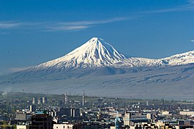
Little Ararat[a] (Armenian: Փոքր Արարատ, romanized: Pok'r Ararat; Turkish: Küçük Ağrı; Kurdish: Agiriyê Biçûk) is the sixth-tallest peak and a stratovolcano in Turkey. It is a large satellite cone located on the eastern flank of the massive Mount Ararat, less than 5 mi (8.0 km) west of Turkey’s border with Iran. Despite being dwarfed by its higher and far more famous neighbor, Little Ararat is a significant volcano in its own right, with an almost perfectly symmetrical, conical form and smooth constructional slopes.[citation needed] Little Ararat rises about 1,296 m (4,252 ft) above the Serdarbulak lava plateau, which forms a saddle connecting it with the main peak.[2]
History
[edit]On 8 November [O.S. 27 October] 1829, Baltic German explorer Friedrich Parrot and Armenian writer Khachatur Abovian climbed Little Ararat.[3] Its eastern flank was on the Iranian side of the border until the early 1930s.
During the Kurdish Ararat rebellion, Kurdish rebels used the area "as a haven against the state in their uprising."[4] Turkey crossed the border and militarily occupied the region, which Iran eventually agreed to cede to Ankara in a territorial exchange.[5][6] The related treaty was signed on 23 January 1932.[7]
See also
[edit]References
[edit]Citations
[edit]- ^ Richard G. Hovannisian (2011). The Armenian Genocide: Cultural and Ethical Legacies. Transaction Publishers. p. 113. ISBN 9781412835923.
- ^ "Mount Agri (Ararat)". anatolia.com. 2003. Retrieved 9 January 2021.
Little Mount Agri (Ararat) reaches up to 3896 meters; the Serdarbulak lava plateau (2600 m) stretches out between the two pinnacles.
- ^ Parrot, Friedrich (2016) [1846]. Journey to Ararat. Translated by William Desborough Cooley. Introduction by Pietro A. Shakarian. London: Gomidas Institute. pp. 183–184. ISBN 978-1909382244.
- ^ Yildiz, Kerim; Taysi, Tanyel B. (2007). The Kurds in Iran: The Past, Present and Future. London: Pluto Press. p. 71. ISBN 978-0745326696.
- ^ Parrot, p. xxiii
- ^ Tsutsiev, Arthur (2014). Atlas of the Ethno-Political History of the Caucasus. Translated by Nora Seligman Favorov. New Haven: Yale University Press. p. 92. ISBN 978-0300153088.
- ^ "Chronology". Bulletin of International News. 8 (16): 26. 4 February 1932. JSTOR 25639018.
Notes
[edit]Sources
[edit]- "Little Ararat, Turkey". Peakbagger.com.


 French
 Deutsch