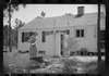
[3] Name on the Register[4] Image Date listed[5] Location City or town Description 1 Gov. Samuel Ashe Grave Upload image October 12, 2001 (#01001096 ) Farm Ln., from the southern side of NC 1411, 0.7 miles east of its crossing of Pike Creek 34°28′41″N 77°51′09″W / 34.478056°N 77.8525°W / 34.478056; -77.8525 (Gov. Samuel Ashe Grave ) Rocky Point 2 Bannerman House Upload image May 31, 1974 (#74001365 ) Northeast of Burgaw off NC 53 on NC 1520 34°36′07″N 77°47′26″W / 34.601944°N 77.790556°W / 34.601944; -77.790556 (Bannerman House ) Burgaw 3 Beatty-Corbett House Upload image March 17, 1986 (#86000549 ) NC 701 at NC 1200 34°33′11″N 78°15′09″W / 34.553056°N 78.2525°W / 34.553056; -78.2525 (Beatty-Corbett House ) Ivanhoe 4 Belvidere Plantation House Upload image June 14, 1982 (#82003495 ) Off NC 1565 34°23′05″N 77°38′51″W / 34.384722°N 77.6475°W / 34.384722; -77.6475 (Belvidere Plantation House ) Hampstead 5 Burgaw Depot Burgaw Depot July 24, 1986 (#86001910 ) 102 E. Fremont 34°33′00″N 77°55′41″W / 34.550000°N 77.928056°W / 34.550000; -77.928056 (Burgaw Depot ) Burgaw 6 Burgaw Historic District Burgaw Historic District August 27, 1999 (#99001047 ) Roughly bounded by Cowan St., Fremont St., Dudley St., and Ashe St. 34°33′05″N 77°55′35″W / 34.551389°N 77.926389°W / 34.551389; -77.926389 (Burgaw Historic District ) Burgaw 7 Canetuck School Upload image May 31, 2018 (#100002520 ) 6098 Canetuck Rd. 34°24′45″N 78°12′16″W / 34.412500°N 78.204444°W / 34.412500; -78.204444 (Canetuck School ) Currie 8 Cape Fear Civil War Shipwreck Discontiguous District Upload image December 23, 1985 (#85003195 ) Address Restricted Topsail Beach 9 Moores Creek National Battlefield Moores Creek National Battlefield October 15, 1966 (#66000070 ) 25 miles northwest of Wilmington on NC 210 34°27′27″N 78°06′36″W / 34.4575°N 78.11°W / 34.4575; -78.11 (Moores Creek National Battlefield ) Wilmington Boundary increased on February 13, 1987 , the Moore's Creek National Military Park 10 Pender County Courthouse Pender County Courthouse May 10, 1979 (#79001741 ) Wright, Wilmington, Walker, and Fremont Sts. 34°33′02″N 77°55′33″W / 34.550556°N 77.925833°W / 34.550556; -77.925833 (Pender County Courthouse ) Burgaw 11 Penderlea Homesteads Historic District Penderlea Homesteads Historic District September 27, 2013 (#13000803 ) Bounded by Sills Creek and Webber, Crooked Run, Lake, Lamb, and Raccoon Rds. 34°39′34″N 78°02′59″W / 34.659475°N 78.049721°W / 34.659475; -78.049721 (Penderlea Homesteads Historic District ) Willard 12 Poplar Grove Poplar Grove July 16, 1979 (#79003346 ) U.S. Route 17 34°19′13″N 77°45′55″W / 34.320275°N 77.765269°W / 34.320275; -77.765269 (Poplar Grove ) Scotts Hill 13 SS. Peter and Paul's Russian Orthodox Greek Catholic Church SS. Peter and Paul's Russian Orthodox Greek Catholic Church April 17, 2017 (#100000903 ) 2384 Front St. 34°30′53″N 77°54′53″W / 34.514722°N 77.914722°W / 34.514722; -77.914722 (SS. Peter and Paul's Russian Orthodox Greek Catholic Church ) St. Helena 14 Sloop Point Upload image January 20, 1972 (#72000985 ) Northeast of Vista off NC 1561 34°24′58″N 77°35′55″W / 34.416111°N 77.598611°W / 34.416111; -77.598611 (Sloop Point ) Vista 15 US Naval Ordnance Testing Facility Assembly Building US Naval Ordnance Testing Facility Assembly Building September 14, 1993 (#93000909 ) Junction of Channel Boulevard and Flake Ave. 34°22′02″N 77°37′49″W / 34.367222°N 77.630278°W / 34.367222; -77.630278 (US Naval Ordnance Testing Facility Assembly Building ) Topsail Beach 16 US Naval Ordnance Testing Facility Control Tower US Naval Ordnance Testing Facility Control Tower September 14, 1993 (#93000910 ) Southwestern corner of S. Anderson Boulevard and Flake Ave. 34°21′58″N 77°37′45″W / 34.366111°N 77.629167°W / 34.366111; -77.629167 (US Naval Ordnance Testing Facility Control Tower ) Topsail Beach 17 US Naval Ordnance Testing Facility Observation Tower No. 2 US Naval Ordnance Testing Facility Observation Tower No. 2 September 14, 1993 (#93000911 ) 1000 block of S. Anderson Boulevard 34°22′53″N 77°36′47″W / 34.381389°N 77.613056°W / 34.381389; -77.613056 (US Naval Ordnance Testing Facility Observation Tower No. 2 ) Topsail Beach 
 French
 Deutsch
.jpg)

.jpg)


.jpg)
.jpg)
.jpg)

