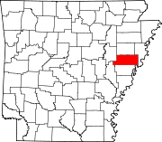
Location of St. Francis County in Arkansas This is a list of the National Register of Historic Places listings in St. Francis County, Arkansas .
This is intended to be a complete list of the properties on the National Register of Historic Places in St. Francis County , Arkansas , United States . The locations of National Register properties for which the latitude and longitude coordinates are included below, may be seen in a map.[1]
There are 15 properties listed on the National Register in the county.
Contents: Counties in Arkansas
This National Park Service list is complete through NPS recent listings posted July 26, 2024. [2]
[3] Name on the Register[4] Image Date listed[5] Location City or town Description 1 Blackfish Lake Ferry Site Upload image April 10, 2003 (#03000195 ) Address Restricted New Shady Grove A Trail of Tears site[6] 2 Scott Bond Family Plot Upload image June 6, 2002 (#02000603 ) 0.3 miles west of 5th St. on Highway 70 , W. 35°00′45″N 90°43′53″W / 35.0125°N 90.731389°W / 35.0125; -90.731389 (Scott Bond Family Plot ) Madison 3 Campbell House Campbell House December 21, 2006 (#06000841 ) 305 N. Forrest St. 35°00′49″N 90°47′03″W / 35.013611°N 90.784167°W / 35.013611; -90.784167 (Campbell House ) Forrest City 4 First United Methodist Church First United Methodist Church May 19, 1994 (#94000467 ) 101 S. Izard St. 35°00′33″N 90°47′01″W / 35.009167°N 90.783611°W / 35.009167; -90.783611 (First United Methodist Church ) Forrest City 5 Forrest City City Hall Upload image May 11, 2022 (#100007718 ) 224 North Rosser St. 35°00′38″N 90°47′13″W / 35.0105°N 90.7870°W / 35.0105; -90.7870 (Forrest City City Hall ) Forrest City 6 Forrest City Colored Cemetery Upload image September 21, 2021 (#100007000 ) SFC Rd. 702, south of U.S. Route 70 , west of Margaret Dr., east of Union Pacific RR 35°00′32″N 90°46′16″W / 35.0089°N 90.7712°W / 35.0089; -90.7712 (Forrest City Colored Cemetery ) Forrest City 7 Forrest City High School Upload image October 8, 1992 (#92001341 ) Rosser St. 35°00′59″N 90°47′21″W / 35.016389°N 90.789167°W / 35.016389; -90.789167 (Forrest City High School ) Forrest City 8 Forrest City Public Library Upload image January 7, 2022 (#100007321 ) 421 South Washington St. 35°00′22″N 90°47′02″W / 35.0062°N 90.7839°W / 35.0062; -90.7839 (Forrest City Public Library ) Forrest City 9 Highway B-1, Little Telico Creek Bridge Upload image May 20, 2009 (#09000316 ) SFC 213 Rd. over Little Telico Creek 35°03′57″N 90°48′57″W / 35.065756°N 90.815922°W / 35.065756; -90.815922 (Highway B-1, Little Telico Creek Bridge ) Caldwell 10 Hughes Water Tower Hughes Water Tower October 5, 2006 (#06000905 ) Church St. 34°57′03″N 90°28′21″W / 34.950833°N 90.4725°W / 34.950833; -90.4725 (Hughes Water Tower ) Hughes 11 Mann House Upload image December 22, 1982 (#82000937 ) 422 Forest St. 35°00′17″N 90°46′13″W / 35.004722°N 90.770278°W / 35.004722; -90.770278 (Mann House ) Forrest City 12 St. Francis River Bridge St. Francis River Bridge April 9, 1990 (#90000516 ) U.S. Route 70 , over the St. Francis River 35°02′07″N 90°42′46″W / 35.035278°N 90.712778°W / 35.035278; -90.712778 (St. Francis River Bridge ) Madison 13 Smith House Upload image December 22, 1982 (#82000938 ) Memphis Ave. 34°54′40″N 91°06′33″W / 34.911111°N 91.109167°W / 34.911111; -91.109167 (Smith House ) Wheatley 14 William Stone House Upload image October 8, 1992 (#92001346 ) Southeastern corner of the junction of Highway 306 and Doris Ln. 35°07′53″N 90°48′38″W / 35.1315°N 90.8105°W / 35.1315; -90.8105 (William Stone House ) Colt 15 Stuart Springs Upload image August 3, 1977 (#77001502 ) Stuart St. 35°01′07″N 90°46′45″W / 35.018611°N 90.779167°W / 35.018611; -90.779167 (Stuart Springs ) Forrest City
^ The latitude and longitude information provided in this table was derived originally from the National Register Information System, which has been found to be fairly accurate for about 99% of listings. Some locations in this table may have been corrected to current GPS standards. ^ National Park Service, United States Department of the Interior , "National Register of Historic Places: Weekly List Actions" , retrieved July 26, 2024. ^ Numbers represent an alphabetical ordering by significant words. Various colorings, defined here , differentiate National Historic Landmarks and historic districts from other NRHP buildings, structures, sites or objects. ^ "National Register Information System" . National Register of Historic Places National Park Service . March 13, 2009.^ The eight-digit number below each date is the number assigned to each location in the National Register Information System database, which can be viewed by clicking the number. ^ "Trail Of Tears National Historic Trail: National Register Research" . National Park Service. Retrieved January 22, 2013 .
Topics Lists by state Lists by insular areas Lists by associated state Other areas Related

 French
 Deutsch