
 French
 Deutsch
Mica, Cluj
Mica | |
|---|---|
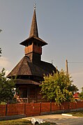
 Archangels' church in Mica | |
 Location in Cluj County | |
 Mica Location in Romania | |
| Coordinates: 47°8′45″N 23°55′50″E / 47.14583°N 23.93056°E | |
| Country | Romania |
| County | Cluj |
| Subdivisions | Dâmbu Mare, Mănăstirea, Mica, Nireș, Sânmărghita, Valea Cireșoii, Valea Luncii |
| Government | |
| • Mayor (2020–2024) | Roland-Tiberiu Zelencz (PNL) |
| Area | 64.62 km2 (24.95 sq mi) |
| Elevation | 238 m (781 ft) |
| Population (2021-12-01)[1] | 3,459 |
| • Density | 54/km2 (140/sq mi) |
| Time zone | EET/EEST (UTC+2/+3) |
| Postal code | 407395 |
| Area code | +(40) x64 |
| Vehicle reg. | CJ |
| Website | www |
Mica (Hungarian: Mikeháza) is a commune in Cluj County, Transylvania, Romania. It is composed of seven villages: Dâmbu Mare (Nagydomb), Mănăstirea (Szentbenedek), Mica, Nireș (Szásznyíres), Sânmărghita (Szentmargita), Valea Cireșoii (Décseipataktanya), and Valea Luncii (Lunkatanya).
Mănăstirea village is the site of Kornis Castle.
Demographics
[edit]According to the census from 2002, there was a total population of 3,836 people living in this commune; of those, 70.77% were ethnic Romanians, 28.12% ethnic Hungarians, and 0.06% ethnic Roma.[2] At the 2011 census, there were 3,566 inhabitants, including 70.25% Romanians, 26.19% Hungarians, and 2.08% Roma. At the 2021 census, Mica had a population of 3,566, of which 74.21% were Romanians, 18.91% Hungarians, and 2.11% Roma.[3]
References
[edit]- ^ "Populaţia rezidentă după grupa de vârstă, pe județe și municipii, orașe, comune, la 1 decembrie 2021" (XLS). National Institute of Statistics.
- ^ "Structura Etno-demografică a României".
- ^ "Populația rezidentă după grupa de vârstă, pe județe și municipii, orașe, comune, la 1 decembrie 2021" (in Romanian). INSSE. 31 May 2023.
-
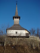
 Wooden church in Dâmbu Mare
 -
 Saint Nicholas' Orthodox church in Mănăstirea
 -
 Someșul Mic in Mănăstirea
 -
 Sânmărghita

.JPG)
.JPG)


This Cluj County location article is a stub. You can help Wikipedia by expanding it. |