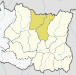
Panchkhapan Municipality
Panchkhapan Municipality पाँचखप्पन नगरपालिका | |
|---|---|
| Coordinates: 27°20′N 87°18′E / 27.33°N 87.30°E | |
| Country | |
| Province | Koshi |
| District | Sankhuwasabha |
| Government | |
| • Type | Mayor–council |
| • Body | Panchkhapan Municipality |
| • Mayor | Bipin Rai (NC) |
| • Deputy Mayor | Bhima Devi Rai (NCP) |
| Area of Municipality | |
• Total | 148.03 km2 (57.15 sq mi) |
| Population (2011) | |
• Total | 17,521 |
| Languages | |
| • Local | Nepali, Tamang, Newari |
| • Official | Nepali |
| Time zone | UTC+5:45 (NST) |
| Postal code | 56900 |
| Website | www.panchkhapanmun.gov.np/ |
Panchkhapan (Nepali: पाँचखप्पन) is an urban municipality out of five urban municipalities of Sankhuwasabha District in Koshi Province of Nepal. It lies on 87°12'12" E to 87°26'45" E Longitude and 27°17'37.4" N to 27°24'38" N Latitude. The municipality was established on 3 March 2017 merging former VDCs: Syabun, Jaljala and Wana. The area of the municipality is 148.03KM2 and according to 2011 census of Nepal the population of the municipality is 17,521.[1][2]
The municipality is surrounded by Taplejung District in east, Savapokhari in north, Khandbari in north-west and west and Chainpur in south.
Demographics
[edit]At the time of the 2011 Nepal census, Panchkhapan Municipality had a population of 17,521. Of these, 52.5% spoke Nepali, 14.9% Tamang, 7.5% Limbu, 6.9% Yakkha, 6.2% Newar, 3.0% Sherpa, 2.4% Magar, 1.9% Chamling, 1.2% Khaling, 1.1% Rai, 1.0% Gurung, 0.3% Bantawa, 0.2% Maithili, 0.1% Lohorung, 0.1% Nachhiring, 0.1% Sampang, and 0.3% other languages as their first language.[3]
In terms of ethnicity/caste, 19.3% were Tamang, 18.6% Chhetri, 9.5% Newar, 8.4% Limbu, 7.7% Kami, 7.3% Yakkha, 6.9% Rai, 5.3% Hill Brahmin, 4.2% Magar, 3.3% Sanyasi/Dasnami, 3.2% Damai/Dholi, 3.0% Sherpa, 1.1% Gurung, 0.9% Sarki, 0.3% Gharti/Bhujel, 0.2% Thakuri, 0.1% other Dalit, 0.1% Kathabaniyan, 0.1% Kumal and 0.4% others.[4]
In terms of religion, 51.6% were Hindu, 26.9% Buddhist, 21.0% Kirati, 0.4% Christian and 0.1% others.[5]
In terms of literacy, 69.9% could read and write, 2.8% could only read and 27.3% could neither read nor write.[6]
References
[edit]- ^ "Panchakhapan Municipality in Nepal Population". citypopulation.de. 8 October 2017. Retrieved 24 February 2018.
- ^ "पाँचखपन नगरपालिकाकाे संक्षिप्त परिचय" [Short Introduction of Panchkhapan Municipality] (in Nepali). Mofald.gov.np. Retrieved 24 February 2018.
- ^ NepalMap Language [1]
- ^ NepalMap Caste [2]
- ^ NepalMap Religion [3]
- ^ NepalMap Literacy [4]


 French
 Deutsch

