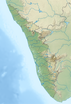
Perunthenaruvi Weir
This article needs additional citations for verification. (July 2021) |
| Perunthenaruvi Weir | |
|---|---|
 | |
| Country | India |
| Location | Pathanamthitta, Kerala |
| Coordinates | 9°24′44″N 76°52′48″E / 9.41222°N 76.88000°E |
| Purpose | Power |
| Status | Operational |
| Opening date | 2017 |
| Owner(s) | Kerala State Electricity Board |
| Dam and spillways | |
| Type of dam | Gravity dam |
| Impounds | Pamba River |
| Height (foundation) | 10.93 m (35.9 ft) |
| Length | 227.50 m (746.4 ft) |
| Elevation at crest | 51.00 m (167.32 ft) |
| Spillway type | Ungated - overflow section |
| Reservoir | |
| Total capacity | 10,000,000 m3 (350,000,000 cu ft) |
| Maximum water depth | 55.20 m (181.1 ft) |
| Normal elevation | 51.00 m (167.32 ft) |
| Power Station | |
| Operator(s) | Kerala State Electricity Board |
| Type | Run-of-the-river |
| Turbines | 2 × 3 MW |
| Installed capacity | 6 MW |
| Website Official website | |
Perunthenaruvi Weir is a diversion dam built across Pamba river at villages of Naranammoozhy and Vechoochira in Pathanamthitta District of Kerala, India. Perumthenaruvi Small Hydroelectric Project 6 MW (2×3) is a run-of-the-river scheme in river Pamba, and the weir is a part of this scheme. This envisages the utilization of water from 442 km2 (171 sq mi) catchment of Pamba and Azhutha river for electricity generation under a net head of 18.00 m. The power house is located on the left bank of Pamba river. The weir is a concrete gravity type with a height of 10.93 metres (35.9 ft) and a length of 227.50 metres (746.4 ft). Taluks through which the release flow are Ranni, Konni, Kozhencherry, Thiruvalla, Chengannur, Kuttanadu, Mavelikara and Karthikappally.[1]
Specifications
[edit]- Latitude : 9⁰ 24′ 44 ” N
- Longitude: 76⁰ 52′ 48” E
- Panchayath : Ranni- Perinad
- Village : Naranammoozhi & Vechoochira
- District : Pathanamthitta
- River Basin : Pamba
- River: Pamba
- Release from Dam to river : Pamba
- Type of Dam : Concrete – Gravity
- Classification : Weir
- Maximum Water Level (MWL) : EL 55.20 m
- Full Reservoir Level ( FRL) : EL 51.0 m
- Storage at FRL : 1.00 Mm3
- Height from deepest foundation : 10.93 m
- Length : 227.50 m
- Spillway : Ungated- Overflow section
- Year of completion : 2017
- Crest LevelEL : 51.00 m
- Name of Project : Perunthenaruvi SHEP
- River Outlet : 2 Nos. 2.00x 4.00m
Hydrology
[edit]- Catchment area - 442 km2
- Average Annual Yield - 1093 Mm3
- Peak flood at the diversion weir - 395Cumecs [2]
Tourism
[edit]
The Poonthenaruvi Water falls and related Eco tourism project is near the weir site.[3] There is hanging bridge and view towers to spectate the beauty of the ravine.[4]
References
[edit]- ^ "Diversion Structures in Pathanamthitta district – KSEB Limited Dam Safety Organisation". Retrieved 2021-07-27.
 This article incorporates text available under the CC BY-SA 2.5 license.
 - ^ Chief Engineer (Civil Construction) South, Vydyuthi Bhavanam, Thiruvananthapuram. "Perunthenaruvi Small Hydro Electric Project".
{{cite web}}: CS1 maint: multiple names: authors list (link) - ^ "Perumthenaruvi". pathanamthittatourism.com. Official Website of DTPC, Pathanamthitta. Retrieved 2021-07-27.
- ^ "Perunthenaruvi project inaugurated". The Hindu. 2016-03-02. ISSN 0971-751X. Retrieved 2021-07-27.


 French
 Deutsch
