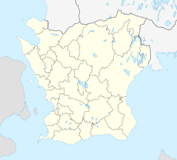
Röstånga
Röstånga | |
|---|---|
 Röstånga Church | |
| Coordinates: 56°00′N 13°17′E / 56.000°N 13.283°E | |
| Country | Sweden |
| Province | Skåne |
| County | Skåne County |
| Municipality | Svalöv Municipality |
| Area | |
• Total | 1.32 km2 (0.51 sq mi) |
| Population (2021-12-31)[1] | |
• Total | 1,111 |
| • Density | 637/km2 (1,650/sq mi) |
| Time zone | UTC+1 (CET) |
| • Summer (DST) | UTC+2 (CEST) |
Röstånga (Swedish pronunciation: [ˈrø̌ːstɔŋa])[2] is a locality situated in Svalöv Municipality, Skåne County, Sweden with around 1100 inhabitants.[1]
At Röstånga there is an entrance to the Söderåsen National Park. The main entrance is at Skäralid, 5 km further north. There is also a valley called Nackarpsdalen, at the end of which there is a lake called Odensjön.
To get to Röstånga by public transport, one can take a local train to Stehag, then bus (directions Klippan, Skäralid and Ljungbyhed). There are also bus connections with Svalöv and Teckomatorp.
References
[edit]- ^ a b c "Tätorternas landareal, folkmängd och invånare per km2 2005 och 2010" (in Swedish). Statistics Sweden. 14 December 2011. Archived from the original on 27 January 2012. Retrieved 10 January 2012.
- ^ Jöran Sahlgren; Gösta Bergman (1979). Svenska ortnamn med uttalsuppgifter (in Swedish). p. 21.


 French
 Deutsch
