
 French
 Deutsch
Rhodelia, Kentucky
Rhodelia, Kentucky | |
|---|---|
 Rhodelia Location within the state of Kentucky  Rhodelia Rhodelia (the United States) | |
| Coordinates: 38°00′25″N 86°25′14″W / 38.00694°N 86.42056°W | |
| Country | United States |
| State | Kentucky |
| County | Meade |
| Elevation | 646 ft (197 m) |
| Time zone | UTC-5 (Eastern (EST)) |
| • Summer (DST) | UTC-4 (EST) |
| ZIP code | 40161[1] |
| Area code(s) | 270 and 364 |
| GNIS feature ID | 508929[2] |
Rhodelia is a rural unincorporated community in Meade County, Kentucky, United States. It is a small community that lies a few miles west of Brandenburg on Kentucky Route 144 near its intersection with Rhodes Road and south of Route 144's intersection with Kentucky Route 259.
History
[edit]A post office called Rhodelia was established in 1879.[3] The community was named for Elias Rhodes, a pioneer settler.[4]
Near Rhodelia is St. Theresa Roman Catholic Church, listed on the National Register of Historic Places.
References
[edit]- ^ "Rhodelia ZIP Code". zipdatamaps.com. 2022. Retrieved November 11, 2022.
- ^ U.S. Geological Survey Geographic Names Information System: Rhodelia, Kentucky
- ^ "Meade County". Jim Forte Postal History. Retrieved December 25, 2015.
- ^ Rennick, Robert M. Kentucky Place Names. University Press of Kentucky. p. 250. ISBN 0-8131-2631-2.
Municipalities and communities of Meade County, Kentucky, United States | ||
|---|---|---|
| Cities | 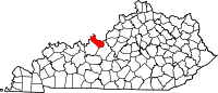 | |
| CDPs | ||
| Other communities | ||
| Footnotes | ‡This populated place also has portions in an adjacent county or counties | |
This Meade County, Kentucky state location article is a stub. You can help Wikipedia by expanding it. |