Shady Grove, Maryland
Shady Grove, Maryland | |
|---|---|
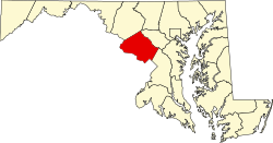
 Location of Montgomery County in the U.S. state of Maryland. | |
| Coordinates: 39°7′5.88″N 77°11′2.34″W / 39.1183000°N 77.1839833°W | |
| Country | |
| State | |
| County | |
| Time zone | UTC-5 (Eastern (EST)) |
| • Summer (DST) | UTC-4 (EDT) |
| ZIP code | 20850, 20855 |
| Area code(s) | 301, 240 |
Shady Grove is an unincorporated area of Montgomery County, Maryland, United States.[1] It has a population of 5,000-7,000, between the cities of Rockville and Gaithersburg, mostly in zip codes 20850 and 20855, though the exact boundaries are not officially defined.
History
[edit]
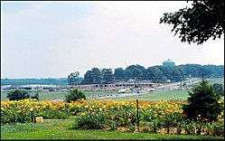
Shady Grove is one of Montgomery County's upper middle class areas. The area is best identified by Shady Grove Road, which is located near exit 8 off of I-270. Other notable places in the area that bear the name are:
- Shady Grove Metrorail station, although it is located in Derwood, Maryland.
- Shady Grove Medical Village and Shady Grove Life Sciences Center
- Shady Grove Adventist Hospital, although it is located in Rockville, Maryland.
- Shady Grove Executive Center
- The Universities at Shady Grove[2]
References
[edit]External links
[edit]


 French
 Deutsch