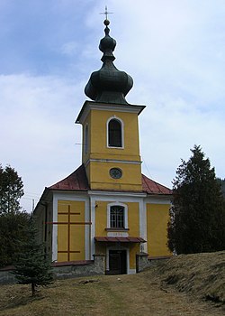
Sulín
Sulín | |
|---|---|
Village | |
 | |
| Coordinates: 49°22′N 20°45′E / 49.367°N 20.750°E | |
| Country | Slovakia |
| Region | Prešov |
| District | Stará Ľubovňa |
| First mentioned | 1960 |
| Area | |
| • Total | 20.1 km2 (7.8 sq mi) |
| Elevation | 425 m (1,394 ft) |
| Population (2004-12-31) | |
| • Total | 414 |
| • Density | 21/km2 (53/sq mi) |
| Postal code | 065 46 |
| Area code | +421-52 |
| Car plate | SL |
Sulín (Rusyn: Сулин, romanized: Sulyn; Hungarian: Szulin) is a village and municipality in Stará Ľubovňa District in the Prešov Region of northern Slovakia.
History
[edit]In historical records the village was first mentioned in 1960. Before the establishment of independent Czechoslovakia in 1918, Sulín was part of Sáros County within the Kingdom of Hungary. From 1939 to 1945, it was part of the Slovak Republic. On 24 January 1945, the Red Army dislodged the Wehrmacht from Sulín and it was once again part of Czechoslovakia.
A more detailed history with photographs can be found at....
Sulín - The Carpathian Connection
Geography
[edit]The municipality lies at an altitude of 425 metres and covers an area of 20.098 km2. It has a population of about 414 people.
External links
[edit] Media related to Sulín at Wikimedia Commons
- Official website


 French
 Deutsch