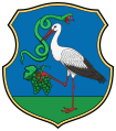
Szarvaskő
Szarvaskő | |
|---|---|
Village (község) | |
 | |
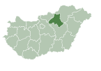
Location of Szarvaskő in Hungary | |
| Coordinates: 47°59′17″N 20°19′51″E / 47.98806°N 20.33083°E | |
| Country | |
| Region | Northern Hungary |
| County | Heves County |
| Subregion | Eger District |
| Government | |
| • Mayor | Dániel Benkó[1] |
| Area | |
• Total | 12.59 km2 (4.86 sq mi) |
| Population (1 Jan. 2015) | |
• Total | 325 |
| • Density | 27.32/km2 (70.8/sq mi) |
| Time zone | UTC+1 (CET) |
| • Summer (DST) | UTC+2 (CEST) |
| Postal code | 3323 |
| Area code | 36 |
| Website | www |
Szarvaskő is a village in Heves County, Northern Hungary Region, Hungary.
Geography
[edit]The village is located on the western border of the Bükk Mountains. Because of the picturesque landscape the village is on the path of the National Blue Trail.
Communications
[edit]Szarvaskő is on the Road 25 between Eger and Tarnalelesz. The Eger-Putnok railway line passes through the village, and there are 2 trains per day at the Szarvaskő railway station.
Sights to visit
[edit]- Szarvaskő Castle Ruin
- Major-tetői kilátó (Major Lookout)
- Roman Catholic church
- Öko-Park Panzió-Kemping és Kalandpark (English: leisure-camping and adventure park)
Gallery
[edit]- The hill with the Szarvaskő castle ruin
- The Pyrker Strait at the border of Szarvaskő with the memorial plaque (on the left side of the picture)
- The Major Lookout
- The church
- The hill with the Szarvaskő castle ruin
References
[edit]- ^ "Szarvaskői Aktualitások". 20 October 2022. Retrieved 2024-11-08.
External links
[edit]![]() Media related to Szarvaskő at Wikimedia Commons
Media related to Szarvaskő at Wikimedia Commons
- Official website in Hungarian
- Szarvaskő


 French
 Deutsch


