Arrondissement de Fürstenfeldbruck — Wikipédia
| Arrondissement de Fürstenfeldbruck Landkreis Fürstenfeldbruck | |
 Héraldique |  Localisation |
| Administration | |
|---|---|
| Pays | |
| Land | |
| District (Regierungsbezirk) | Haute-Bavière |
| Chef-lieu | Fürstenfeldbruck |
| Villes principales | Germering, Fürstenfeldbruck |
| Préfet (Landrat) | Thomas Karmasin |
| Partis au pouvoir | CSU |
| Code arrondissemental (Kreisschlüssel) | 09 1 79 |
| Immatriculation | FFB |
| Communes | 23 |
| Démographie | |
| Population | 218 579 hab. (31 décembre 2021) |
| Densité | 503 hab./km2 |
| Géographie | |
| Superficie | 434,78 km2 |
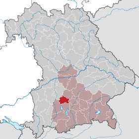
| Localisation | |
 | |
| Liens | |
| Site web | www.lra-ffb.de |
| modifier | |
L'arrondissement de Fürstenfeldbruck est un arrondissement (Landkreis en allemand) de Bavière (Allemagne) situé dans le district (Regierungsbezirk en allemand) de Haute-Bavière. Son chef-lieu est Fürstenfeldbruck.
Villes, communes & communautés d'administration
[modifier | modifier le code](nombre d'habitants en 2006)
|
|


 French
 Deutsch